Haringhe (Bandaghem) Military Cemetery
- Country Belgium
- Total identified casualties 807 Find these casualties
- Region West-Vlaanderen
- Identified casualties from First & Second World War
- GPS Coordinates Latitude: 50.90163, Longitude: 2.61485
Location information
The cemetery is located 18 km from Ieper town centre on a road leading from the N308 connecting Ieper to Poperinge and on to Roesbrugge. From Ieper town centre the Poperingseweg (N308), is reached via Elverdingsestraat then directly over two small roundabouts in the J. Capronstraat. The Poperingseweg is a continuation of the J. Capronstraat and begins after a prominent railway level crossing. On reaching the ring road of Poperinge, the R33 Europalaan, the left hand clockwise route circles the town of Poperinge and rejoins the N308 towards Oost Cappel. 10 km after rejoining the N308 lies the village of Roesbrugge. The second left hand turning in the village of Roesbrugge leads onto the Haringestraat and for 2 km to the village of Haringe. The second right hand turning in the village of Haringe leads onto Nachtegaalstraat. The cemetery lies 400 metres along the Nachtegaalstraat on the left hand side of the road.
Visiting information
ARRIVAL
The route to the cemetery is signposted.
PARKING
It is possible to park in a partially paved layby at the front of the cemetery, on Nachtegaalstraat, approximately 10 metres from the main entrance. The inner part of the layby is a mixture of gravel and earth.
ACCESS, LAYOUT AND MAIN ENTRANCE
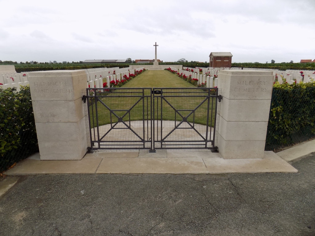
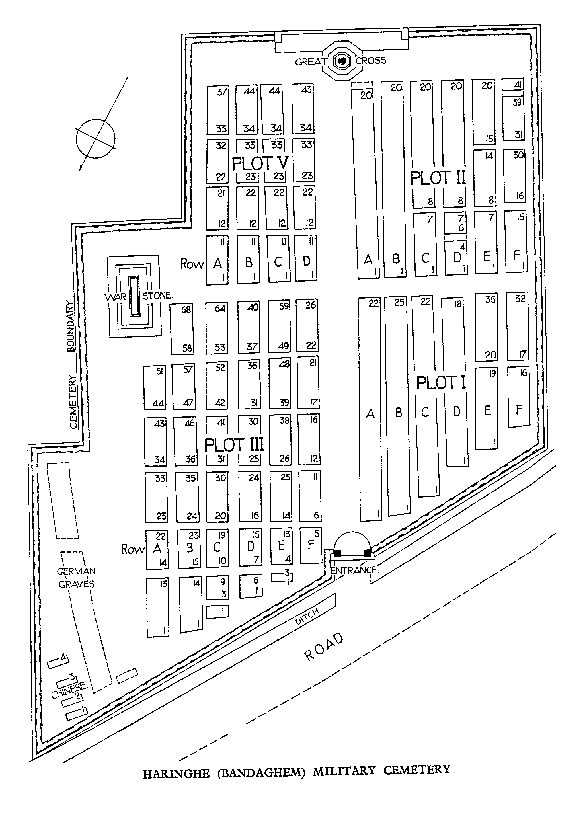
The cemetery is a rectangular shape on one side, with stepped shaped rectangular sections along the left-hand side of the cemetery and surrounding by a low hedge.
The main entrance has a low (waist height) two leaf metal gate approximately 1.80 metres wide. The latched gate on the right side opens inwards into the cemetery. The left leaf can also be opened using a vertical latch at the bottom of the gate.
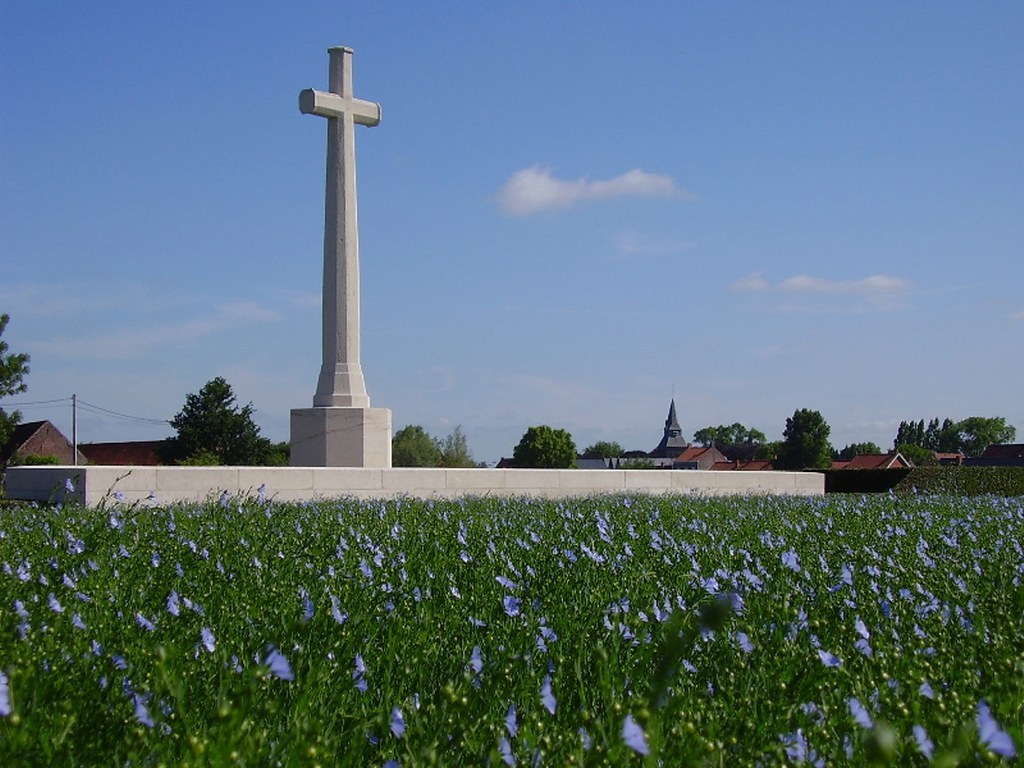
The Cross of Sacrifice is in line with the entrance at the rear of the cemetery.
The Stone of Remembrance is located on the left side of the cemetery when viewed from the entrance.
All internal cemetery paths are grass, the ground is flat and firm.
There is a small shelter building with a stone bench inside at the top right-hand corner of the cemetery. There is a single step up from the grass to the interior of the shelter.
The Register Box is built into the left-hand pillar inside the main entrance.
ALTERNATIVE ACCESS
There are no alternative entrances into the cemetery.
ADDITIONAL INFORMATION
The cemetery is permanently open.
History information
Bandaghem, like Dozinghem and Mendinghem, were the popular names given by the troops to groups of casualty clearing stations posted to this area during the First World War.
The cemetery site was chosen in July 1917 for the 62nd and 63rd Casualty Clearing Stations and burials from these and other hospitals (notably the 36th Casualty Clearing Station in 1918) continued until October 1918.
The cemetery contains 772 Commonwealth burials of the First World War. There is a separate plot of 39 German war graves, but four plots (X, XI, XII and XIII) of French graves were removed to other burial grounds after the war. There are also five Second World War burials in the cemetery, three of which are unidentified.
The cemetery was designed by Sir Reginald Blomfield.