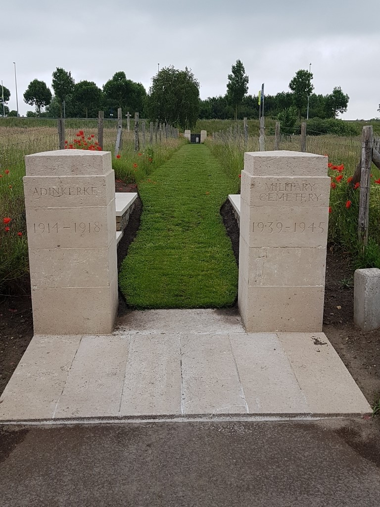
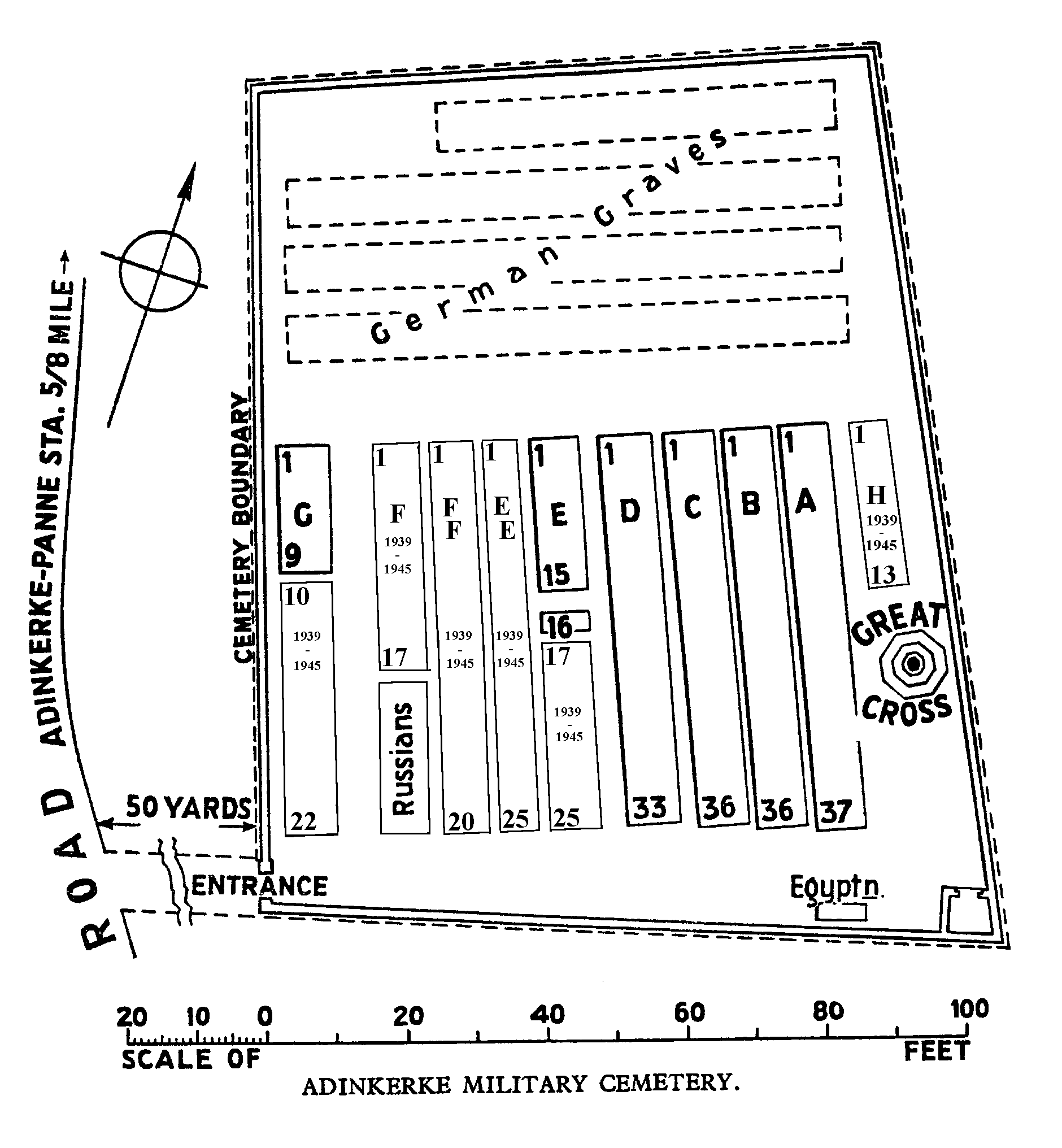
Adinkerke Military Cemetery
- Country Belgium
- Total identified casualties 359 Find these casualties
- Region West-Vlaanderen
- Identified casualties from First & Second World War
- GPS Coordinates Latitude: 51.0706, Longitude: 2.6016
Location information
Adinkerke Military Cemetery is located 6 km west of Veurne, 3 km inland from the costal town of Koksijde and 20 km east of Dunkirk. From Veurne the N39 Duinkerkestraat leads for 6 km to the village of Adinkerke. On reaching the village of Adinkerke the cemetery is located on the first left hand turning onto the Kromfortstraat, on the left hand side of the road.
Visiting information
Visitors should note a 50 metre grassed access path to this site which is not suitable for vehicles.
The location or design of this site, makes wheelchair access impossible. For further information regarding wheelchair access, please contact our Enquiries Section on telephone number 01628 507200.
History information
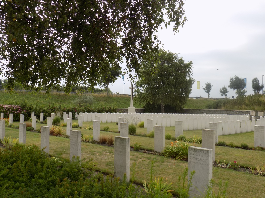
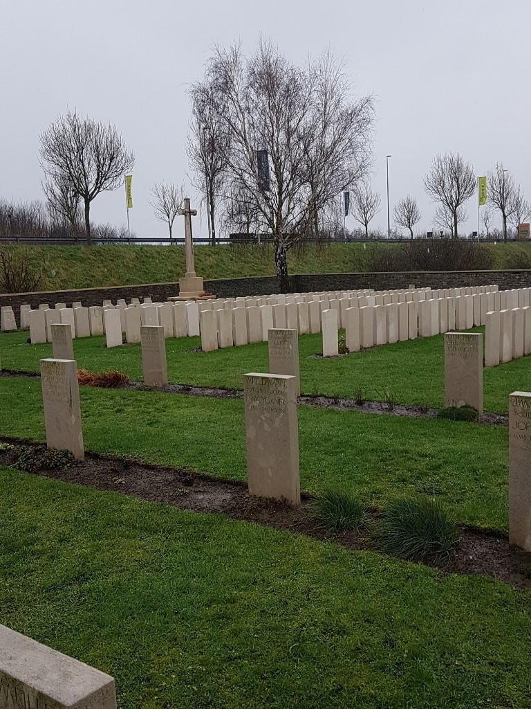
From June to November 1917 the Commonwealth XV Corps held the front from the Belgian coast to St. Georges. The 24th and 39th Casualty Clearing Stations were posted at Oosthoek (between Adinkerke and Furnes) from July to November, and the 1st Canadian Casualty Clearing Station was at Adinkerke for a short time in June. During the Second World War, the British Expeditionary Force was involved in the later stages of the defence of Belgium following the German invasion in May 1940, and suffered many casualties in covering the withdrawal to Dunkirk. Commonwealth forces did not return until September 1944, but in the intervening years, many airmen were shot down or crashed in raids on strategic objectives in Belgium, or while returning from missions over Germany. Adinkerke Military Cemetery contains 168 Commonwealth burials of the First World War, and 55 from the Second World War. There are also 142 Czech and German war graves.