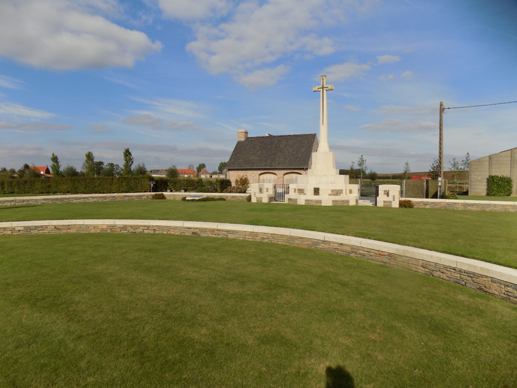
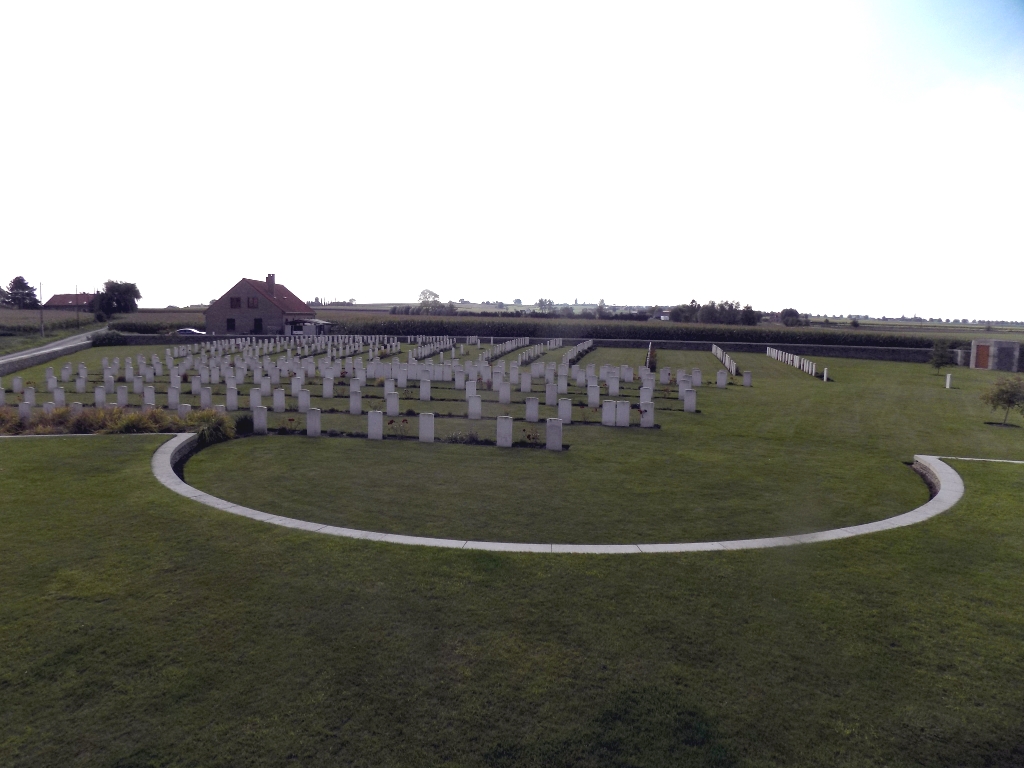
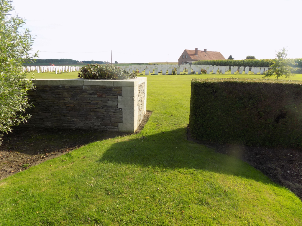
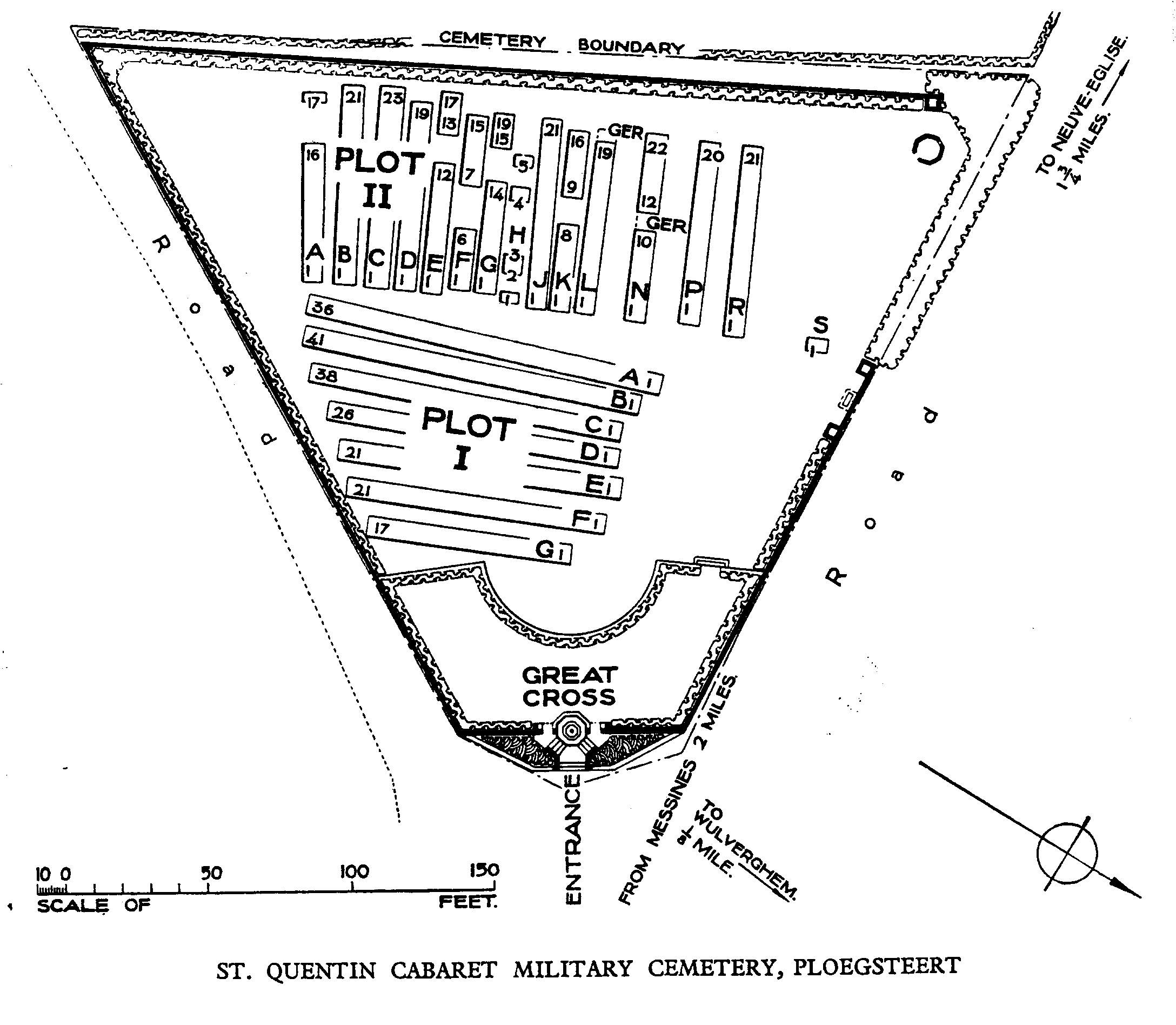
St. Quentin Cabaret Military Cemetery
- Country Belgium
- Total identified casualties 456 Find these casualties
- Region Hainaut
- Identified casualties from First World War
- GPS Coordinates Latitude: 50.75709, Longitude: 2.85619
Location information
St. Quentin Cabaret Military Cemetery is located 10.5 Kms south of Ieper town centre, on a road leading from the Rijselseweg N365, which connects Ieper to Wijtschate, Mesen (Messines) and on to Armentieres. From Ieper town centre the Rijselsestraat runs from the market square, through the Lille Gate (Rijselpoort) and directly over the crossroads with the Ieper ring road. The road name then changes to the Rijselseweg. On reaching Mesen the first right hand turn leads onto Mesenstraat towards the village of Wulvergem. In the village of Wulvergem the first left hand turning leads onto Sint-Kwintenstraat. 200 metres along Sint-Kwintenstraat on the left hand side of the road lies the cemetery.
History information
St. Quentin Cabaret was an inn about 460 metres east of Kandahar Farm, near the village of Wulverghem (now Wulvergem) and the front line. At times, the inn was used as battalion headquarters.
The cemetery was begun in February 1915 by the 46th (North Midland) Division (Plot I, Rows E and F), and continued to be used by the divisions holding the sector until it fell into German hands with the capture of Wulverghem in April 1918. The village and cemetery were recovered in September, but only two further burials were made.
There are 460 Commonwealth burials of the First World War in the cemetery.
The cemetery was designed by Charles Holden.