Westoutre British Cemetery
- Country Belgium
- Total identified casualties 127 Find these casualties
- Region West-Vlaanderen
- Identified casualties from First & Second World War
- GPS Coordinates Latitude: 50.80004, Longitude: 2.74504
Location information
Westoutre British Cemetery is located 11.5 Kms south-west of Ieper town centre on a road leading from the N375 Dikkebusseweg. From Ieper town centre the Dikkebusseweg (N375) is located via Elverdingsestraat, straight over a roundabout onto J.Capronstraat (for 30 metres), then left along M.Fochlaan. Immediately after the train station, the first right hand turning is the Dikkebusseweg. 10 Kms along the Dikkebusseweg lies the right hand turning onto the N315 Sulferbergstraat. 2.5 Kms along the N315 lies the village of Westouter. The cemetery itself is located on the Poperingestraat, 200 metres from the village centre, opposite the fire station.
Visiting information
ARRIVAL
The cemetery is located on the N398 (Poperingestraat) in the village of Westoutre.
PARKING
Parking for the cemetery is at the edge of the road and along the front of the cemetery.
The parking area is within 2 metres of the closest accessible entrance.
ACCESS LAYOUT AND MAIN ENTRANCE
The parking area adjacent to the road is comprised of brick paving, with a recessed channel along the centre of the paved area.
The entrance is made of 2 grass and stone platforms (grass and white stone capped brick walls). There are two steps up from the layby in front of the cemetery to the first grassed area, with an additional two stone steps to the upper platform. The grass is level with the low wall and drops down 300 mm along its length to the lower platform. At the left side of the upper platform is the entrance gate.
The main gate is located on the right-hand side of the cemetery and is a 90-centimetre wide, mid-level, thigh heigh, black metal gate, the opening latch is on the top left side of the gate. The gate opens inwards into the cemetery. There is a strip of stone paving under the gate, level with grass on either side.
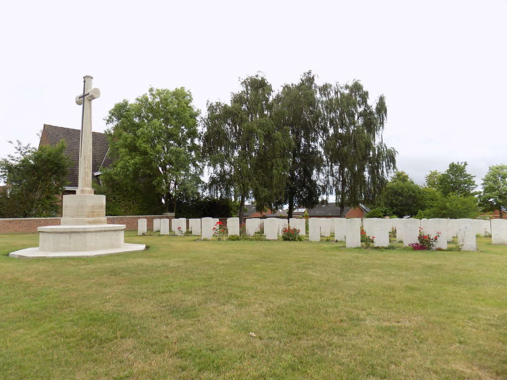
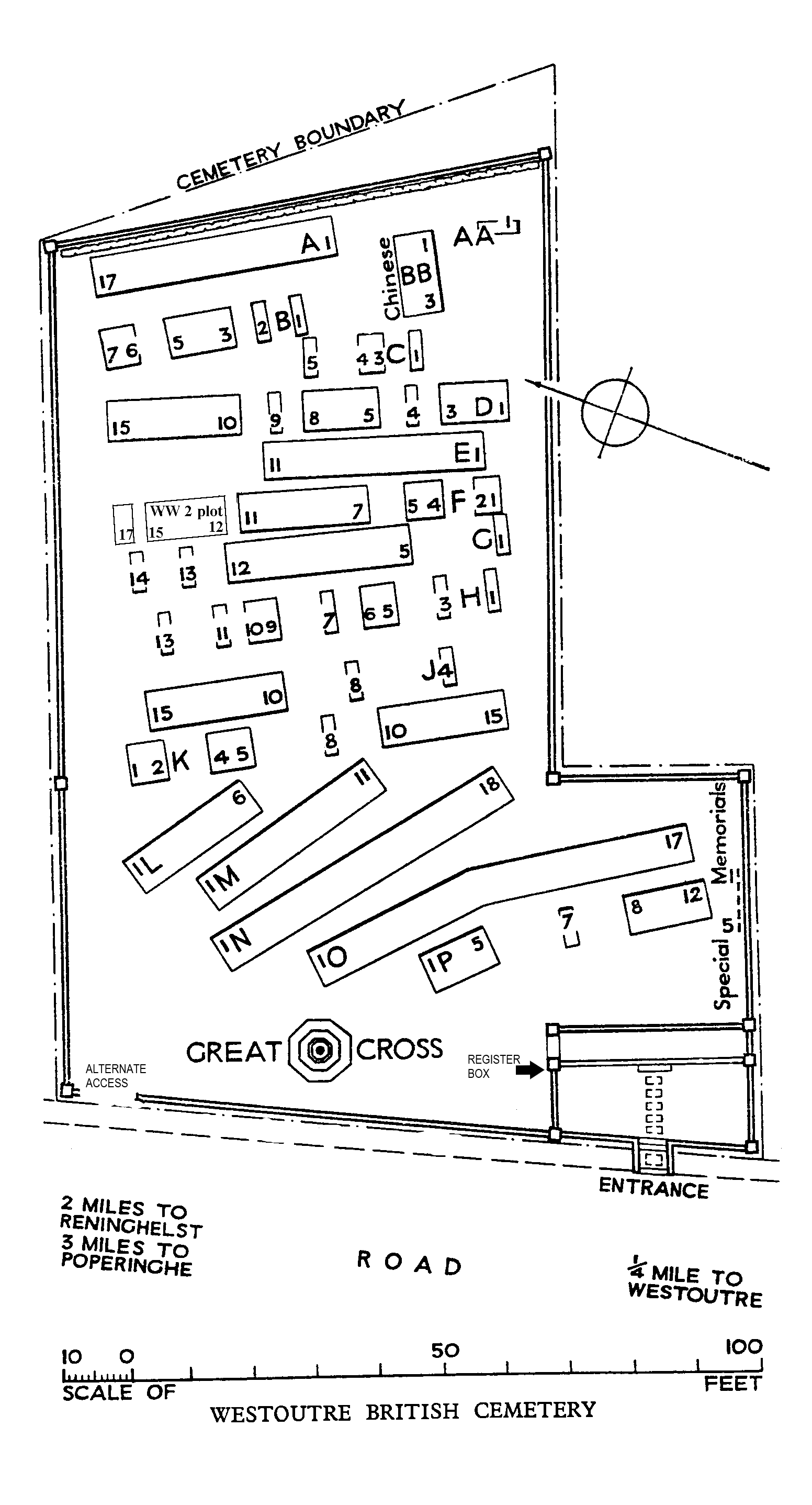
The Cross of sacrifice is in the Centre of the cemetery, immediately in front of the wall along the roadside.
The Register Box is inside the cemetery, built into the left-hand pillar at the main entrance.
The surface is grass, the ground is firm and slopes upwards to the rear of the cemetery.
The grass is level with the top of the front wall running along the parking layby and drops off approximately 400mm from the wall down to the brick paving.
ALTERNATIVE ACCESS
On the far-left hand side of the parking area is a 1.50-metre-wide gap in the wall with a grass ramp that leads up to the burial area.
ADDITIONAL INFORMATION
The cemetery is permanently open.
History information
The village of Westoutre (now Westouter) remained in Allied hands from the early months of the First World War to the Armistice, but in the summer of 1918, after the Battles of the Lys, it was within 2.4 Kms of the front line.
Westoutre British Cemetery was begun in October 1917. It was used until the following April and again in August-October 1918, and 50 graves were brought into it from the battlefields of the Ypres salient, from BIXSCHOTE GERMAN CEMETERY and KEMMEL FRENCH CEMETERY after the Armistice. French units used the cemetery in April-August 1918, but these graves were later removed.
The cemetery now contains 175 Commonwealth burials and commemorations of the First World War. 52 of the burials are unidentified but there are special memorials to five casualties known or believed to be buried among them. The four Second World War burials all date from May 1940 and the withdrawal of the British Expeditionary Force to Dunkirk ahead of the German advance. There is also one French burial from this period.
The cemetery was designed by W H Cowlishaw.