Cambes-En-Plaine War Cemetery
- Country France
- Total identified casualties 223 Find these casualties
- Region Calvados
- Identified casualties from Second World War
- GPS Coordinates Latitude: 49.23657, Longitude: -0.38597
Location information
Cambes-en-Plaine is a village 7 kilometres north-west of Caen. Take the road from Caen towards Courseulles-sur-Mer, the D79, and turn off to the right 6 kilometres north of Caen on the D79B. This will bring you to the village centre of Cambes-en-Plaine opposite the church. Turn left towards the north side of the village and turn right after 500 metres. The War Cemetery will then be found after 350 metres on the right hand side.
Visiting information
ARRIVAL
The route to the cemetery is signposted.
PARKING
Parking is to the front of the cemetery at the side of the main road in an off-road layby, approximately 40 metres from the entrance.
There is space for multiple vehicles to park in the layby.
The ground is flat and firm with a tarmac surface.
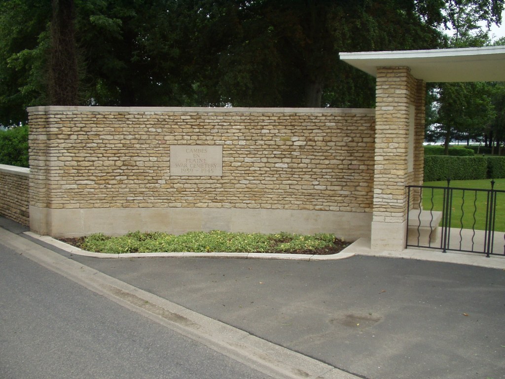
ACCESS LAYOUT AND MAIN ENTRANCE
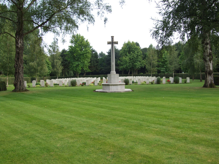
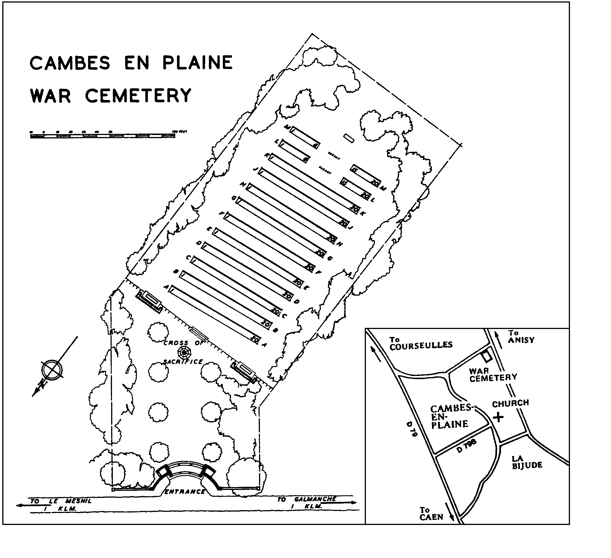
Rectangular shaped cemetery.
The man entrance feature gate is approximately 800 mm tall, black metal and shaped in an arc. A very shallow step, approximately 25 mm tall leads up to the entrance gate.
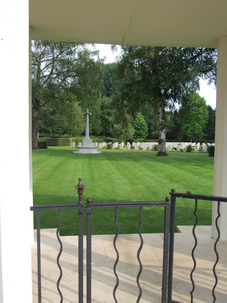
The entrance feature has gates made of 3 sections between stone pillars, each section 1.5 metres wide. The central section has 2 latched 600 mm wide sections that open inwards into the cemetery. The entrance feature is covered with a concrete roof.
The Register Box is located on the right side of the entrance feature, inside the gate.
There are stone benches located inside the entrance shelter.
Two steps lead down from the entrance feature into the cemetery.
There is a tree lined aisle from the road to the main burial area.
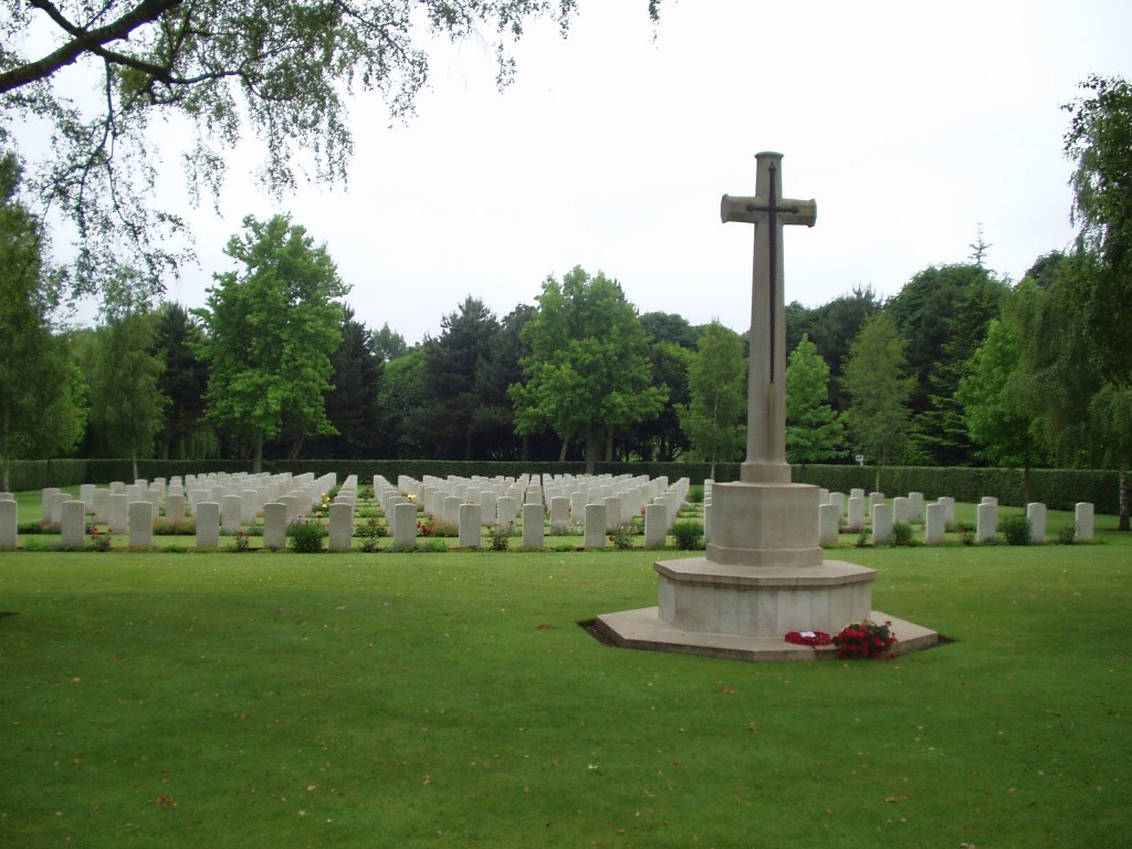
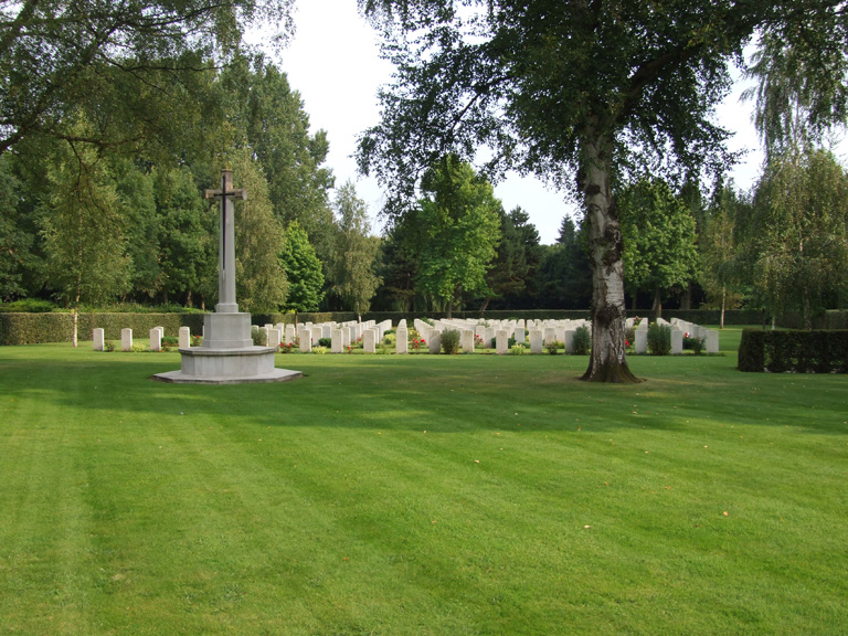
The Cross of Sacrifice is located at the front of the burial area, approximately 25 metres from the entrance, in the centre of cemetery.
There are stone benches located on either side of the Cross of Sacrifice facing inwards into the cemetery.
Internal paths are grass, ground is flat and firm.
ALTERNATIVE ACCESS
There is a 1.8 metre-wide access gate located 15 metres south of the entrance. There is a concrete shallow gulley and sloped kerb leading up to grass. The gate is 6 metres from the roadside.
ADDITIONAL INFORMATION
The cemetery is permanently open.
History information
The Allied offensive in north-western Europe began with the Normandy landings of 6 June 1944.
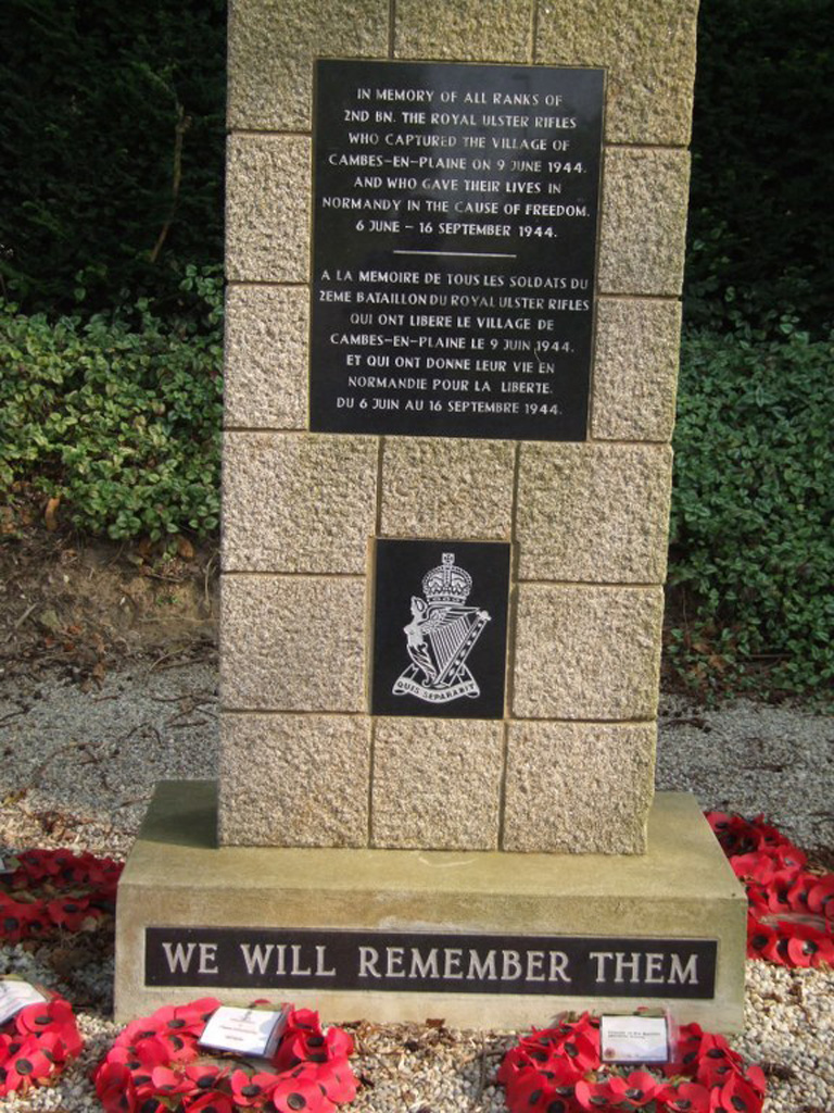
A unit of the East Riding Yeomanry, R.A.C., in support of the 3rd British Infantry Division, reached the northern outskirts of Cambes-en-Plaine on the 9th June. Here they found the Germans dug in and the advance to Caen was halted.
The original burials date from 8-12 July 1944, when the final attack on Caen (Operation Charnwood) was in progress. By noon on 9 July, most of Caen, north of the river Orne, had been captured.
More than half of the burials here belong to the 59th (Staffordshire) Division, in particular units of The South Staffordshire Regiment and The North Staffordshire Regiment, which was involved in this battle.
The cemetery contains 224 Second World War burials. It was designed by P.D. Hepworth.