Ranville Churchyard
- Country France
- Total identified casualties 46 Find these casualties
- Region Calvados
- Identified casualties from Second World War
- GPS Coordinates Latitude: 49.23199, Longitude: -0.25785
PLEASE NOTE
In March 2022 following storm Eunice, trees had to be removed from the cemetery resulting in major horticultural works.
As a result, some parts of the lawn are under construction and access to some headstones will be restricted until the summer 2022.
The main entrance to the site remains accessible. We apologise for any inconvenience caused.
Location information
Ranville is best reached by taking the D513 northeastwards out of Caen and after about 9 kilometres turning left at Herouvillette. Go north for one kilometre and then turn left into Ranville village. The Churchyard is on Rue des Airbornes.
Visiting information
ARRIVAL
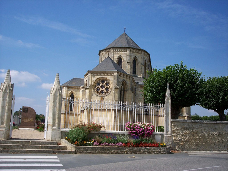
Ranville Churchyard is next to the village church in the centre of the village of Ranville, 9 kilometres northeast of Caen in the Calvados Region of France.
PARKING
Parking is located in front of the cemetery along the eastern perimeter wall. There are spaces for up to ten vehicles.
There is one accessible parking space, indicated with a signpost at the leftmost limit of the parking area.
The parking area is within 10 metres of the main entrance to the cemetery. The ground is flat and firm with a concrete and tarmac surface.
ACCESS LAYOUT AND MAIN ENTRANCE
The main entrance to the cemetery is in the middle of a tall white metal fence, with the entrance marked by two stone pillars.
A two-section metal gate, two metres wide, opens inwards into the cemetery.
There are 3 stone steps going up to the main gate, with a handrail on either side. Once inside the gate, the ground is level and flat. There is a metal grate drainage channel approximately 100 mm wide just inside the gate.
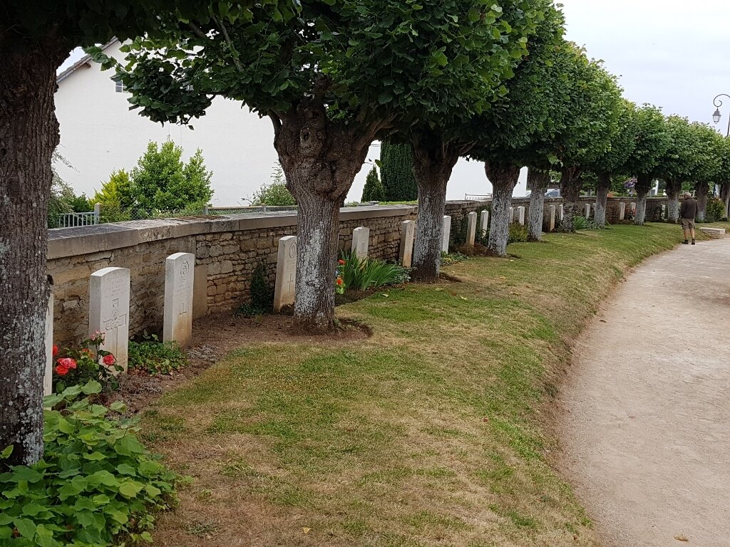
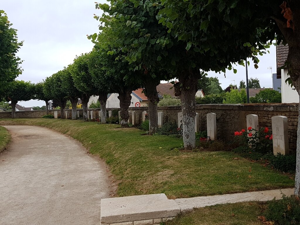
The CWGC headstones are located on the inside of the perimeter wall of the cemetery and are positioned in an arc running along the northeast boundary to the right of the main entrance.
The ground close to the main entrance is paved, flat and firm. There are paved double paths that follow an arc route around the cemetery.
There is a metal bench just inside the main entrance.
Where the paths are not paved, they are grass, the ground is level and firm.
ALTERNATIVE ACCESS
Along the perimeter wall, approximately ten metres from the accessible parking space is a gap with a 1.5-metre-wide white metal gate. The gate is approximately 1.80 metres high and opens inwards into the cemetery. There is a handle which is turned counterclockwise to open the gate.
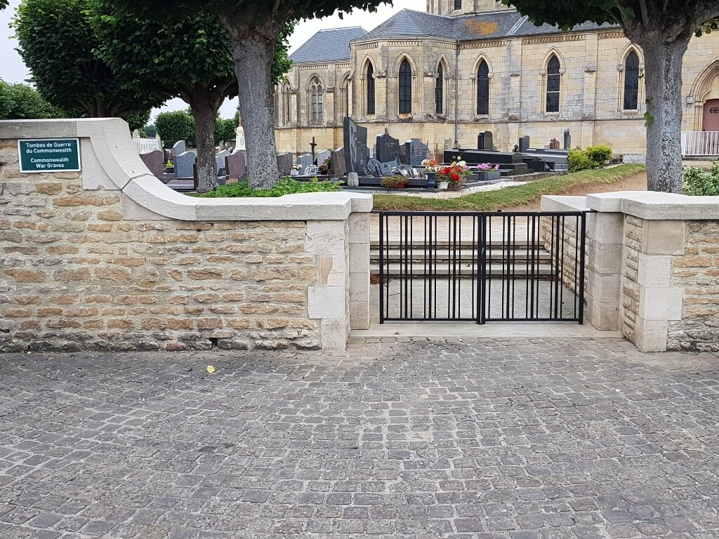
There is an additional entrance into the CWGC section at the northeastern corner of the cemetery. A latched low-level two section gate opens inwards from a cobbled semi-circular paved area in front of the cemetery wall. Three steps lead up to the internal pathway. This entrance is at the midpoint of the CWGC war graves located on either side of this entrance. The ground is flat and firm.
There is also an opening approximately 1.5 metres wide, leading into Ranville War Cemetery on the southern boundary wall.
ADDITIONAL INFORMATION
Ranville Churchyard Cemetery is locked from 1900 hrs to 0800 hrs overnight.
History information
The Allied offensive in northern Europe began with the Normandy landings of 6 June 1944.
Ranville was the first village to be liberated in France when the bridge over the Caen Canal was captured intact in the early hours of 6 June by troops of the 6th Airborne Division, who were landed nearby by parachute and glider. Many of the division's casualties are buried in Ranville War Cemetery and the adjoining churchyard
The CEMETERY contains 2,235 Commonwealth burials of the Second World War, 97 of them unidentified. There are also 321 German graves and a few burials of other nationalities.
The CHURCHYARD contains 47 Commonwealth burials, one of which is unidentified, and one unidentified German grave.