Longuenesse (St. Omer) Souvenir Cemetery
- Country France
- Total identified casualties 3397 Find these casualties
- Region Pas de Calais
- Identified casualties from First & Second World War
- GPS Coordinates Latitude: 50.73114, Longitude: 2.25023
Location information
St. Omer is a large town 45 kilometres south-east of Calais. Longuenesse is a commune on the southern outskirts of St. Omer. The Cemetery is approximately 3 kilometres from St Omer, beside the Wizernes (Abbeville) road (the D928), at its junction with the Rue des Bruyeres.
Visiting information
ARRIVAL
The route to cemetery is signposted.
PARKING
There is parking on the main road along the front of the cemetery close to the cemetery entrance, with up to 15 parking spaces. This on-street parking is on the opposite side of the road to the cemetery. There is a pedestrian crosswalk in front of the main entrance.
In addition to on-street parking, there is a large car park with space for multiple vehicles located to the rear of the cemetery on Rue Louis Delattre.
The closest entrance is within 10 metres of the parking areas along the main road.
ACCESS LAYOUT AND MAIN ENTRANCE
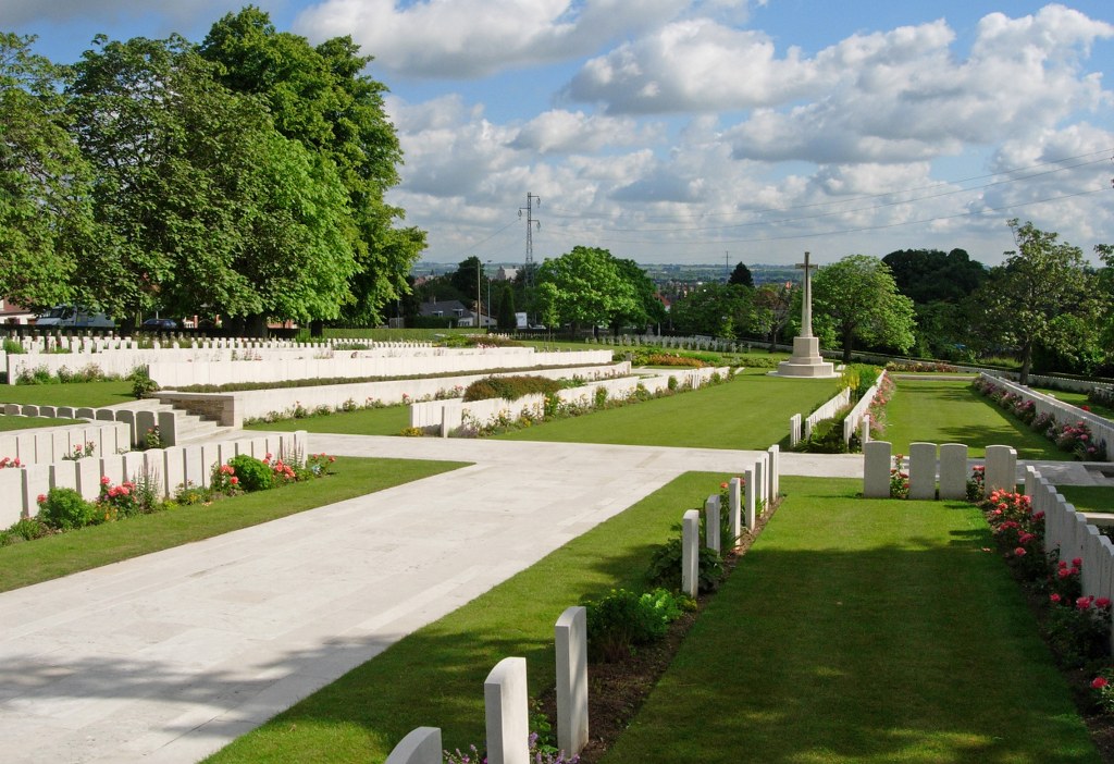
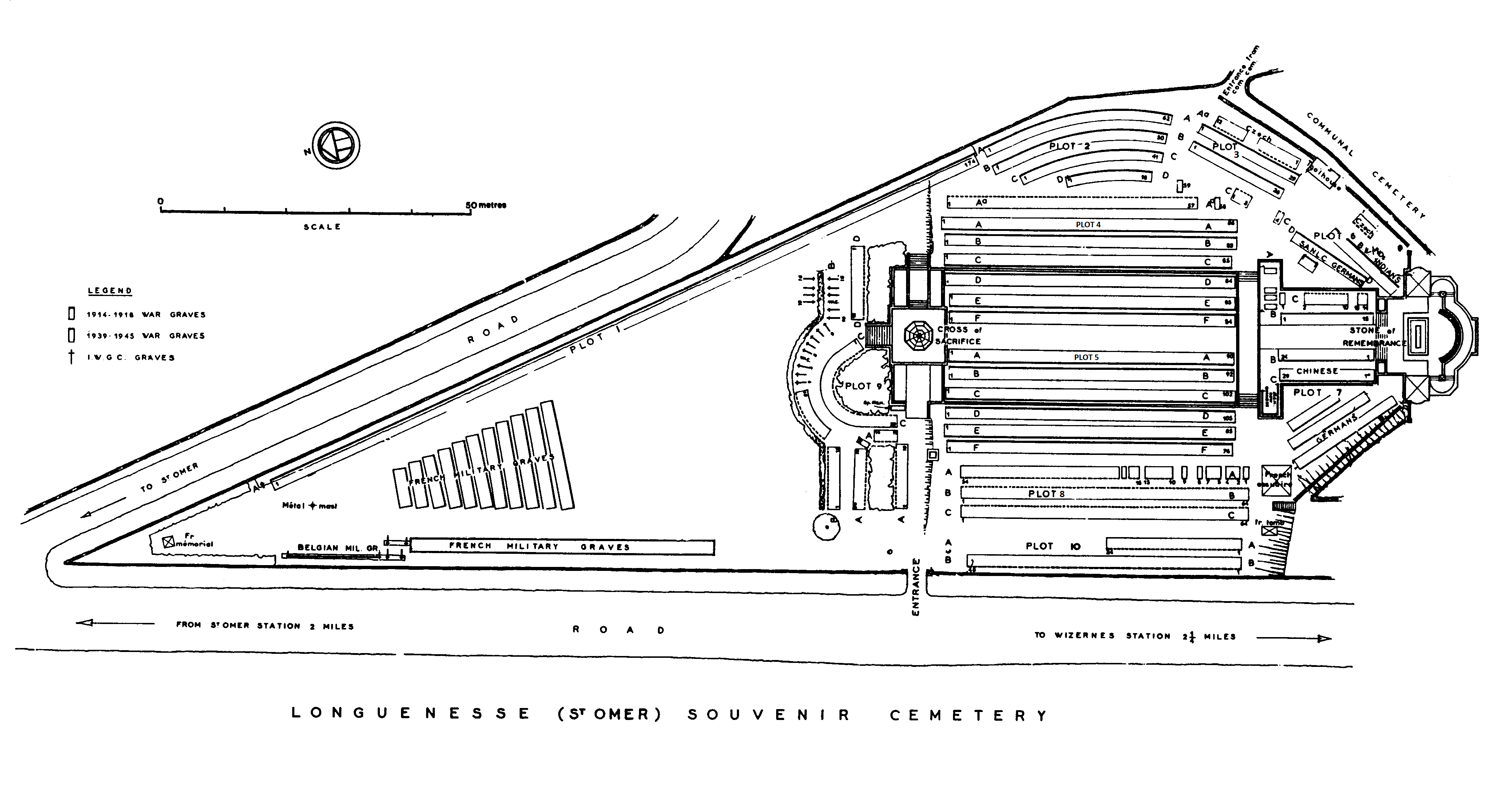
The cemetery is a triangular shape and organised by casualty nationality, in separate areas, on multiple levels.
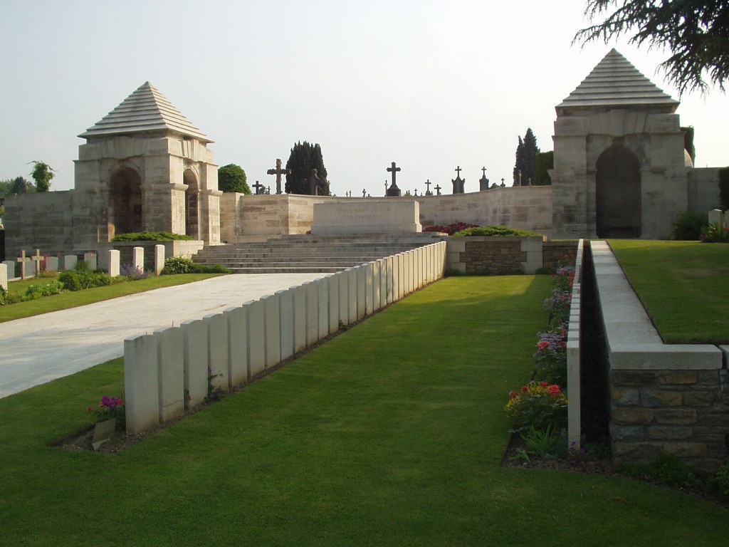
At the main entrance is a tall (1.90 metre) black, metal gate, between 2 stone pillars. The double gate is 2.5 metres wide, with a twist-and-turn ring handle to open the right-side gate, opening inwards. Paving in front of the gate is approximately 25 mm higher than the footpath along the roadway running alongside the cemetery. The paving inside the gate is 75 mm lower than the paving in front of the entrance. The paving leads directly onto grass inside the cemetery.
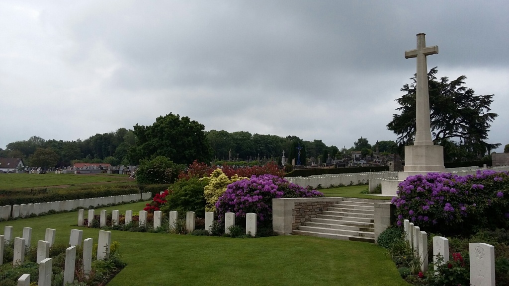
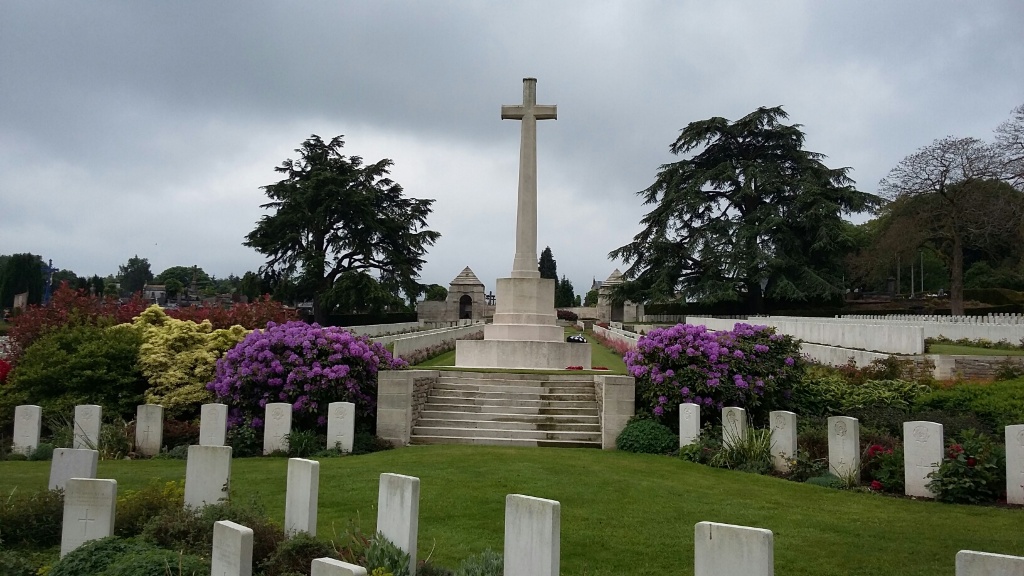
The cemetery is on a slope. The ground surface is mostly grass but there are a few paved areas where there are steps and grass platforms accessed by stone steps or sloped grass areas. The cemetery slopes upwards from the northern end towards the shelter buildings and Stone of Remembrance.
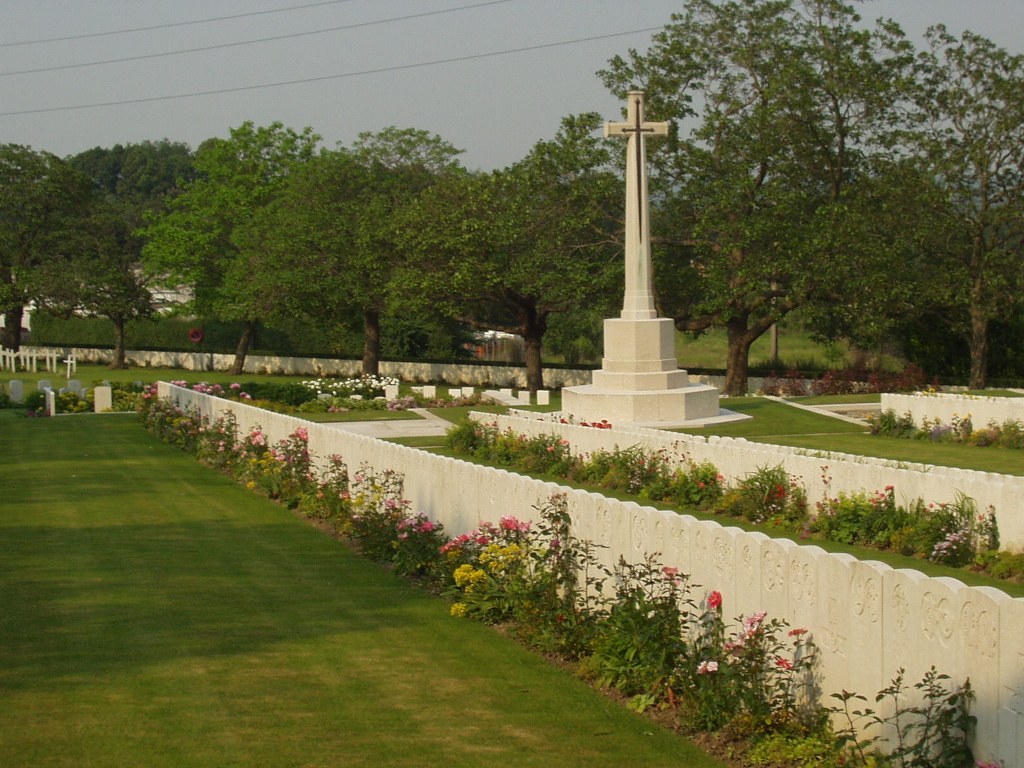
The Cross of Sacrifice is in a central position on a flat grass platform. It is accessed by stone steps from the northern and eastern sides with a mixture of paved and grassed platforms surrounding the Cross. The Cross is accessible directly from the main entrance with no change in levels on the western side.
There are two stone shelter buildings at the southern end of the cemetery in line with the Cross of Sacrifice, in line with the Stone of Remembrance. A large paved area, accessed by steps leads to the rear shelter buildings. There is a small step up from the paved area surrounding the Stone of Remembrance into each shelter.
The Register Box is located in the right-side shelter, viewed from the Stone of Remembrance. There is an open archway in this shelter which drops off approximately one metre on the north side of the shelter looking towards the cemetery.
The left-side shelter is accessible via the raised platform with the Stone of Remembrance. It can also be accessed from the plot north of the shelter through the open archway with a single step up from the grass.
There are stone benches located inside both shelter buildings.
ALTERNATIVE ACCESS
From the car park it is possible to access the cemetery through a rear entrance into the cemetery near the Cross of Sacrifice. Further access into the cemetery is also possible from the adjoining communal cemetery south of the cemetery via steps to the rear of the shelter buildings.
ADDITIONAL INFORMATION
The cemetery is permanently open.
Please note, in some rows there are two headstones per grave, which can cause confusion when counting headstones to find a grave. If a headstone is not found by counting headstones, then we suggest continuing to look further along the row as for instance, the headstone for grave 10 could be 19th or 20th headstone in the row.
History information
St. Omer was the General Headquarters of the British Expeditionary Force from October 1914 to March 1916. Lord Roberts died there in November 1914. The town was a considerable hospital centre with the 4th, 10th, 7th Canadian, 9th Canadian and New Zealand Stationary Hospitals, the 7th, 58th (Scottish) and 59th (Northern) General Hospitals, and the 17th, 18th and 1st and 2nd Australian Casualty Clearing Stations all stationed there at some time during the war. St. Omer suffered air raids in November 1917 and May 1918, with serious loss of life.
The cemetery takes its names from the triangular cemetery of the St. Omer garrison, properly called the Souvenir Cemetery (Cimetiere du Souvenir Francais) which is located next to the War Cemetery.
The Commonwealth section of the cemetery contains 2,874 Commonwealth burials of the First World War (6 unidentified), with special memorials commemorating 23 men of the Chinese Labour Corps whose graves could not be exactly located. Second World War burials number 403, (93 unidentified). Within the Commonwealth section there are also 34 non-war burials and 239 war graves of other nationalities.
The cemetery was designed by Sir Herbert Baker.