St. Venant Communal Cemetery
- Country France
- Total identified casualties 381 Find these casualties
- Region Pas de Calais
- Identified casualties from First & Second World War
- GPS Coordinates Latitude: 50.62422, Longitude: 2.55486
Location information
St. Venant is a town in the Department of the Pas-de-Calais, 15 kilometres north-west of Bethune. The Communal Cemetery is 1 kilometre east of the town. Leave the church and head east crossing the main road at the base of the bridge over the river. After 500 metres the car park for the Communal Cemetery is found on the left hand side.
History information
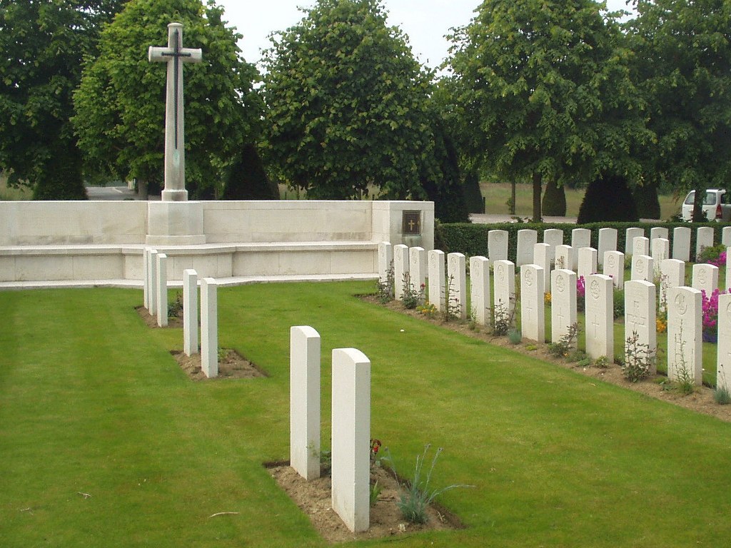
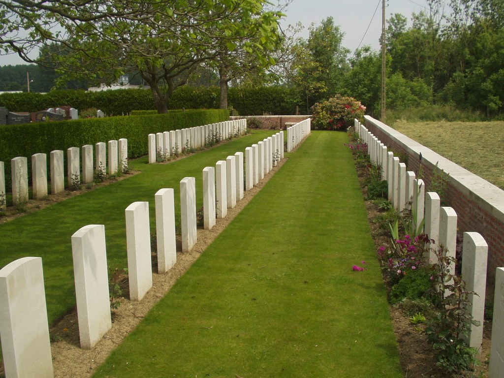
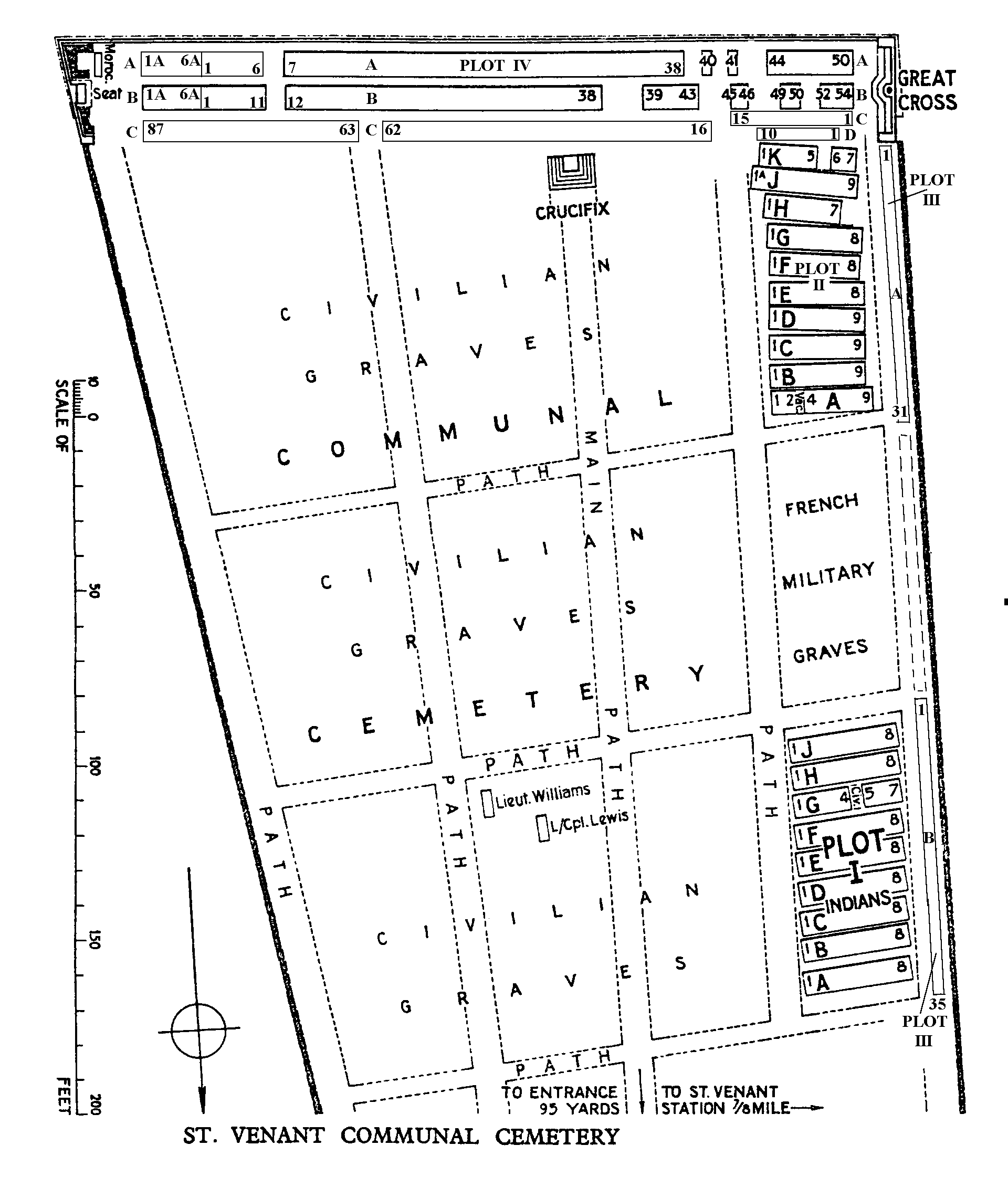
From January 1915 to October 1917, British and Indian Casualty Clearing Stations were posted at St. Venant. In April 1918, during the Battles of the Lys, the Germans advanced half-way between Merville and St. Venant, but the latter town remained in British hands. On the West side of St. Venant Communal Cemetery is the Indian Plot (I), used from January to July 1915; behind that is a French Military Plot; and behind the French Plot is Plot II, used from August 1915 to December 1916. Two British graves are in a civilian plot. During the 1939-45 War, St. Venant was the centre of heavy fighting when delaying actions covered the withdrawal of the British Expeditionary Force to the coast. In fact British troops continued fighting at St. Venant after the evacuation of Dunkirk, and 90 or more were buried in a mass grave in a field at St. Venant. The 1939-45 burials are in Plots III and IV. There are 253 Commonwealth burials of the 1914-18 war, 10 of which are unidentified, and 177 of the 1939-1945 war, 40 of which are unidentified, in this site. The 1939-45 total includes the 90 originally buried in a mass grave and an officer who is commemorated by a special memorial inscribed "Believed to be".