Worms (Hochheim Hill) Cemetery
- Country Germany
- Total identified casualties 113 Find these casualties
- Region Rheinland-Pfalz
- Identified casualties from First World War
- GPS Coordinates Latitude: 49.6487, Longitude: 8.33229
Location information
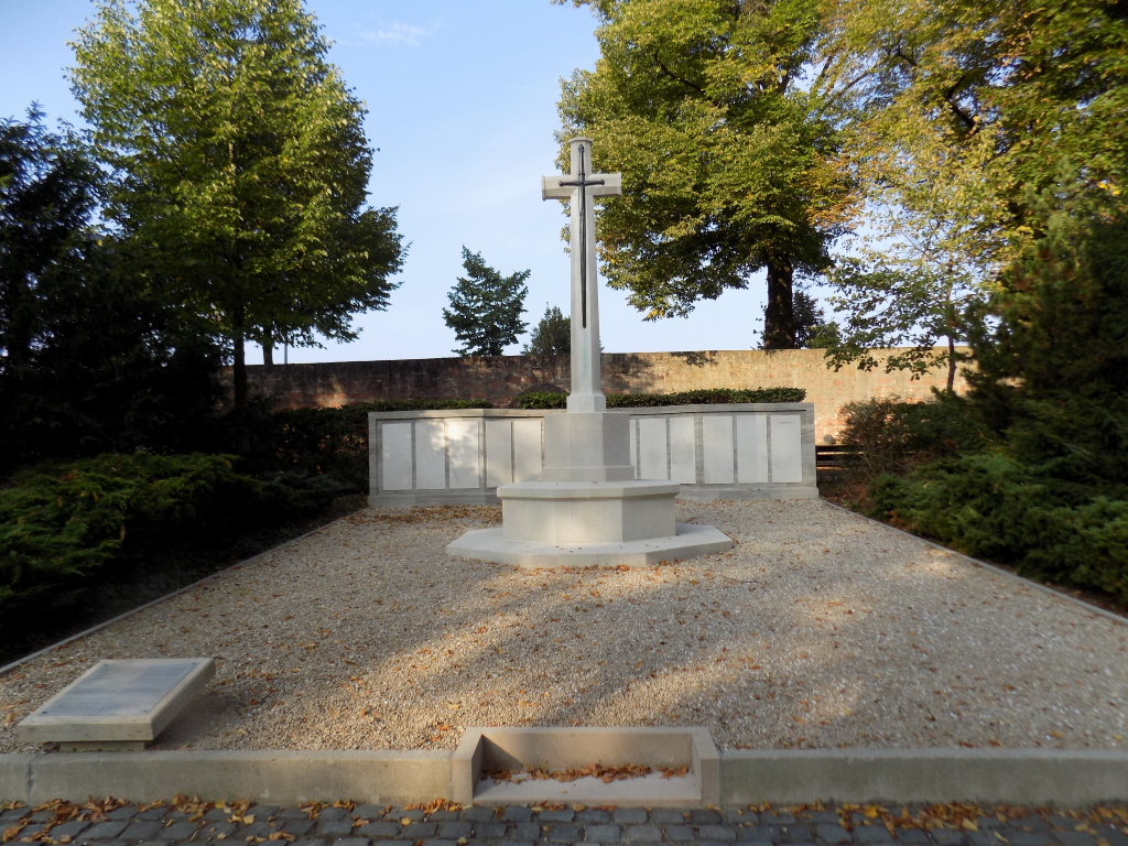
Worms is a town in south west Germany approx 40 kms north of Mannheim and approx 78 kms south of Frankfurt am Main. From the A61 Köln to Mannheim motorway take exit 57 WORMS-NORD / MÖRSTADT and follow L425 direction WORMS-NORD for approx 2 kms then turn right onto K18 direction WORMS-HERRNSHEIM. Continue for approx 3.8 kms to a set of traffic lights at the junction of JOHANN-HINRICH-WICHERN-STRAßE and HÖHENSTRAßE. Continue along HÖHENSTRAßE for approx 100 m and the parking for the cemetery can be found on the left. On entering the cemetery continue straight for approx 200 m, then up some steps and the Cross of Sacrifice can be found on the right. The cemetery address is: Höhenstraße 67549 Worms Germany GPS Co-ordinates: N 49 38 55, E 08 19 56
Visiting information
There is a car park and a side entrance to the cemetery. At the entrance is a large plan of the entire cemetery. The cemetery has the following opening times :
1 April-31 August (summer) from 7.00 hrs till 21.00 hrs; 1 September-31 October (autumn) from 7.00 hrs till 20.00 hrs; 1 November-31 March (winter)from 8.00 hrs till 17.00 hrs
History information
The majority of First World War Commonwealth war graves in Germany were moved into four permanent cemeteries after the war. However, a few graves could not be moved on religious grounds or for other reasons and they remain in their original locations in German military and civil cemeteries. Worms (Hochheim Hill) Cemetery contains a substantial plot of Allied prisoner of war burials. Among these are the graves of 113 Commonwealth servicemen who died in 1918. The names of the dead are inscribed on a screen wall. Their names are carved on a screen wall in the Allied Plot.