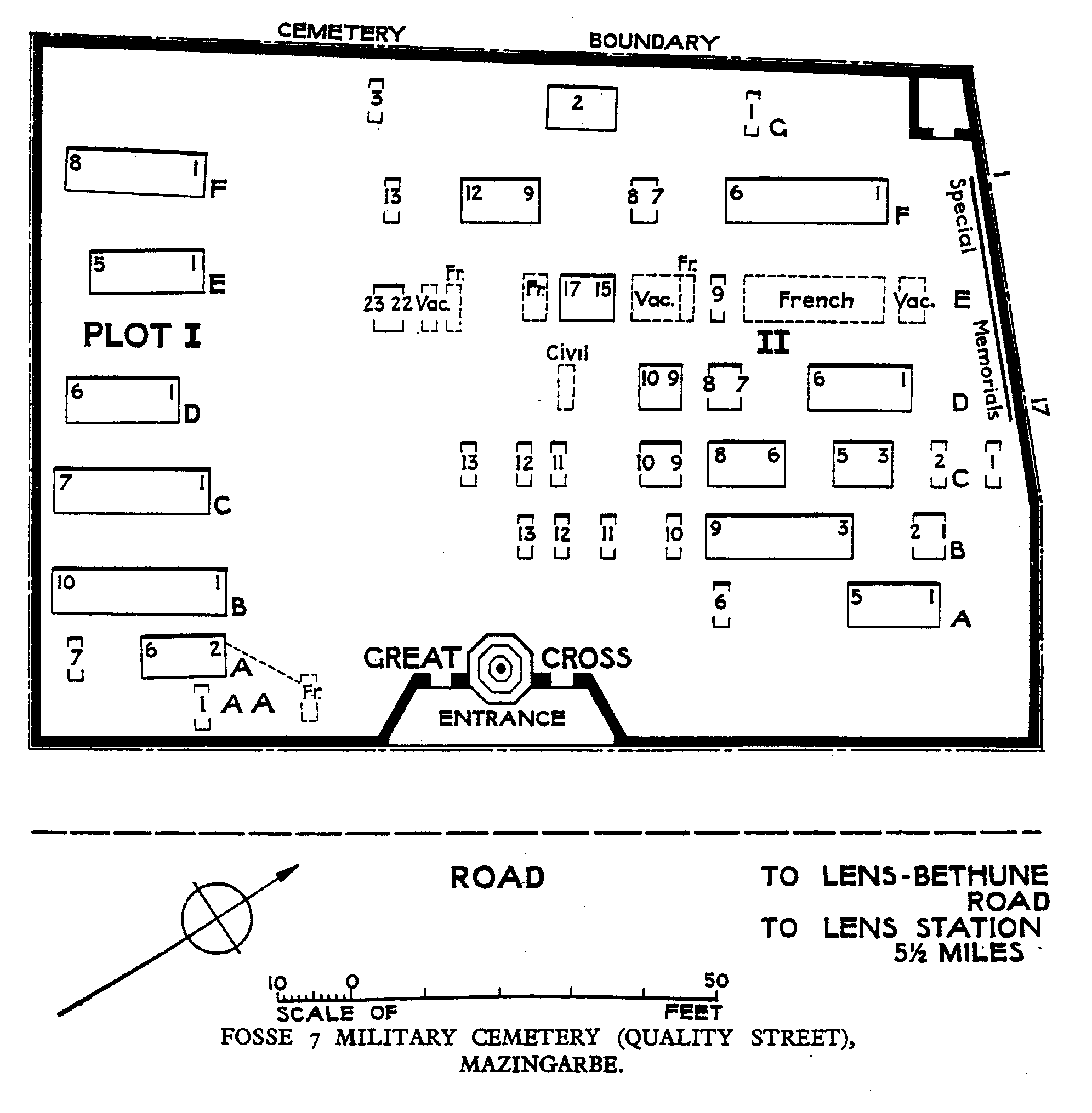
Fosse 7 Military Cemetery (Quality Street), Mazingarbe
- Country France
- Total identified casualties 118 Find these casualties
- Region Pas de Calais
- Identified casualties from First World War
- GPS Coordinates Latitude: 50.46525, Longitude: 2.75675
PLEASE NOTE
Maintenance work is currently in progress. The site will remain open and accessible during this time. We apologise for any inconvenience caused.
Location information
Mazingarbe is a village in the Department of the Pas-de-Calais, 10 kilometres south-east of Bethune. From Lens, take the N43 towards Bethune. Arriving at Mazingarbe take the first road on your left. The cemetery is 200 metres on the right.
Visiting information
Wheelchair access is possible with some difficulty. For further information regarding wheelchair access, please contact our Enquiries Section on telephone number 01628 507200.
History information
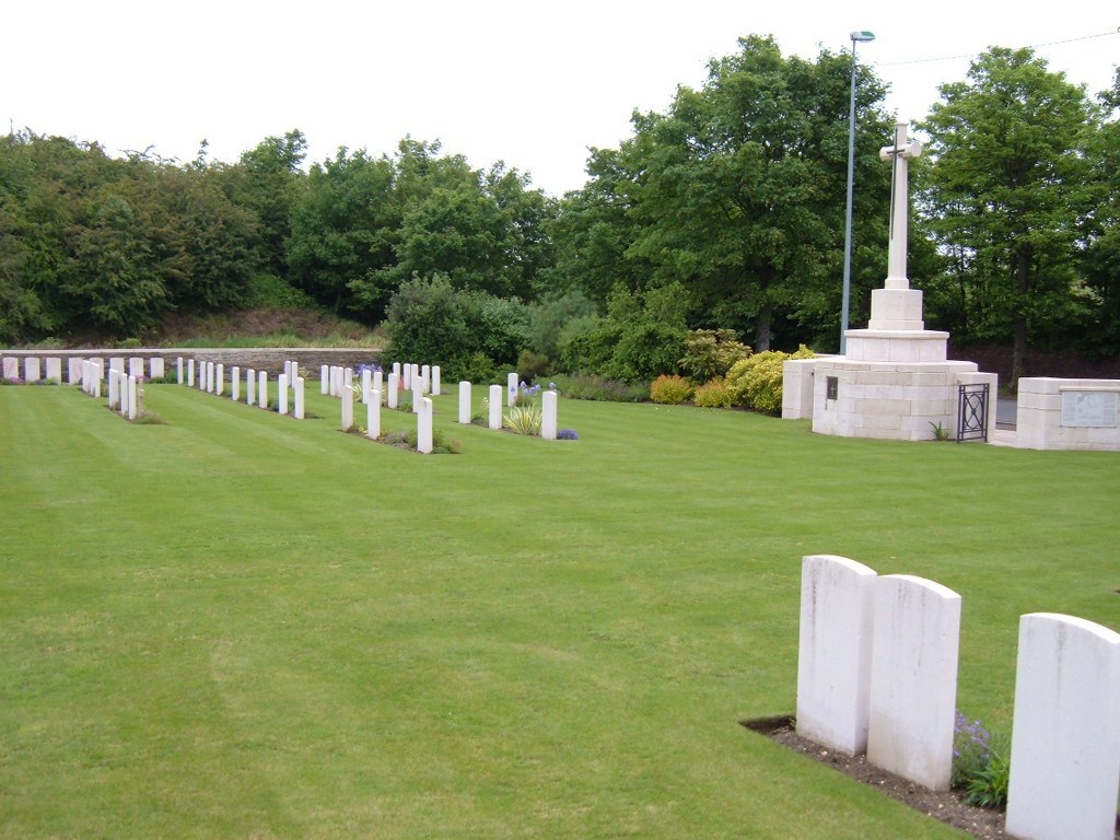
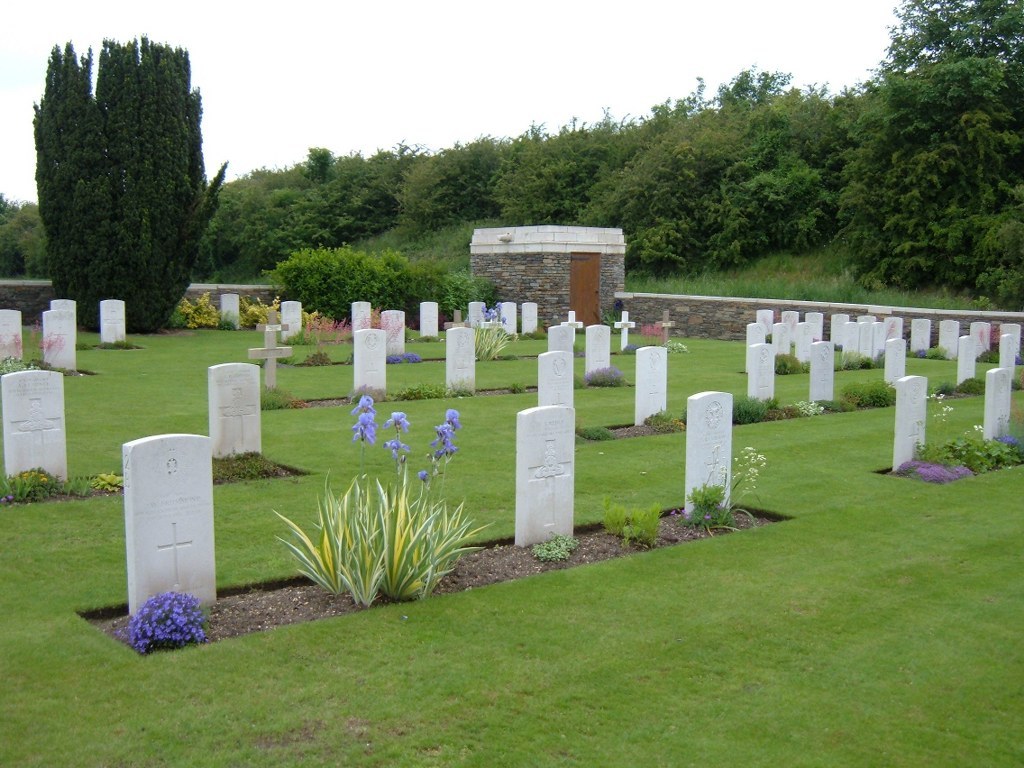
Fosse 7 was four kilometres East of Mazingarbe, on the West side of the road from Lens to Bethune and it consisted of a pit-head and an Electric Power Station with a garden suburb of miners' houses (the trench which led into the cemetery was named "Quality Street" during the War). The cemetery was begun by French troops in May, 1915, and carried on by British units from June, 1915, to April, 1917. There are now over 100, 1914-18 war casualties commemorated in this site. Of these, over 10 are unidentified and 17, destroyed by shell fire, are now represented by special memorials. The cemetery covers an area of 1,200 square metres and is enclosed by a rubble wall.