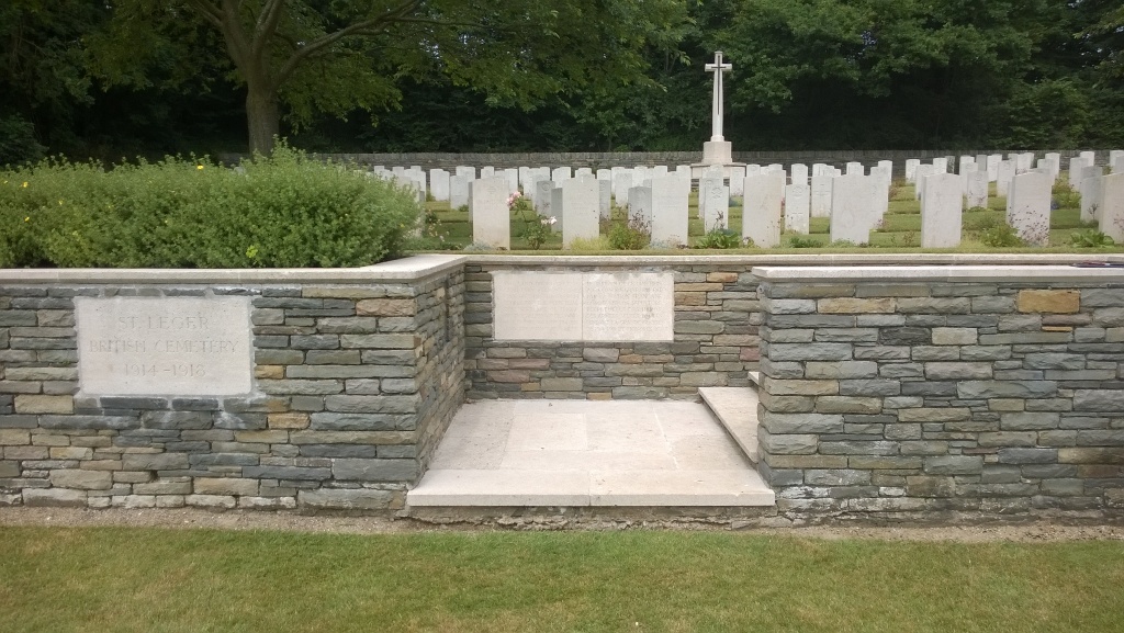
St. Leger British Cemetery
- Country France
- Total identified casualties 181 Find these casualties
- Region Pas de Calais
- Identified casualties from First World War
- GPS Coordinates Latitude: 50.18865, Longitude: 2.85433
Location information
St. Leger is a village approximately 12 kilometres south of Arras and 8 kilometres north of Bapaume. St Leger British Cemetery lies down a 500 metre track to the north-west of the village.
Visiting information
Wheelchair access to this site is possible, but maybe by an alternative entrance. For further information regarding wheelchair access, please contact our enquiries dept. on 01628 634221.
History information
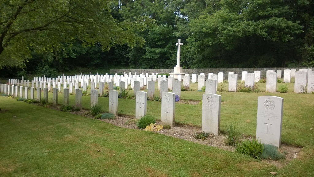
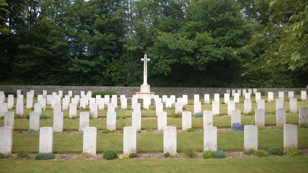
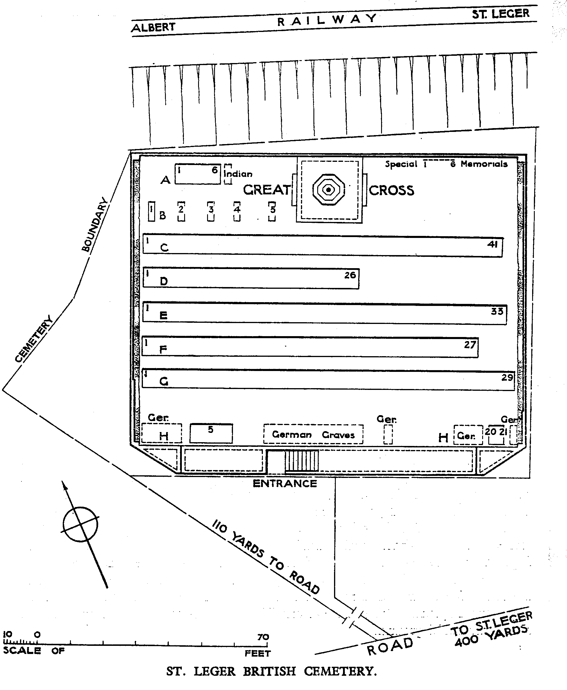
St. Leger village was occupied by Commonwealth troops in the middle of March 1917, lost after obstinate defence by the 40th and 34th Divisions a year later, and recaptured towards the end of the following August, after severe fighting, by the 62nd (West Riding) and Guards Divisions. The cemetery was begun in March 1917 and used by fighting units and field ambulances until March 1918, when a certain number of burials were made by the Germans. The Cemetery contains 184 Commonwealth burials and commemorations of the First World War. Three of the burials are unidentified and six destroyed by shell fire are represented by special memorials. The cemetery also contains 20 unidentified German burials.