Ville-Sur-Ancre Communal Cemetery Extension
- Country France
- Total identified casualties 52 Find these casualties
- Region Somme
- Identified casualties from First World War
- GPS Coordinates Latitude: 49.95847, Longitude: 2.60875


Location information
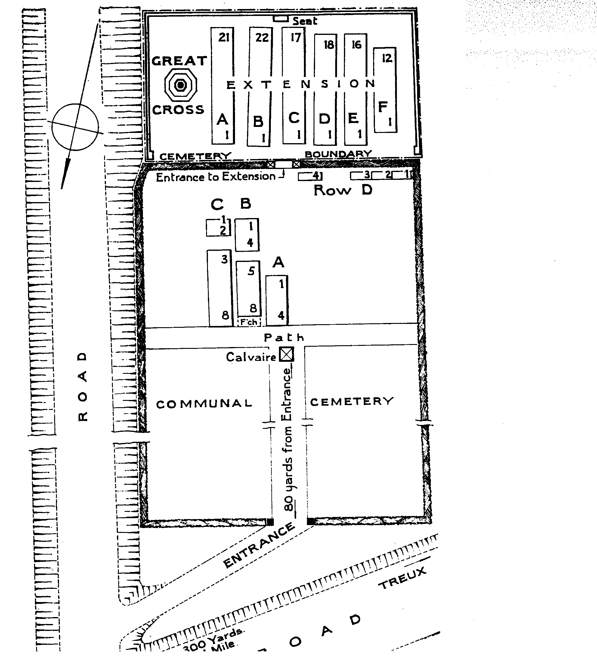
Ville-sur-Ancre is a village in the Department of the Somme, 7 Kms south-west of Albert and 2 Kms north of Morlancourt. The Communal Cemetery is on the road to Treux and the Extension adjoins the south end of it.
Visiting information
The location or design of this site makes wheelchair access impossible. For further information regarding wheelchair access, please contact our enquiries department on 01628 634221.
History information
In 1916 the village of Ville-sur-Ancre was used occasionally by field ambulances. It was captured by the Germans at the end of April 1918, and retaken by the 2nd Australian Division on 19 May. The communal cemetery was used for burials during 1916. The extension was begun in August 1918 by the 12th Division Burial Officer, and after the Armistice graves were brought in from the battlefields of the Somme and the Ancre. One of the concentrated graves was brought from BEAUMONT-HAMEL GERMAN CEMETERY, on the South-West side of Beaumont-Hamel village. The EXTENSION contains 106 First World War burials, 54 of them unidentified. The COMMUNAL CEMETERY contains 24 Commonwealth burials of the First World War, and one French grave. There are also four Second World War burials, one of which is unidentified.