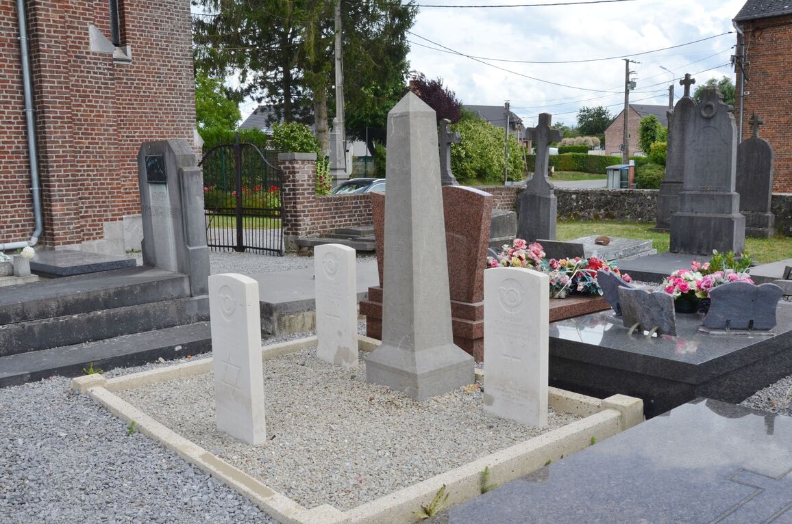
Semousies Churchyard
- Country France
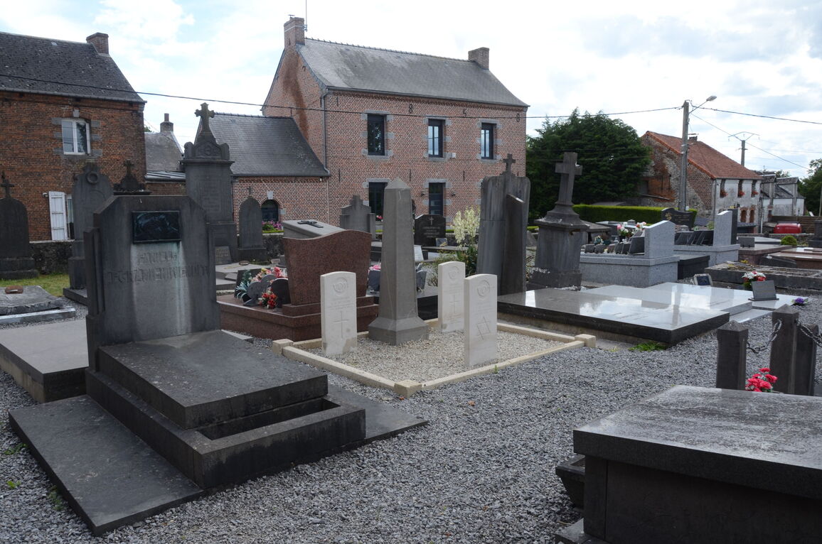
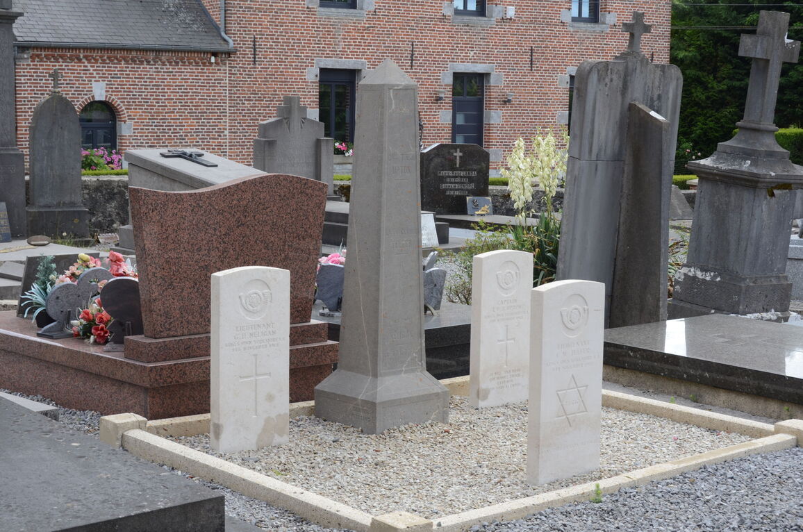
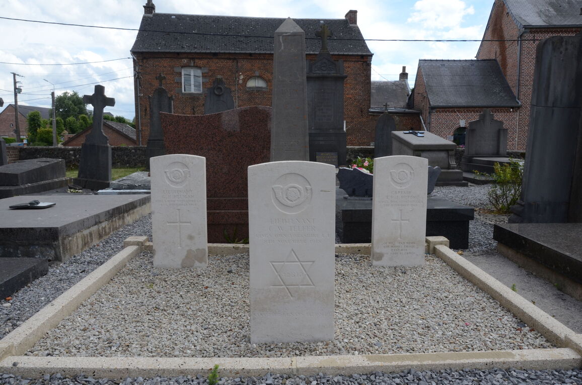
- Total identified casualties 3 Find these casualties
- Region Nord
- Identified casualties from First World War
- GPS Coordinates Latitude: 50.16421, Longitude: 3.96111
Location information
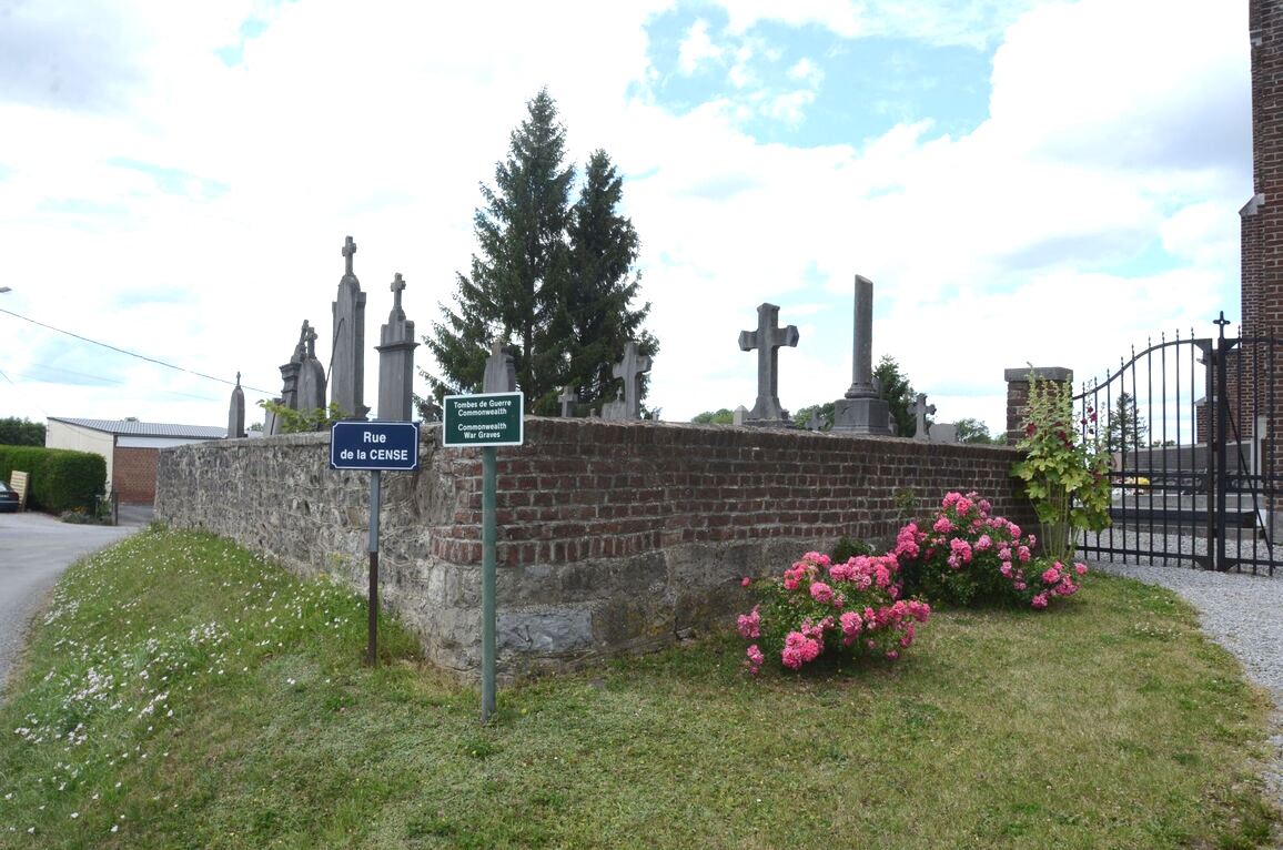
Semousies is a village in the Department of Nord, some 6 kilometres north of Avesnes-sur-Helpe. The village is on the right of the N2 Avesnes-sur-Helpe/Maubeuge. The cemetery is beside the church in the centre of the village. The three Commonwealth burials are on the left hand side of the entrance.
History information
Semousies Churchyard contains three Commonwealth burials of the First World War.