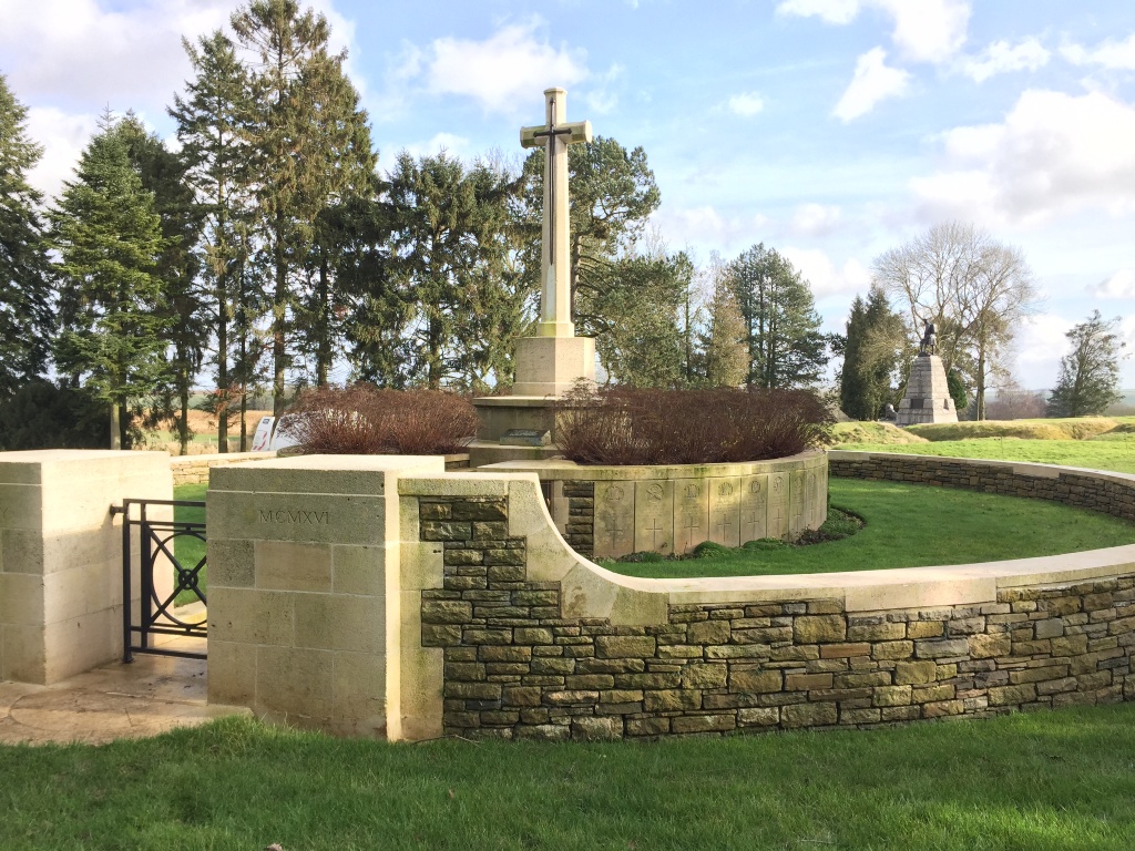
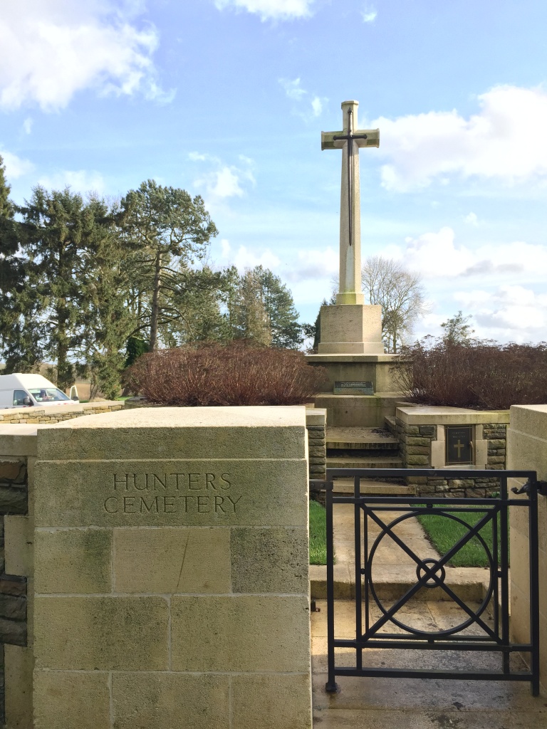
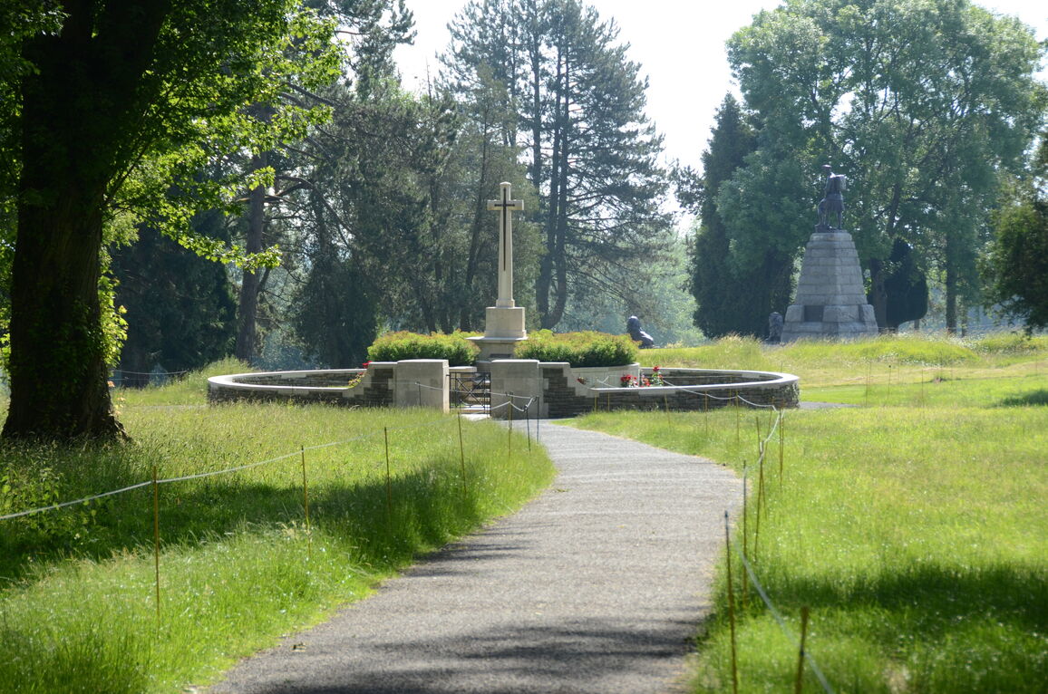
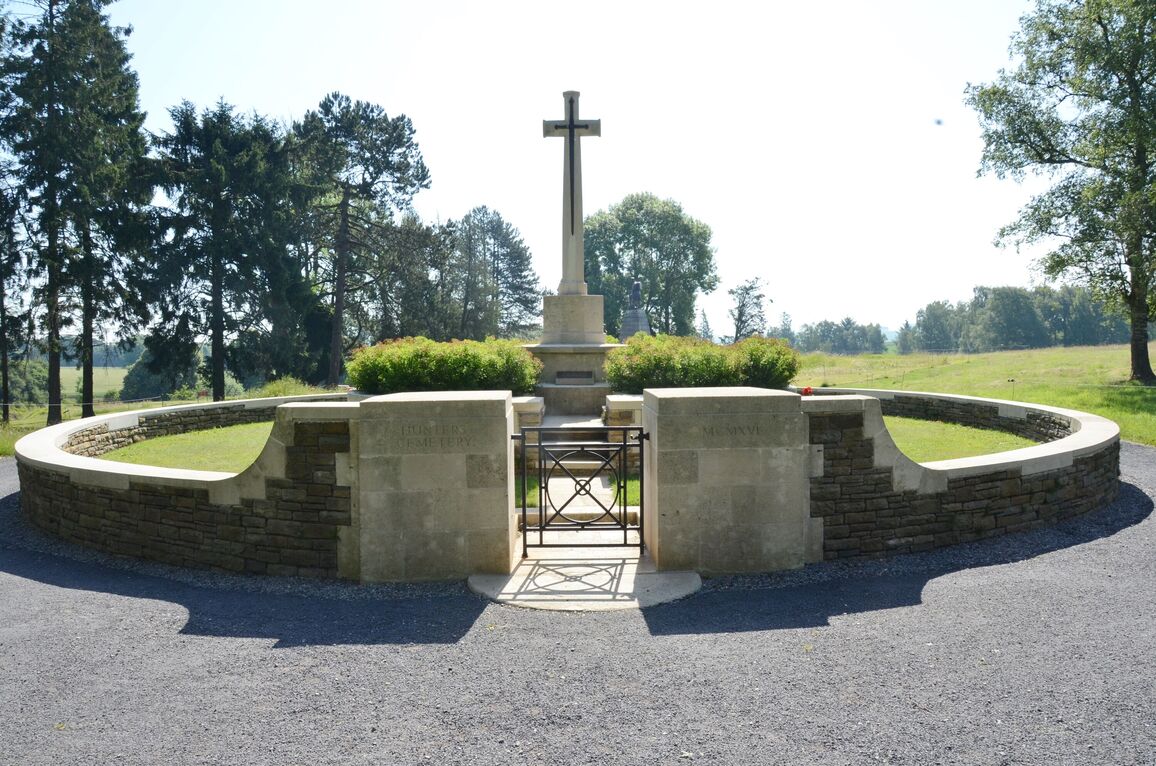
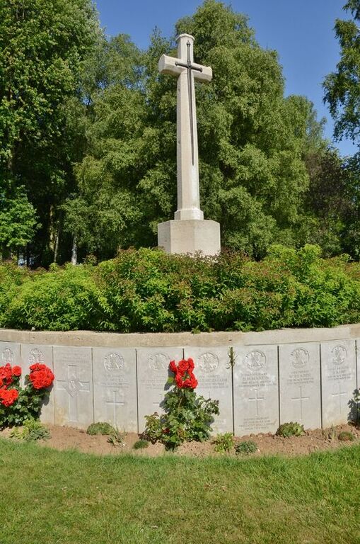
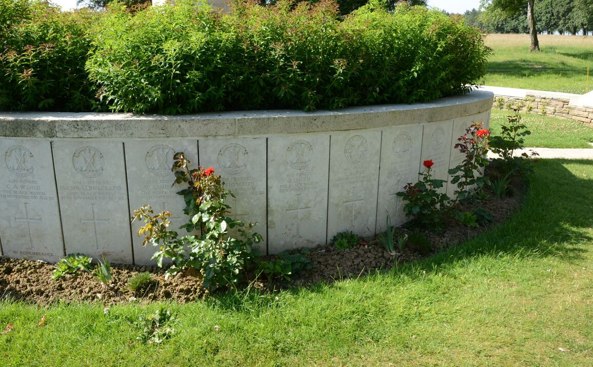
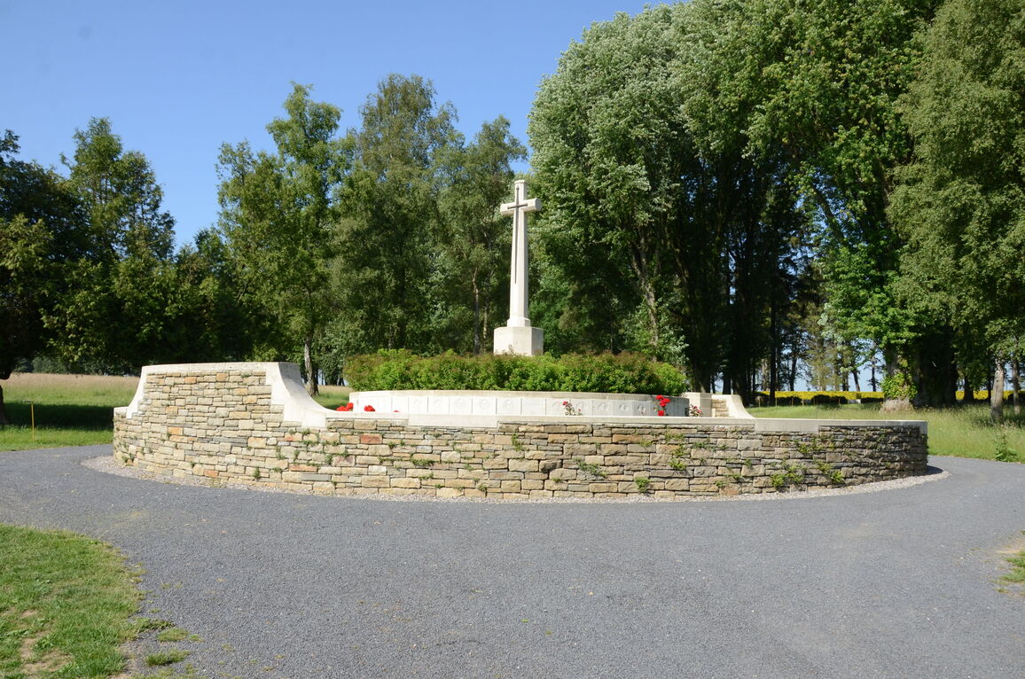
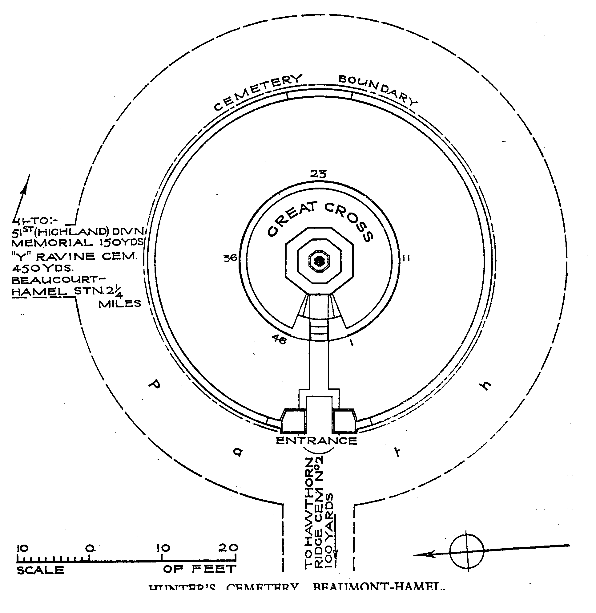
Hunter's Cemetery, Beaumont-Hamel
- Country France
- Total identified casualties 41 Find these casualties
- Region Somme
- Identified casualties from First World War
- GPS Coordinates Latitude: 50.07808, Longitude: 2.64946
Location information
Beaumont-Hamel is a village in the Department of the Somme. Using the D919 from Arras to Amiens you will drive through the villages of Bucquoy and Puisieux and then Serre-les-Puisieux (approximately 20 kilometres south of Arras). On leaving Serre-les-Puisieux, 3 kilometres further along the D919, turn left following the signs for "Newfoundland Park, Beaumont Hamel". Hunter's Cemetery stands at the upper end of "Y" Ravine, within Newfoundland Memorial Park.
Visiting information
Wheelchair access with some difficulty. For further information regarding wheelchair access, please contact our enquiries department on telephone number 01628 634221.
History information
Beaumont-Hamel was attacked in vain on the 1st July, 1916, and captured by the 51st (Highland) and 63rd (Royal Naval) Divisions on the following 13th November. Hunter's Cemetery (the origin of the name may refer to a Chaplain attached to the Black Watch, the Rev. Hunter) is, in fact, a great shell-hole, in which soldiers of the 51st Division, who fell in the capture of Beaumont-Hamel, were buried after the battle. There are now over 40, 1914-18 war casualties commemorated in this site.