Bordighera British Cemetery
- Country Italy
- Total identified casualties 84 Find these casualties
- Identified casualties from First World War
- GPS Coordinates Latitude: 43.78543, Longitude: 7.67815
Location information
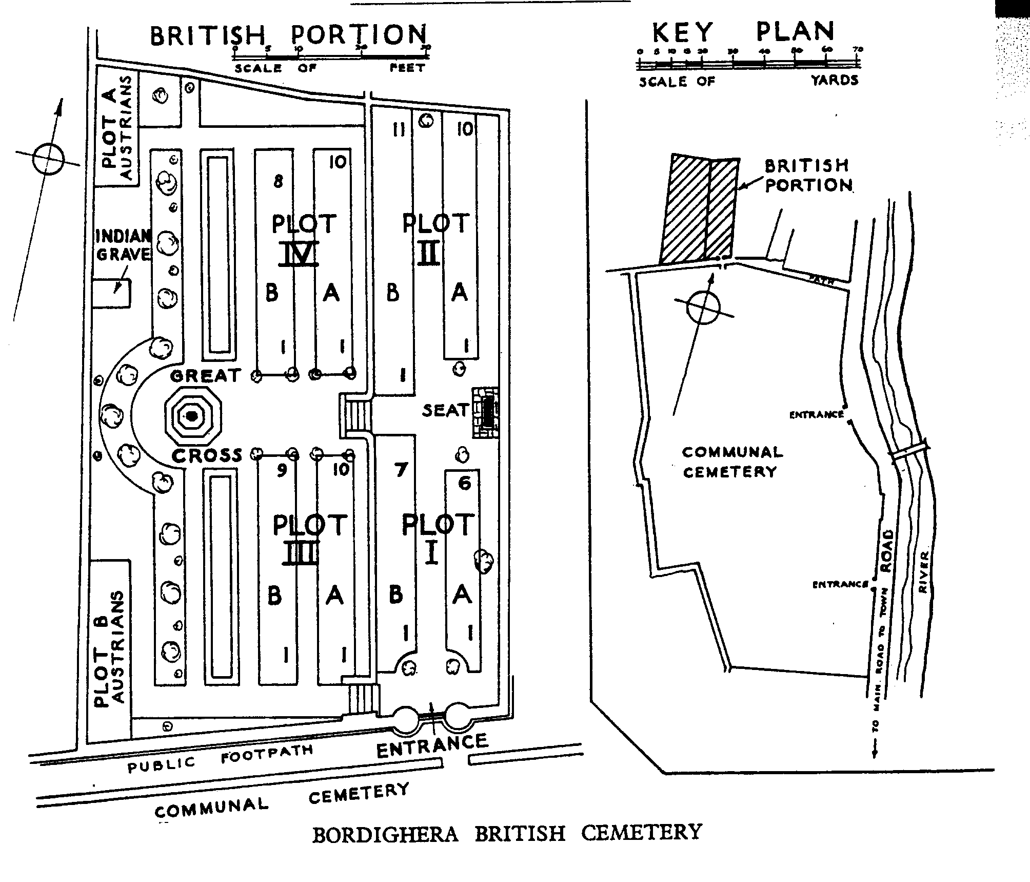
Exit the A10 motorway at Bordighera and follow the signs in the direction of San Remo - this road leads east along the coast. Pass a small yacht harbour on your right and take the second left after the yacht harbour, following Commission signs. The cemetery is 350 metres on the left, within Bordighera Main Communal Cemetery. This is a CWGC cemetery with its own entrance and is permanently open. Cemetery address: Via al Campo Santo - 18012 Bordighera (IM). GPS Co-ordinates: Latitude: 43.78544, Longitude: 7.678263.
Visiting information
The Cemetery is permanently open and may be visited at any time. Wheelchair access is possible via the main entrance.
For further information and enquiries please contact enquiries@cwgc.org
History information
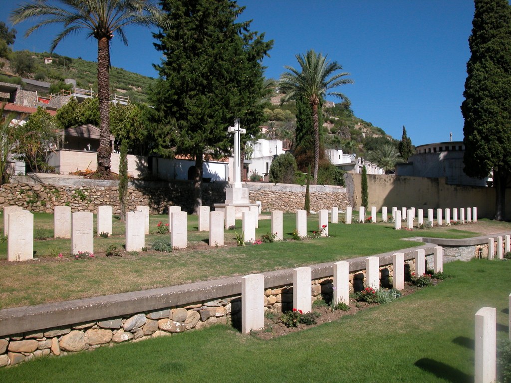
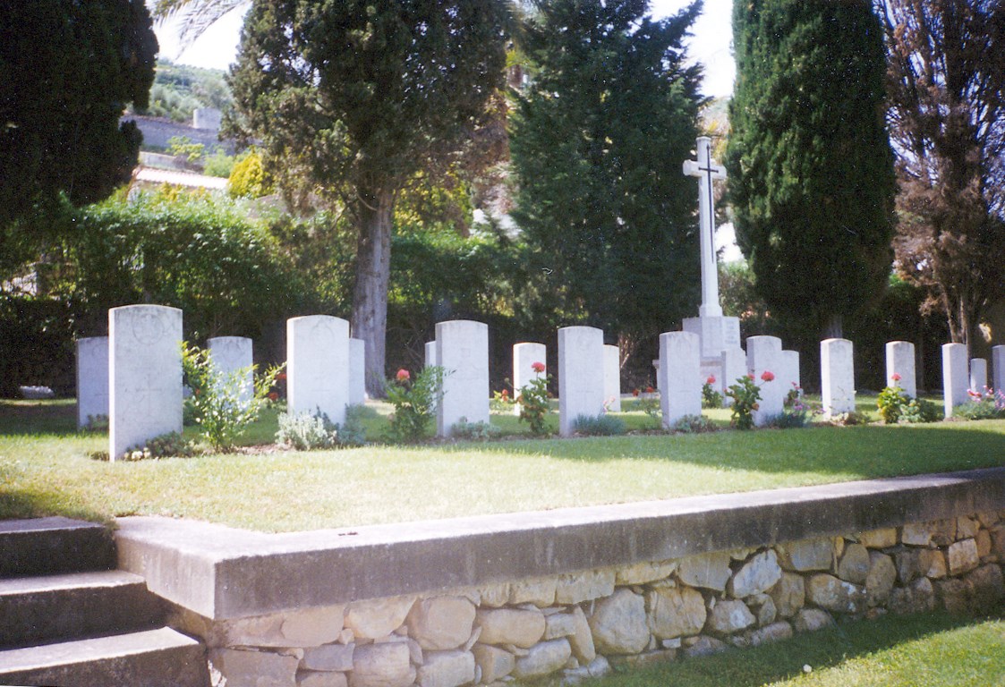
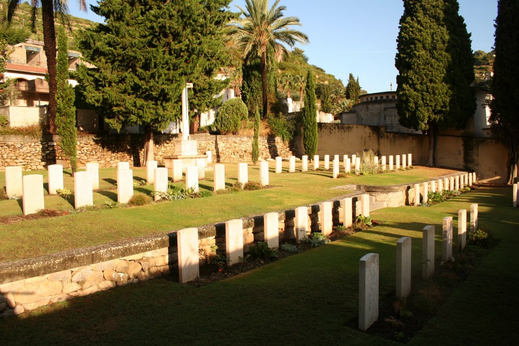
The Italians entered the war on the Allied side, declaring war on Austria, in May 1915. Commonwealth forces were at the Italian front between November 1917 and November 1918, and rest camps and medical units were established at various locations in northern Italy behind the front, some of them remaining until 1919. From the Summer of 1917 until late 1918, the Mediterranean lines of communication for the British Salonika Force ran the length of Italy from Taranto in the south-east, to Turin in the north-west. The 62nd General Hospital was posted at Bordighera from January 1918 to January 1919, and the 66th from January to March 1918. The British cemetery is opposite the town cemetery and was used from November 1917 to January 1919. It contains 72 Commonwealth burials of the First World War, and 12 Austrian war graves.