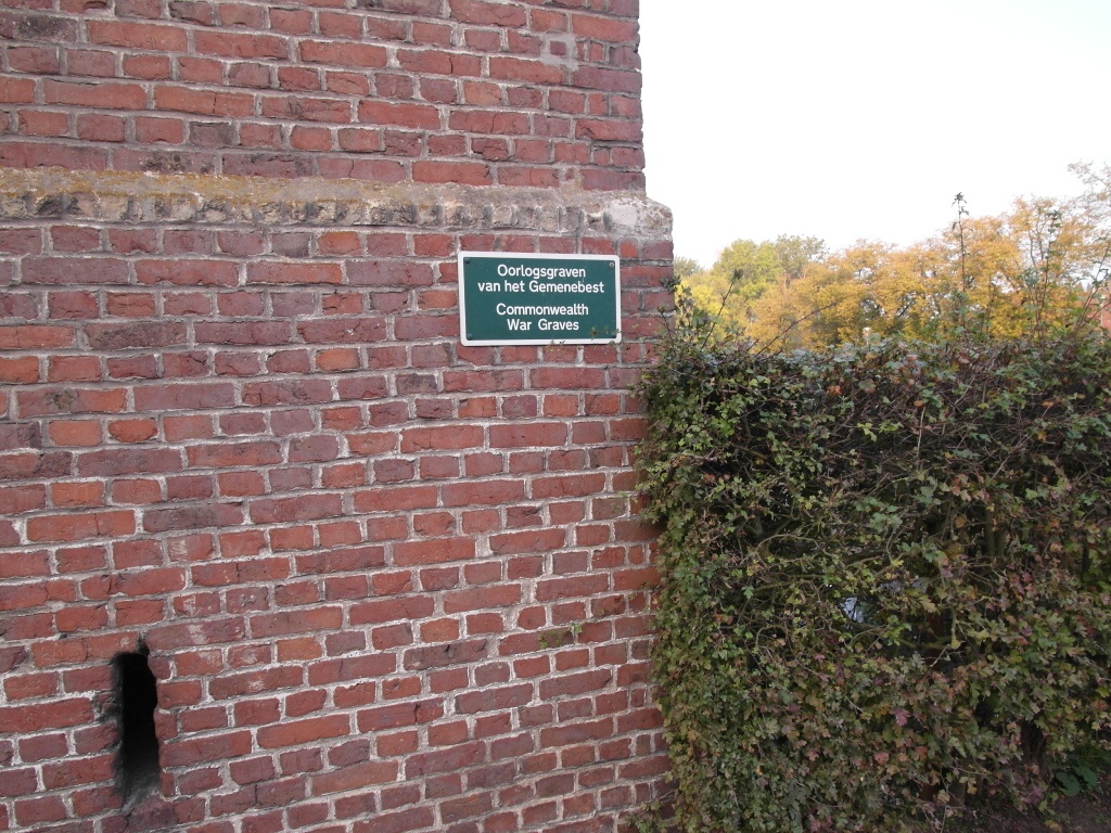
Watou Churchyard
- Country Belgium
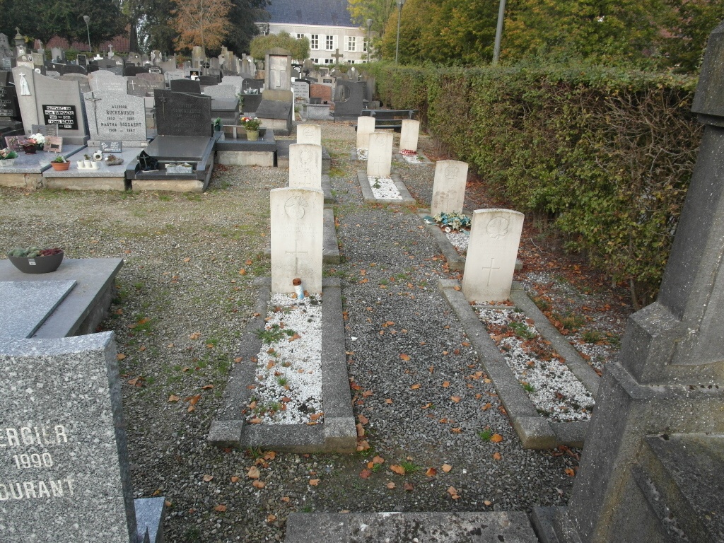
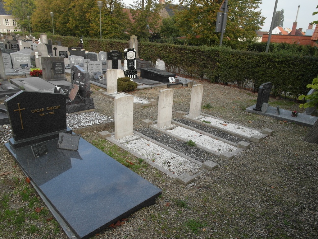
- Total identified casualties 12 Find these casualties
- Region West-Vlaanderen
- Identified casualties from First World War
- GPS Coordinates Latitude: 50.85918, Longitude: 2.61964
Location information
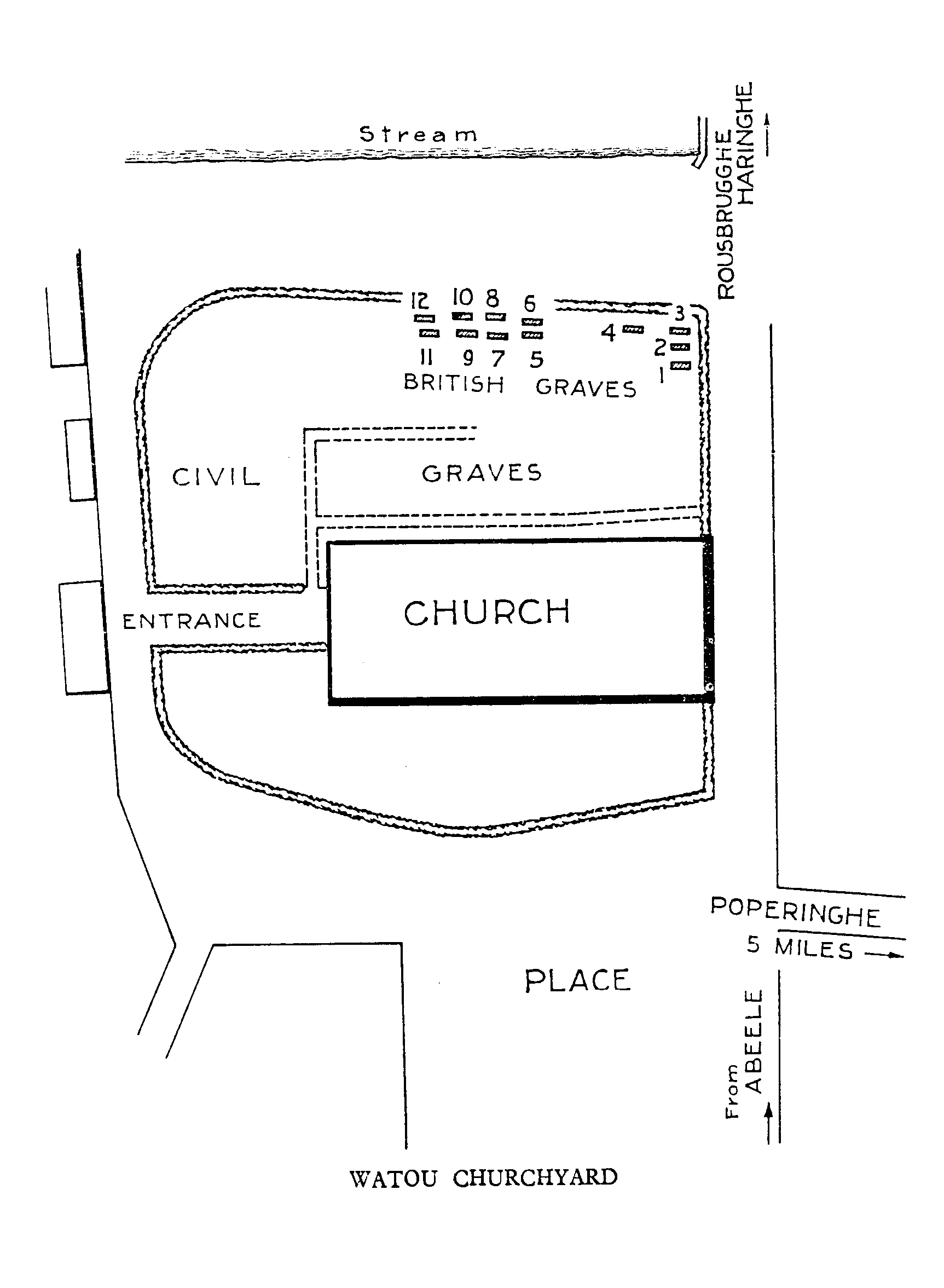
Watou Churchyard is located 19 Km west of Ieper town centre on the Watouseweg, a road leading from the N308 connecting Ieper to Poperinge. From Ieper town centre the Poperingseweg (N308), is reached via Elverdingsestraat then directly over two small roundabouts in the J.Capronstraat. The Poperingseweg is a continuation of the J.Capronstraat and begins after a prominent railway level crossing. On reaching Poperinge the N308 meets the left hand turning onto the Poperinge ring road, R33. The R33 rejoins the N308 on the west side of Poperinge where it continues for 1 Km to the junction with the Watouseweg. 8 Km along the Watouseweg lies the village of Watou. The churchyard is located centrally in the village on the Watouplein.
History information
Watou Churchyard was used at intervals from April 1915 to April 1918 and contains 12 Commonwealth burials of the First World War.