Herstal (Rhees) Communal Cemetery
- Country Belgium
- Total identified casualties 1 Find these casualties
- Region Liege
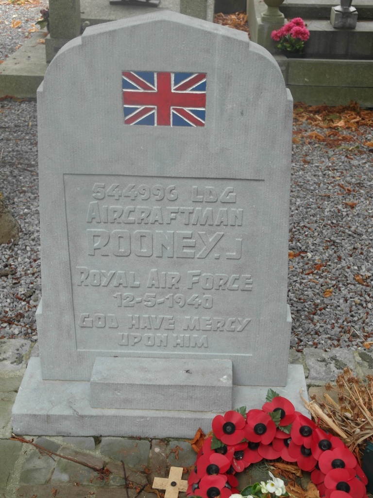
- Identified casualties from Second World War
- GPS Coordinates Latitude: 50.68124, Longitude: 5.61933
Location information
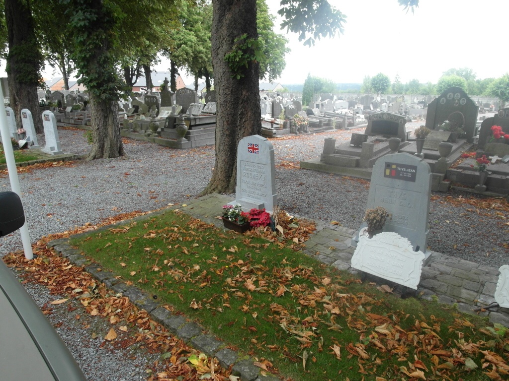
The town of Herstal is located north-east of the town of Liege off the N671. From the motorway E40/A3, which runs between Brussels and Liege, turn off at junction 35 and onto the N671 in the direction Herstal. At the first large junction turn right into rue de la Clawenne and on into rue Louis Demeuse. At the fork bear left into rue Malvoie and continue straight on into rue de Milmort where the cemetery will be found along on the left. The Commonwealth war grave is located along the centre alley of the cemetery on the left.
History information
The British Expeditionary Force was involved in the later stages of the defence of Belgium following the German invasion in May 1940, and suffered many casualties in covering the withdrawal to Dunkirk.
Herstal (Rhees) Communal Cemetery contains the grave of one airman of the Second World War. The grave is in the Belgian pelouse d'honneur.