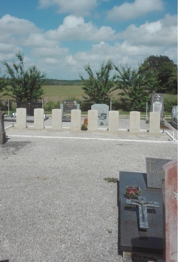
Montcony Churchyard
- Country France
- Total identified casualties 8 Find these casualties
- Region Saone-et-Loire
- Identified casualties from Second World War
- GPS Coordinates Latitude: 46.70019, Longitude: 5.29101
Location information
Montcony is a village 84 kilometres north-east of Macon and 10 kilometres north east of the town of Louhans. The Churchyard is in the centre of the village and the graves of the six British and two Canadian airmen are to the right of the entrance in two plots.