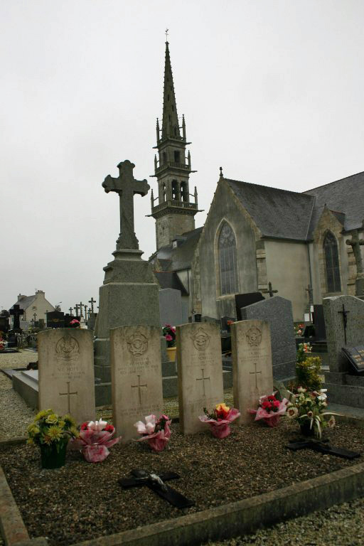
Ploudaniel Churchyard
- Country France
- Total identified casualties 4 Find these casualties
- Region Finistere
- Identified casualties from Second World War
- GPS Coordinates Latitude: 48.53697, Longitude: -4.31169
Location information
Ploudaniel is a village and commune about 13 miles (21 kilometres) north-east of Brest, on the Landerneau-Lesneven road. Ploudaniel is on a branch railway line from Brest, but services are not frequent and the most convenient way of reaching the village is by taxi from Brest. The churchyard is on the western side of the Landerneau-Lesneven road, which runs through the village. On the eastern side of the churchyard, south of the war memorial, are the graves of one soldier and one airman belonging to the forces of the United Kingdom and two airmen of the Royal Australian Air Force.