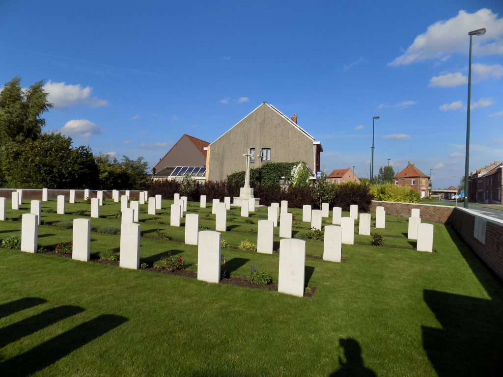
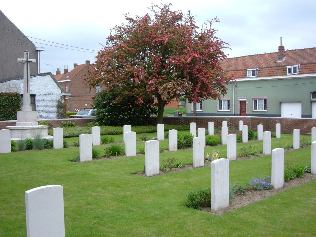
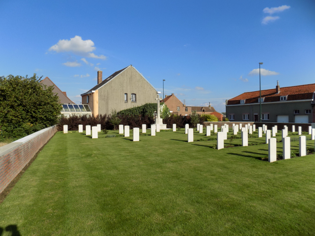
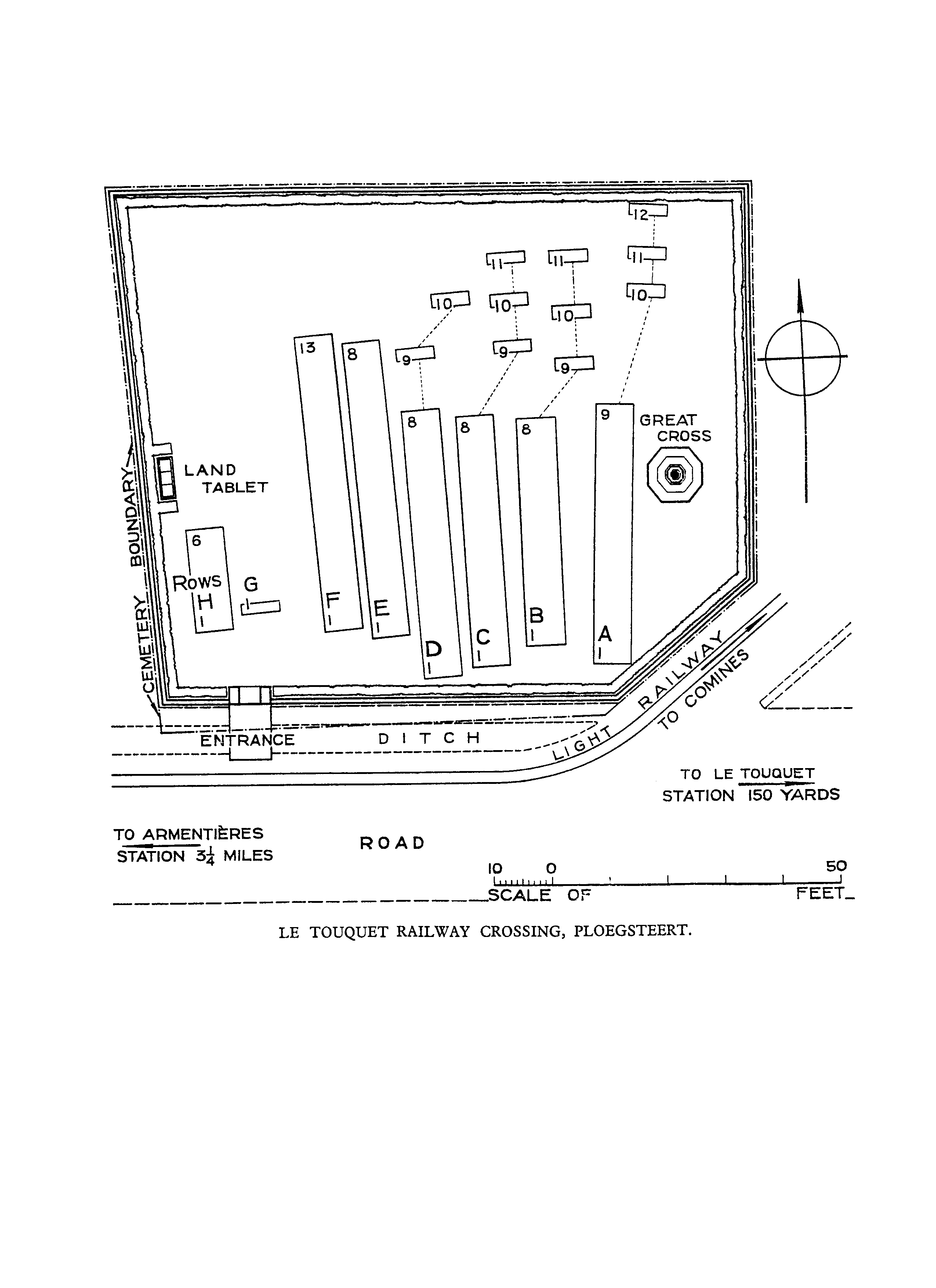
Le Touquet Railway Crossing Cemetery
- Country Belgium
- Total identified casualties 50 Find these casualties
- Region Hainaut
- Identified casualties from First World War
- GPS Coordinates Latitude: 50.71124, Longitude: 2.91181
Location information
Le Touquet Railway Crossing Cemetery is located 15 Km south of Ieper town centre, on a road leading from the Rijselseweg N365, which connects Ieper to Wijtschate, Mesen, Ploegsteert and onto Armentieres. From Ieper town centre the Rijselsestraat runs from the market square, through the Lille Gate (Rijselpoort) and directly over the crossroads with the Ieper ring road. The road name then changes to the Rijselseweg. 2 Km after the village of Ploegsteert lies the left hand turning onto Witteweg (Chemin de la Blanche). The first right hand turning from the Witteweg leads towards Motor Car Cemetery. At the end of this road lies the left hand turning towards Touquet. This road is called rue du Touquet. The cemetery is located 1 Km along this road after passing Tancrez Farm Cemetery.
Visiting information
Wheelchair access is possible via the main entrance. For further information regarding wheelchair access, please contact our Enquiries Department on telephone number: 01628 634221
History information
The cemetery was used from October 1914 to June 1918. Rows A to E contain the graves of 28 men of the 1st Rifle Brigade killed in October and November 1914, during fierce German attacks on the 11th Infantry Brigade. There are now 74 First World War casualties buried or commemorated in this cemetery. 24 of the graves are unidentified but special memorials commemorate three casualties known to be buried among them. The cemetery was designed by G H Goldsmith.