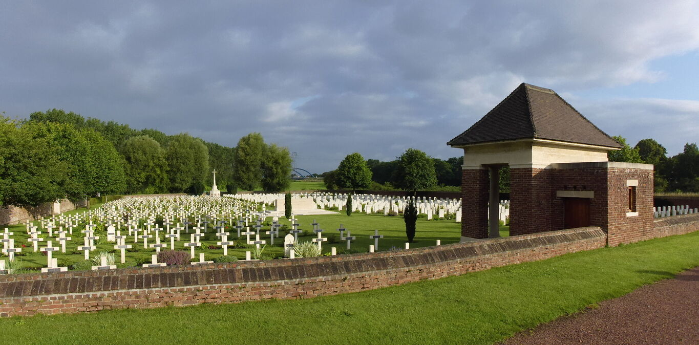
Aix-Noulette Communal Cemetery Extension
- Country France
- Total identified casualties 689 Find these casualties
- Region Pas de Calais
- Identified casualties from First World War
- GPS Coordinates Latitude: 50.43106, Longitude: 2.71223
Location information
Aix-Noulette is a village in the Department of the Pas-de-Calais, about 13 kilometres south of Bethune on the main road to Arras. From Arras take the D937 towards Bethune. At Aix-Noulette, turn right at the church. The Communal Cemetery and Extension are a few hundred metres on the left side of the road to Bully-Grenay.
Visiting information
ARRIVAL
The cemetery is signposted.
PARKING
There is a car park with space for multiple vehicles to the right of the communal cemetery, on Rue de Bully (D58)
It is also possible to park alongside the communal cemetery off the main road alongside the cemetery boundary wall
The ground surface is flat and firm with a red coloured loose gravel surface.
ACCESS LAYOUT AND MAIN ENTRANCE
The CWGC cemetery is located to the rear of the civil cemetery. An opening in the wall of the cemetery, approximately 1-metre-wide leads into the civil cemetery, approximately 20 metres from the car park. Gravel pathways between the civil burials lead from the civil cemetery entrance; a distance of approximately 120 metres from the car park. Access into the CWGC cemetery is through an opening in the wall in the bottom left corner of the site. The opening is one metre wide and offers step free access into the cemetery.
There is a moveable waist height, green wooden rabbit barrier in the opening.
There is a stone shelter building to the right of the entrance along the rear wall.
The Stone of Remembrance is in the centre of the cemetery in line with the shelter building and the Cross of Sacrifice at the far end of the site.
There is a stone bench seating area, inside the shelter building to the right of the entrance into the cemetery. Three steps lead up to the interior on each side of the building.
The Register Box is located inside the shelter above the stone bench.
All internal paths are grass, the ground is flat and firm.
ALTERNATIVE ACCESS
There is an additional entrance in the perimeter wall between the civilian cemetery and the CWGC plot between two large stone pillars, at the mid-point of the cemetery in the left wall. The opening is 1.2 metres wide and has a step down from the gravel pathway in the civil cemetery down to the CWGC cemetery.
There are 2 moveable waist height, green wooden rabbit barriers in the opening.
ADDITIONAL INFORMATION
The cemetery is permanently open.
History information
The Cemetery Extension was begun by French troops early in 1915, and the two French plots are next to the Communal Cemetery. It was taken over by the 1st and 2nd Divisions in February, 1916, and used by fighting units and Field Ambulances until October, 1918. It was increased after the Armistice by the concentration of graves from the battlefields to the East.
There are now 749 Commonwealth burials of the 1914-1918 war commemorated here, 61 being unidentified. There are also 502 French burials here.
The cemetery covers an area of 5,198 square metres and is enclosed by a red brick wall on three sides, and on the South by the wall of the Communal Cemetery.


