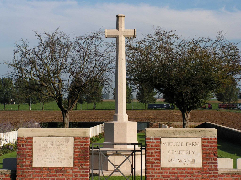
Wieltje Farm Cemetery
- Country Belgium
- Total identified casualties 106 Find these casualties
- Region West-Vlaanderen
- Identified casualties from First World War
- GPS Coordinates Latitude: 50.86879, Longitude: 2.91102
Location information
The cemetery is located to the North-East of the town of Ieper. From Ieper station turn left and drive along M.Fochlaan to the roundabout, turn right and go to the next roundabout. Here turn left into M.Haiglaan and drive to the next roundabout. Here turn right into Oude Veurnestraat, this then changes into Diksmuidseweg and Brugseweg drive along this road to the traffic lights. Straight over the lights to the end of the road. At the T junction turn left (still Brugseweg) and continue along this road through the village of Sint Jan. The cemetery is on the left hand side of the road approx 200 metres after the village.
Visiting information
ARRIVAL
The cemetery is signposted at the side of the road pointing in the direction of the pathway leading to the site.
The cemetery is in agricultural land and can only be accessed by a 170-metre-long mowed grass track (path).
PARKING
Parking is available at the side of the main road in the nearby village. There is space for up to 10 vehicles to park.
The ground is flat and firm with a tarmac surface.
The entrance to the access track is close to the cemetery signpost. There is a combination of hedges, concrete and metal fencing on the either side of the track. The track is grass and approximately 1 metre wide. A 150-metre straight path between two residential properties leads to a farmer’s field at the rear. The path then makes a left turn then a sharp right through agricultural fields to the entrance of the cemetery.
ACCESS LAYOUT AND MAIN ENTRANCE
The cemetery is rectangular in shape and surrounded by a brick wall.
The main entrance has a 90-centimetre wide, mid-level, (thigh height), black metal gate with and up and down latch positioned on the top left of the gate. A section of paving is underneath the gate level with the grass on either side. The gate opens inwards into the cemetery.
The Cross of Sacrifice is located immediately inside the gate.
The Register Box is mounted into the centre of the boundary wall at the rear of the cemetery.
All internal paths are grass, the ground is flat and firm.
There is no seating in the cemetery.
ALTERNATIVE ACCESS
There is no alternative access into the cemetery.
ADDITIONAL INFORMATION
The cemetery is permanently open.
Visitors should note that the path(access) track can become muddy, slippery and waterlogged in periods of heavy rainfall.
History information
Wieltje Farm Cemetery was made and used by fighting units (in particular by the 2nd/4th Gloucesters) in July-October 1917.
There are now 115 Commonwealth servicemen of the First World War buried or commemorated in this cemetery. 10 of the burials are unidentified and there are special memorials to 20 casualties whose graves were destroyed by shell fire. There is also one German war grave.
The cemetery was designed by A J S Hutton.


