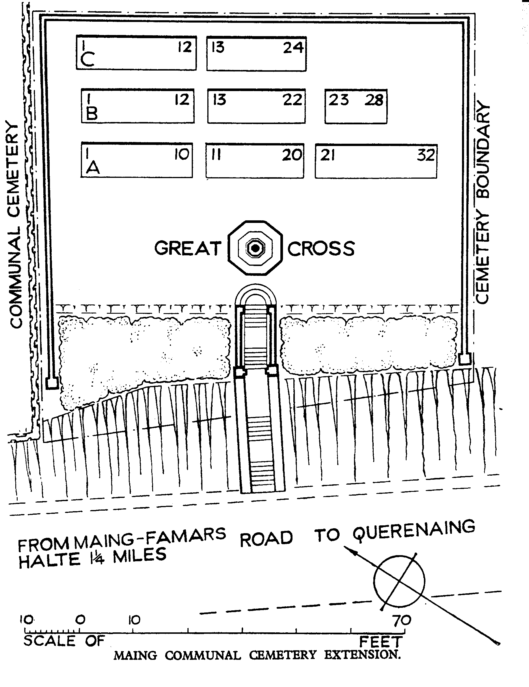
Maing Communal Cemetery Extension
- Country France
- Total identified casualties 85 Find these casualties
- Region Nord
- Identified casualties from First World War
- GPS Coordinates Latitude: 50.30193, Longitude: 3.48325
Location information
Maing is a village approximately 8 kilometres south of Valenciennes. The Cemetery is on the southern side of the village on the north-eastern side of the road to Querenaing and 2 kilometres before Thiant.
Visiting information
The location or design of this site makes wheelchair access very difficult. For further information regarding wheelchair access, please contact our Enquiries Section on enquiries@cwgc.org or 01628 507200.
History information
Maing village was captured by the 51st (Highland) Division on the 24th October 1918.
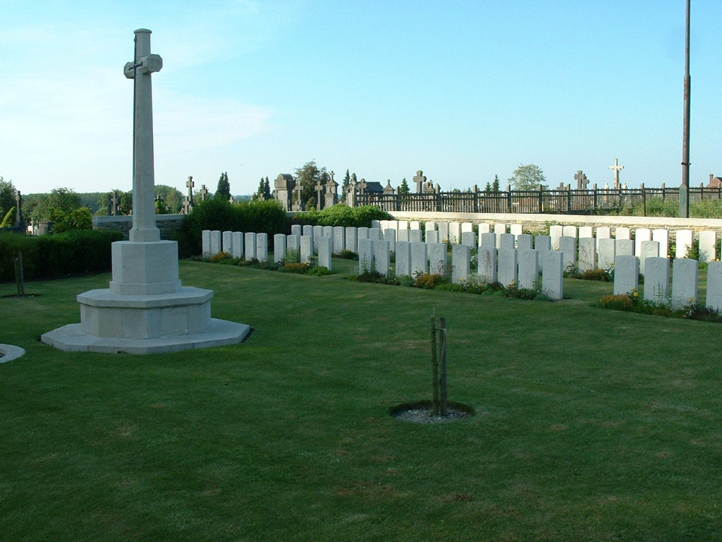
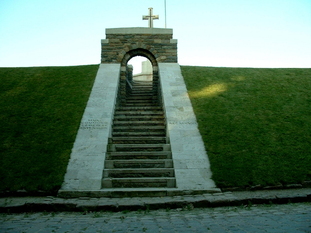
The Extension is on the South side of the Communal Cemetery. It was made by units of the 51st (Highland) and 49th (West Riding) Division in October and November 1918. In addition, five British casualties buried by the Germans in Maing Communal Cemetery in October 1918 were transferred into the Extension in the 1920s.
There are now over 80, 1914-18 war casualties commemorated in this site. Of these, a small number are unidentified.
The Cemetery covers an area of 548 square metres and is enclosed at the sides and the back by a low stone rubble wall.