Ferme-Olivier Cemetery
- Country Belgium
- Total identified casualties 407 Find these casualties
- Region West-Vlaanderen
- Identified casualties from First World War
- GPS Coordinates Latitude: 50.88543, Longitude: 2.79899
Location information
Ferme-Olivier Cemetery is located 7 kilometres north west of Ieper town centre on the Steentjesmolenstraat, N333, a road leading from the N8 Veurnseweg connecting Ieper to Elverdinge and on to Veurne. From Ieper town centre the Veurnseweg (N8) is reached via Elverdingsestraat, then turning right onto Haiglaan. Veurnseweg is a continuation of Haiglaan. On reaching the village of Elverdinge the Steentjesmolenstraat, N333, is the second left hand turning. The cemetery lies 1.3 kilometres along the Steentjesmolenstraat on the left hand side of the road.
Visiting information
Ferme Olivier Cemetery is 7 kilometres northwest of Leper town centre in the West Vlaanderen region of Belgium in Elverdinghe.
ARRIVAL
The route to the cemetery is signposted.
PARKING
There is layby parking at the side of the main road, approximately 10 meters from the main entrance memorial archway building, that marks the main entrance at the front of the cemetery.
There is space for several vehicles to park, within 10 metres of the main entrance. The ground is firm and flat.
ACCESS, LAYOUT AND MAIN ENTRANCE
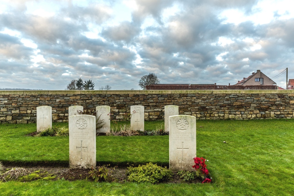
There is a stone wall surrounding the cemetery.
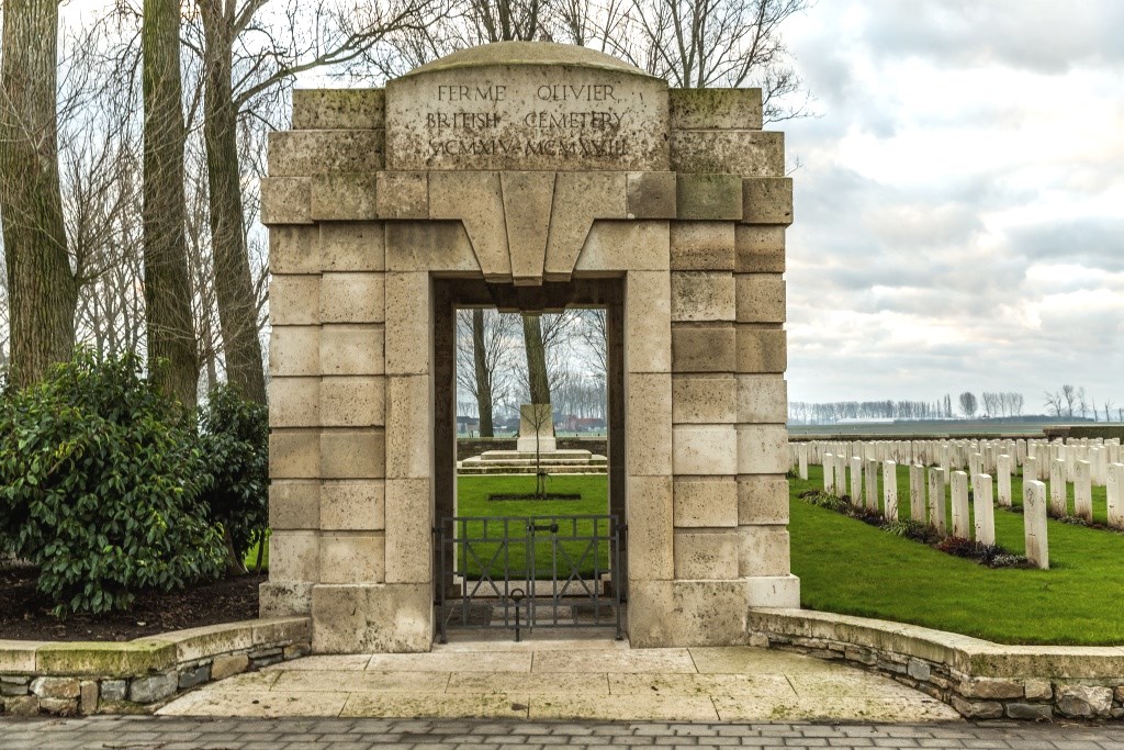
The main entrance to the cemetery is through the memorial arch at the eastern boundary of the site. There is a latched low-level, 1.8 metre-wide double black metal gate underneath the arch, approximately 800 mm clear opening for each section, which opens into the cemetery. There is a small stone lip leading from the entrance into the cemetery.
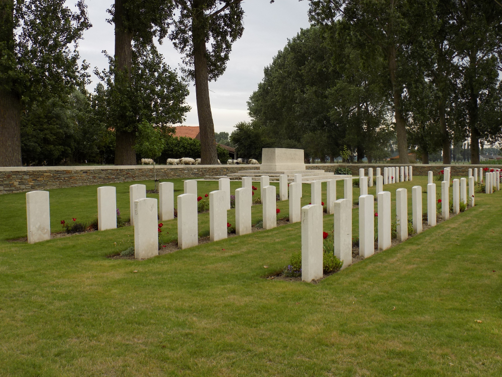
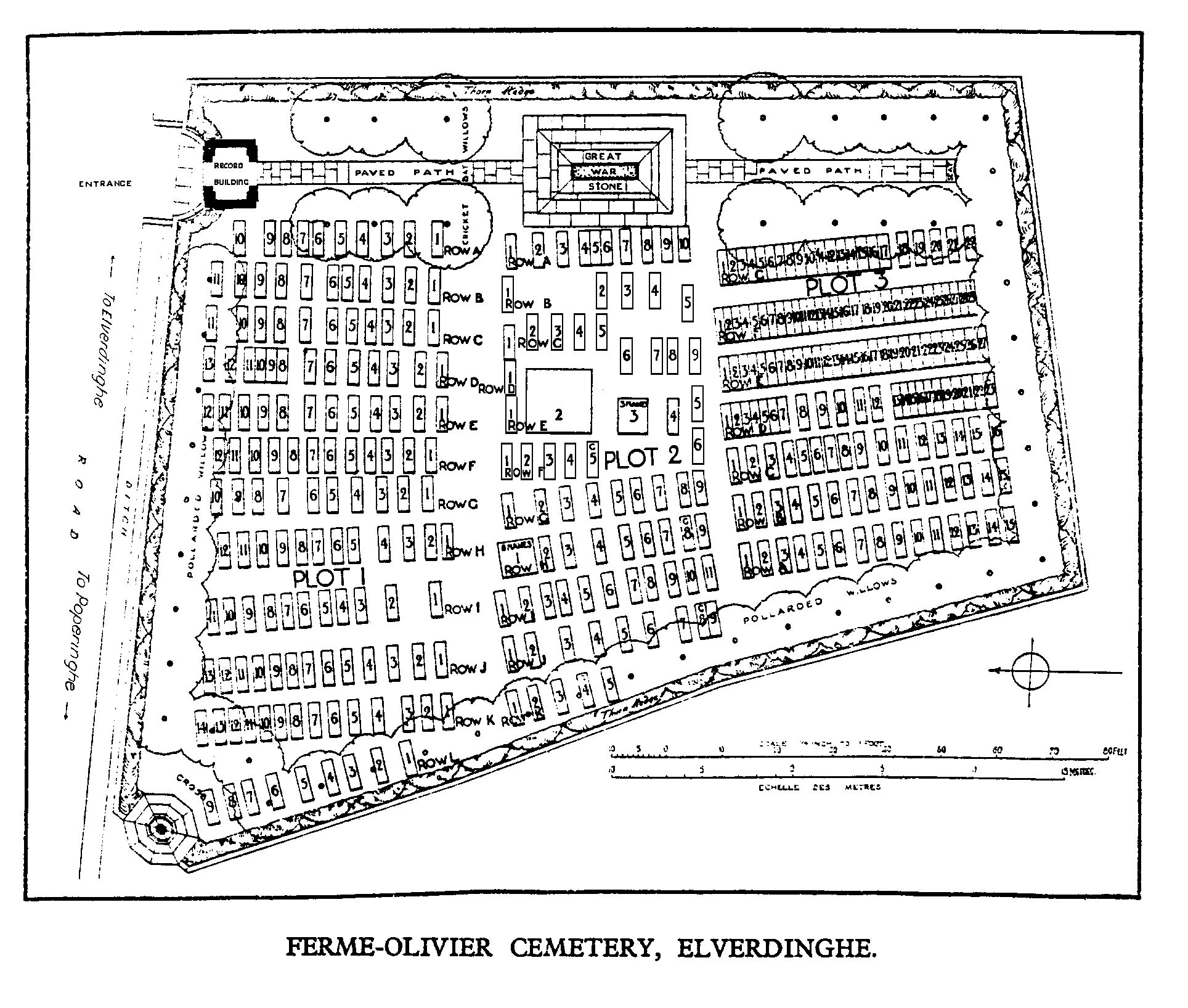
There is a Stone of Remembrance located midway in the cemetery in line with the entrance.
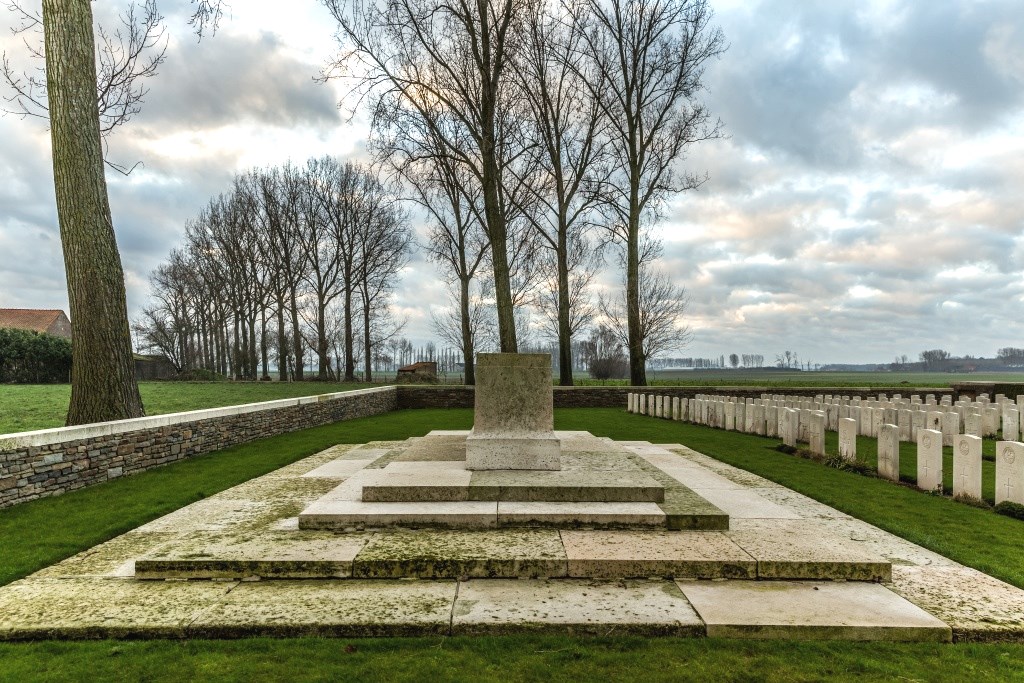
The Cross of Sacrifice is in the western corner of the cemetery close to the main road.
The Register Box is inside the entrance archway, built into the wall.
There is a stone bench inside the archway at the main entrance.
A metal information sign is mounted on the wall inside the archway.
All internal paths are grass, the ground is flat and firm.
ALTERNATIVE ACCESS
It is possible to access directly onto the grass into the cemetery from the pathway next to the Cross of Sacrifice.
ADDITIONAL INFORMATION
The cemetery is permanently open.
History information
The cemetery was used continuously between 9 June 1915 and 5 August 1917, with the 62nd, 16th, 9th, 11th, 129th and 130th Field Ambulances successively having dressing stations close by. Throughout this period, the village was just within range of the German artillery and a two collective graves in Plot 2, Row E, contain the remains of 41 men of the 3rd Bn. Monmouthshire Regiment killed on parade on 29 December 1915 by a single shell fired from a naval gun in Houthulst Forest. The graves in Plot 3 run in order of date of death and show the successive occupations of Elverdinghe Chateau by the 38th (Welsh) Division, the Guards Division and units of the Royal Artillery.
The cemetery contains 408 Commonwealth burials of the First World War, 6 of which are unidentified, and three German war graves.
The cemetery was designed by Sir Reginald Blomfield.