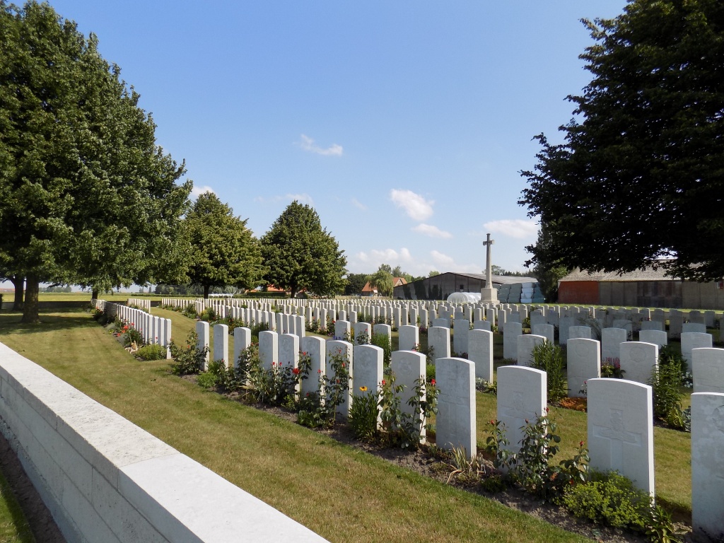
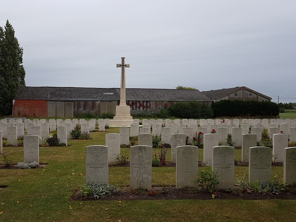
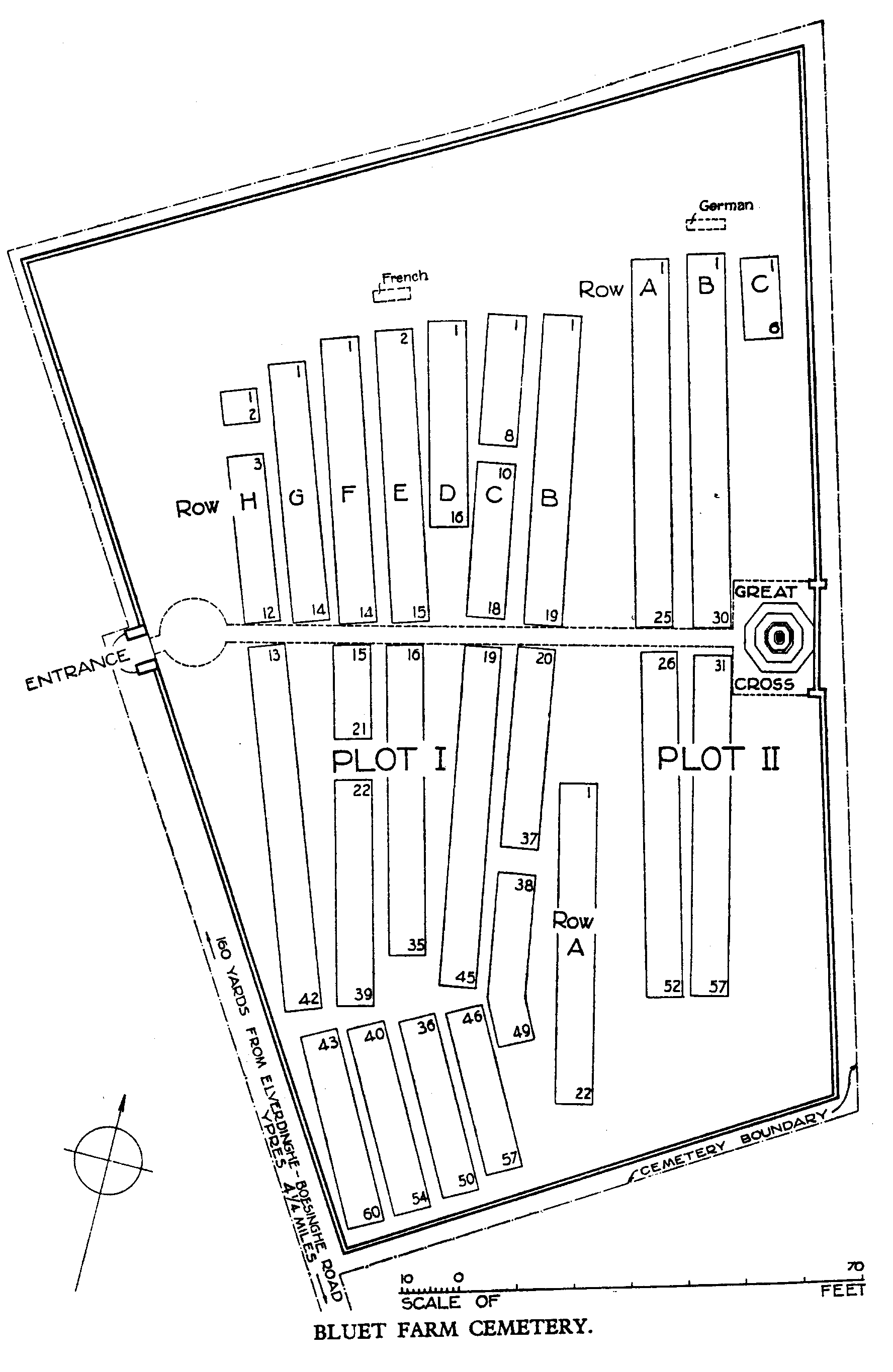
Bleuet Farm Cemetery
- Country Belgium
- Total identified casualties 453 Find these casualties
- Region West-Vlaanderen
- Identified casualties from First & Second World War
- GPS Coordinates Latitude: 50.88866, Longitude: 2.83171
Location information
The cemetery is located to the north west of the town of Ieper near a village called Elverdinge, this is on the N8 road between Ieper and Veurne, 3 kilometres from Ieper. Driving into the village from Ieper go to the traffic lights and turn right, this street is called Steenstraat, and after 50 metres follow the street to the right, called Boezingsestraat. The cemetery is 500 metres along this street on the left hand side.
Visiting information
Wheelchair access to the cemetery possible via main entrance. For further information regarding wheelchair access, please contact our Enquiries Department on 01628 507200.
History information
Bleuet Farm was used as a dressing station during 1917 Allied offensive on this front. The cemetery was begun in a corner of the farm and was in use from June to December 1917, though a few of the burials are of later date. Two graves were brought into the cemetery after the Armistice from isolated positions close by. There are now 442 First World War burials in the cemetery and nine from the Second World War, all dating from the Allied retreat to Dunkirk in May 1940. The cemetery was designed by Sir Reginald Blomfield.