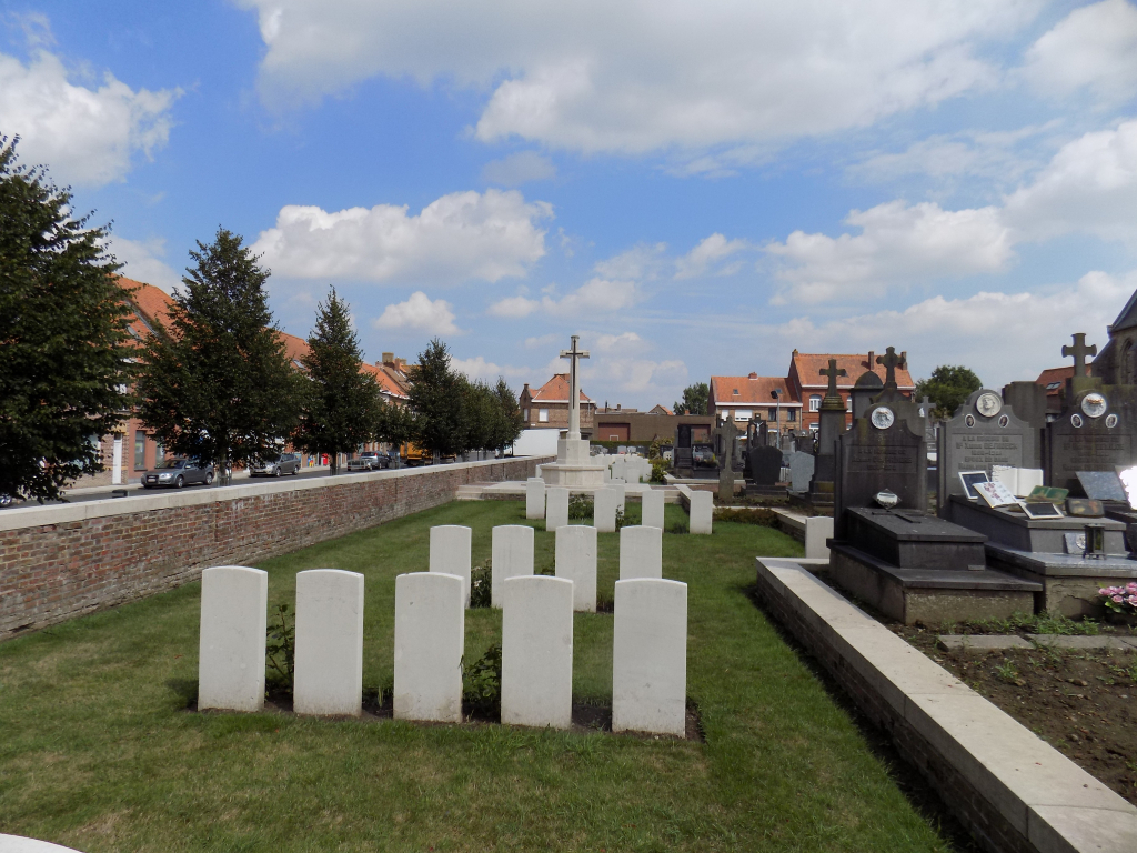
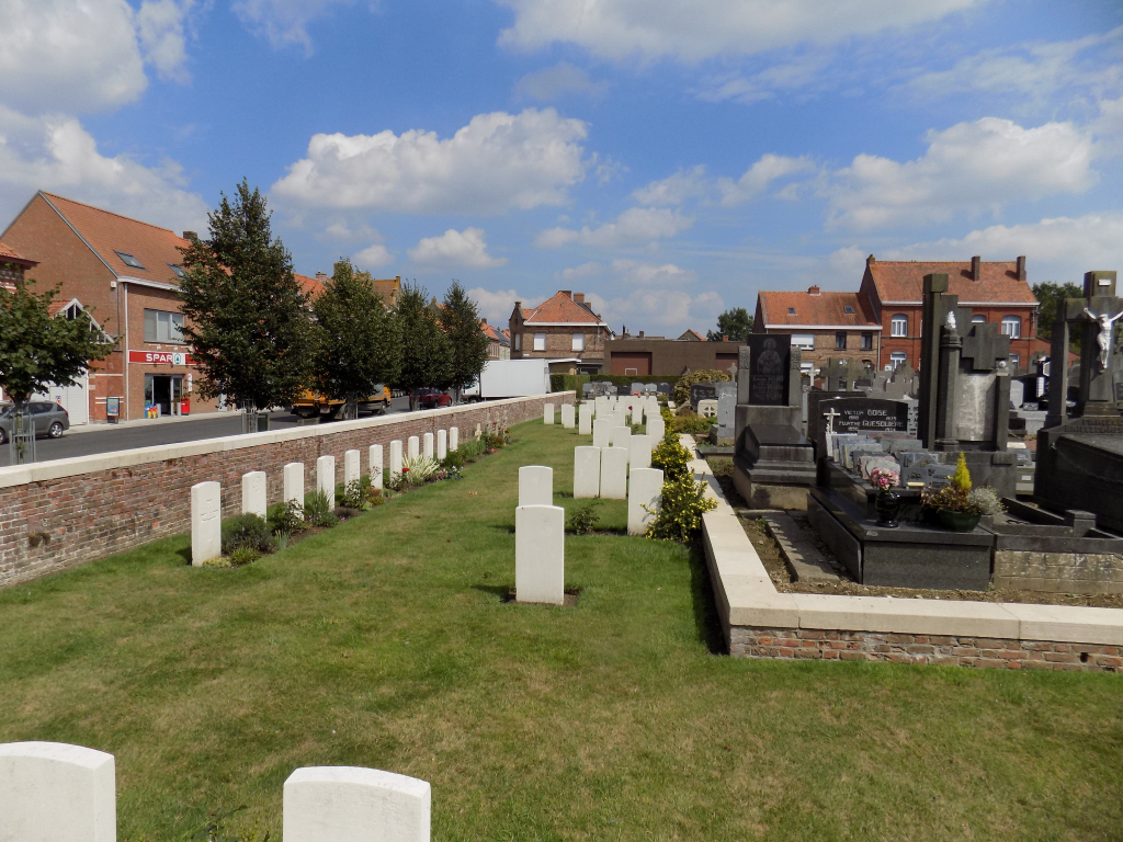
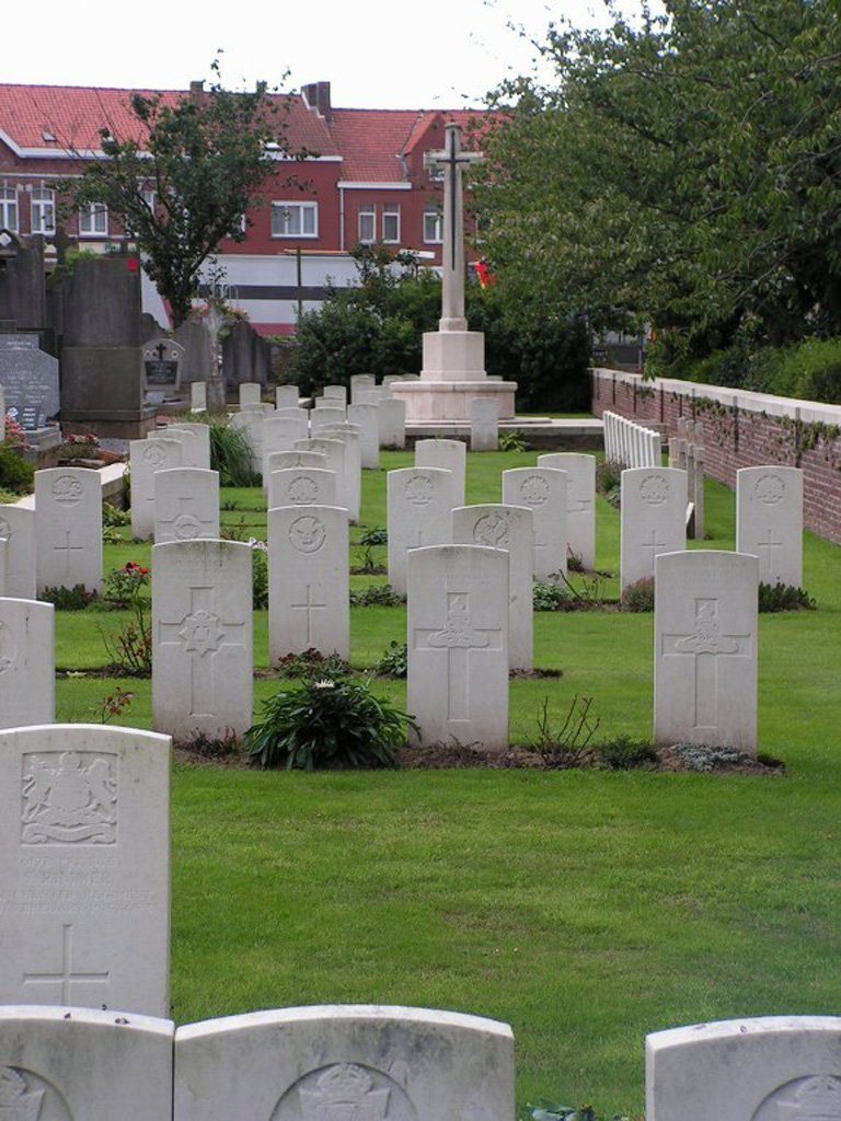
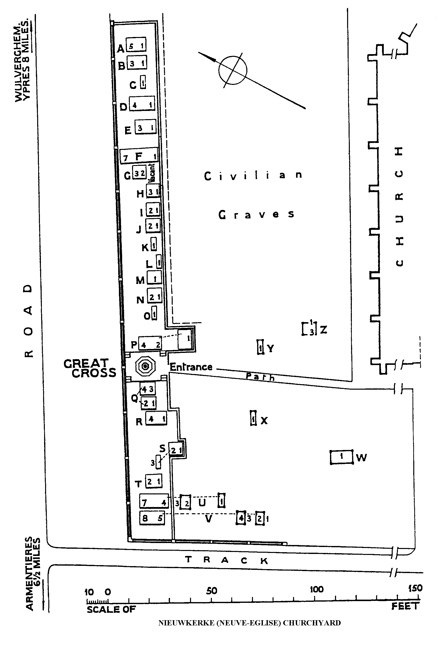
Nieuwkerke (Neuve-Eglise) Churchyard
- Country Belgium
- Total identified casualties 106 Find these casualties
- Region West-Vlaanderen
- Identified casualties from First & Second World War
- GPS Coordinates Latitude: 50.74562, Longitude: 2.8257
Location information
Nieuwkerke (Neuve-Eglise)Churchyard is located 12 Kms south of Ieper town centre, on a road leading from the Kemmelseweg (N331) which connects Ieper to Kemmel and onto Nieuwkerke. From Ieper town centre the Kemmelseweg is reached via the Rijselsestraat, through the Lille Gate (Rijselpoort) and straight on towards Armentieres (N336). 900 metres after the crossroads is the right hand turning onto the Kemmelseweg (made prominent by a railway level crossing). After passing the village of Kemmel the N331 continues for 4 Kms towards Nieuwkerke. On reaching Nieuwkerke turn right into Nieuwkerkestraat (direction of Armentiers). The churchyard is located 80 metres along the Nieuwkerkestraat on the left hand side of the road.
History information
Nieuwkerke (also known as Neuve-Eglise) was captured by the Germans on from 14 April 1918, after a stubborn defence by the 49th (West Riding) and 33rd Division, and remained in their hands until it was retaken by the 36th (Ulster) Division on 2 September. The churchyard was used by field ambulances and fighting units at intervals during the war, particularly, in the early days, by the Cavalry and the 5th Division.
During the Second World War, the British Expeditionary Force was involved in the later stages of the defence of Belgium following the German invasion in May 1940, and suffered many casualties in covering the withdrawal to Dunkirk.
Nieuwkerke Churchyard contains 92 Commonwealth burials of the First World War and ten from the Second World War. There are also four war graves of other nationalities within the churchyard.