Poperinge Communal Cemetery
- Country Belgium
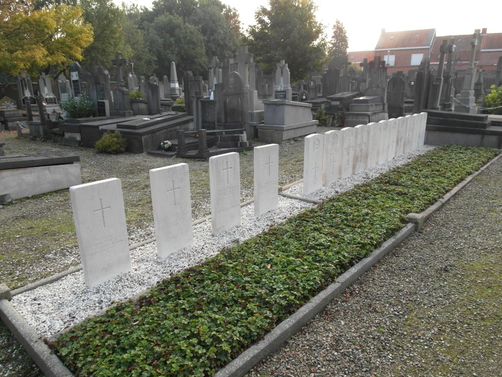
- Total identified casualties 21 Find these casualties
- Region West-Vlaanderen
- Identified casualties from First World War
- GPS Coordinates Latitude: 50.85212, Longitude: 2.72675


Location information
Poperinge Communal Cemetery is located 10.5 kilometres west of Ieper town centre, in the town of Poperinge itself. From Ieper, Poperinge is reached via N308. From Ieper town centre the Poperingseweg (N308), is reached via Elverdingsestraat then directly over two small roundabouts in the J.Capronstraat. The Poperingseweg is a continuation of the J.Capronstraat and begins after a prominent railway level crossing. On reaching the town of Poperinge the left hand turning from the N308 leads onto the R33 Poperinge ring road. 1 kilometre along the N33 lies the right hand turning onto Deken De Bolaan. The cemetery is located 800 metres along the Deken De Bolaan on the corner with Rekhof. The Commission headstones are located against the cemetery wall on the far right hand side of the site and in the middle of the cemetery.
History information
The town of Poperinghe (now Poperinge) was of great importance during the First World War because, although occasionally bombed or bombarded at long range, it was the nearest place to Ypres (now Ieper) which was both considerable in size and reasonably safe. It was at first a centre for casualty clearing stations, but by 1916 it became necessary to move these units further back and field ambulances took their places. The earliest Commonwealth graves in the town are in the communal cemetery, which was used from October 1914 to March 1915. The Old Military Cemetery was made in the course of the First Battle of Ypres and was closed, so far as Commonwealth burials are concerned, at the beginning of May 1915. The New Military Cemetery was established in June 1915. The communal cemetery contains 22 Commonwealth burials of the First World War.