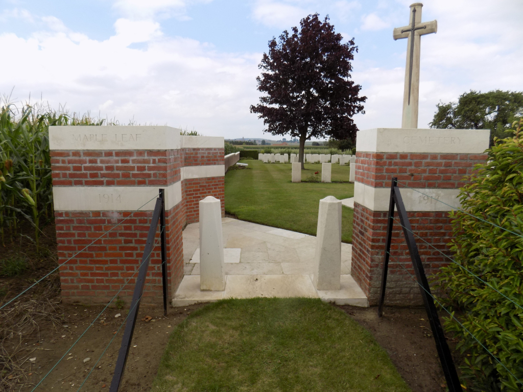
Maple Leaf Cemetery
- Country Belgium
- Total identified casualties 176 Find these casualties
- Region West-Vlaanderen
- Identified casualties from First World War
- GPS Coordinates Latitude: 50.72056, Longitude: 2.83899
Location information
Maple Leaf Cemetery is located 14 Kms south of Ieper town centre, on a road leading from the Rijselseweg, N365, which connects Ieper to Wijtschate, Mesen, Ploegsteert and on to Armentieres. From Ieper town centre the Rijselsestraat runs from the market square, through the Lille Gate (Rijselpoort) and directly over the crossroads with the Ieper ring road. The road name then changes to the Rijselseweg. On reaching the village of Ploegsteert, turn right at the church onto rue du Romarin. At the end of this road lies the left hand turning onto Niepkerkestraat (for only 50 metres), then immediately right onto Zakstraat. The cemetery is located 50 metres beyond the right hand turning onto Zakstraat.
Visiting information
Wheelchair access possible via main entrance.
For further information regarding wheelchair access, please contact our Enquiries Department on telephone number: 01628 634221
History information
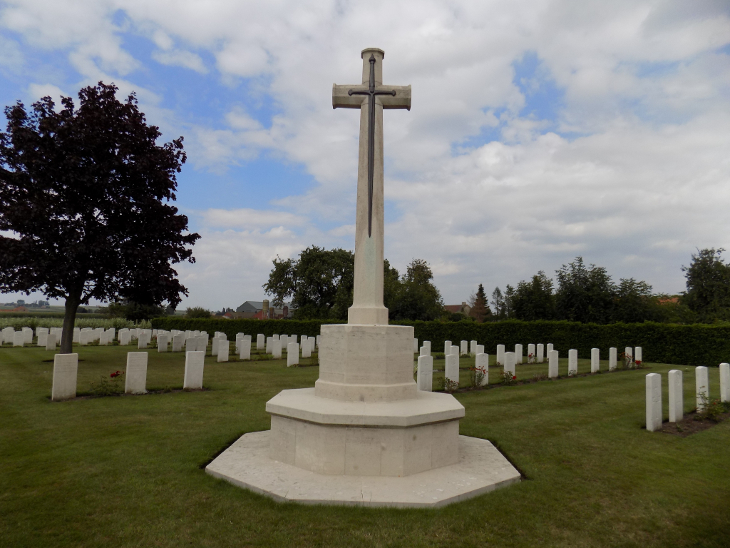
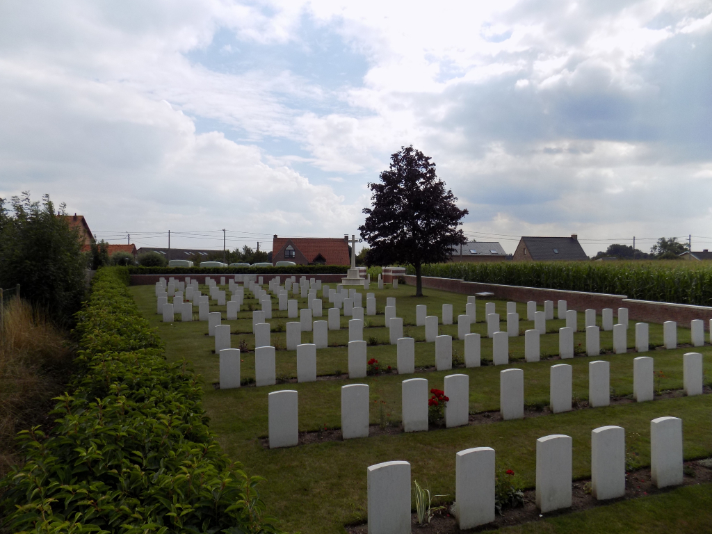
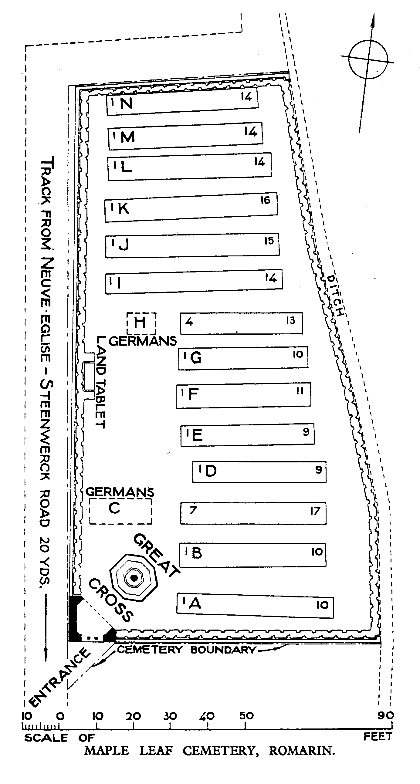
Maple Leaf Cemetery was begun in December 1914 by fighting units and field ambulances, but from July 1915 to April 1916, the village was occupied by the Advanced Dressing Station of the 3rd Canadian Field Ambulance and the cemetery thus acquired its present name. The last Commonwealth burial was made in December 1917, but German graves were added in April 1918 when the cemetery was in German hands.
The cemetery contains 167 Commonwealth and nine German burials of the First World War.
The cemetery was designed by G H Goldsmith.