Devonshire Cemetery, Mametz
- Country France
- Total identified casualties 153 Find these casualties
- Region Somme
- Identified casualties from First World War
- GPS Coordinates Latitude: 49.9883, Longitude: 2.73597
Location information
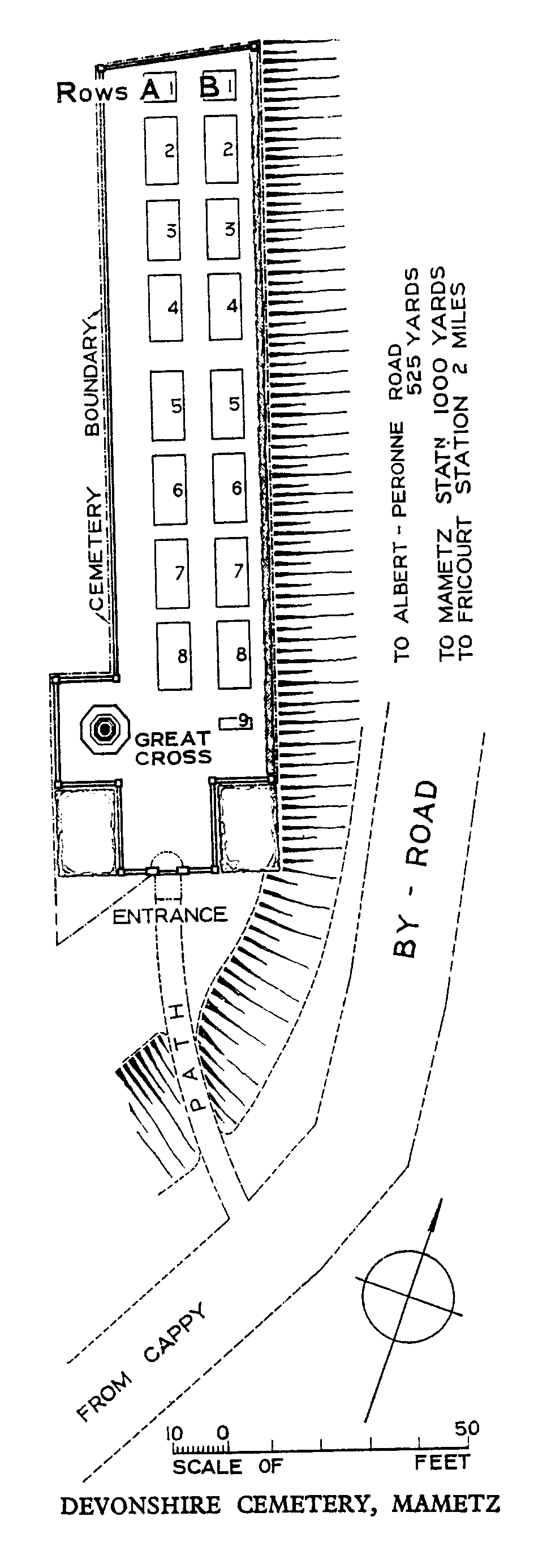
Mametz is a village in the Department of the Somme, 6.5 kilometres east of Albert. Devonshire Cemetery is 800 metres south of Mametz and is situated on high ground some 450 metres west of the road (D938) from Albert to Peronne, 6.5 kilometres from Albert.
Visiting information
The location or design of this site makes wheelchair access impossible.
History information
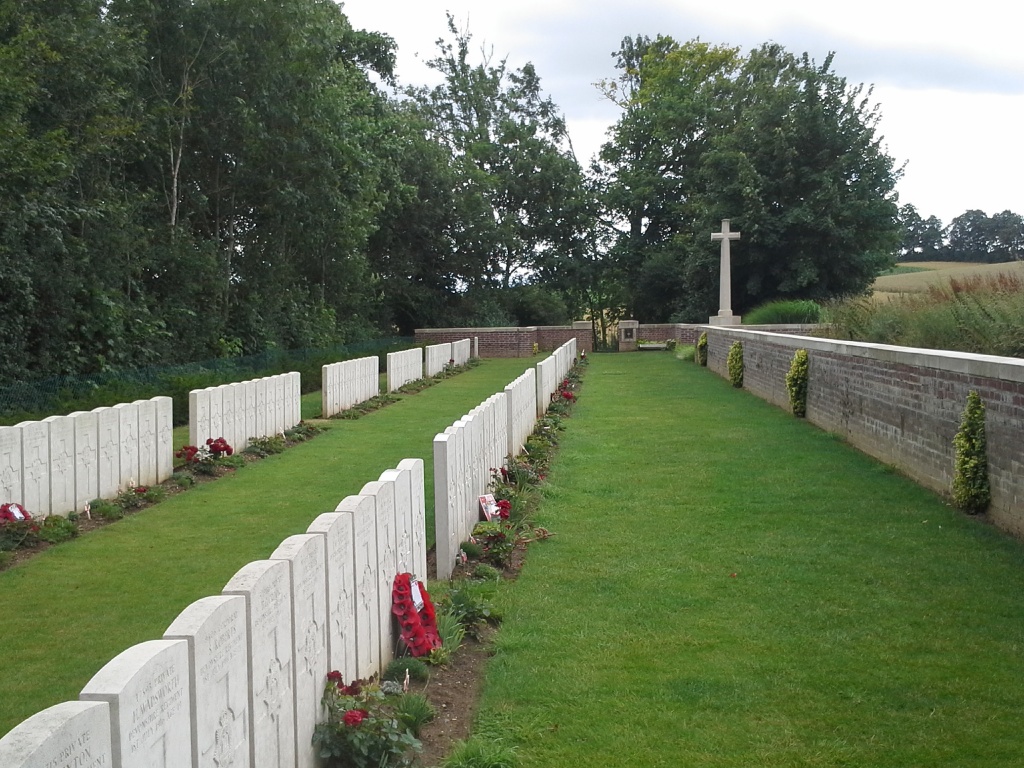
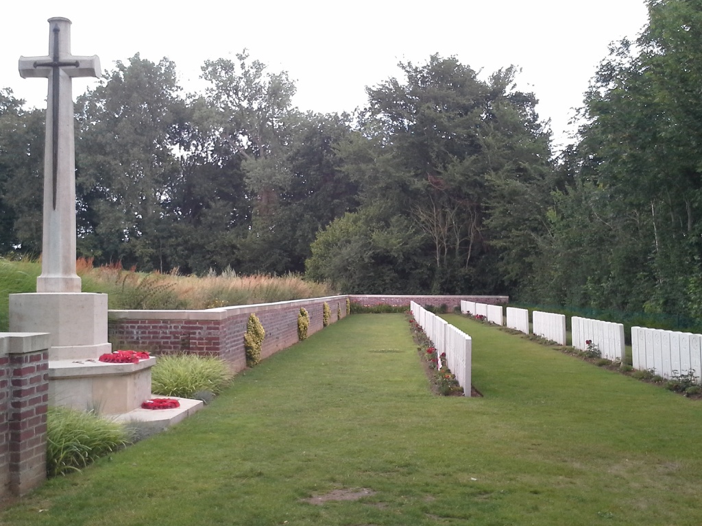
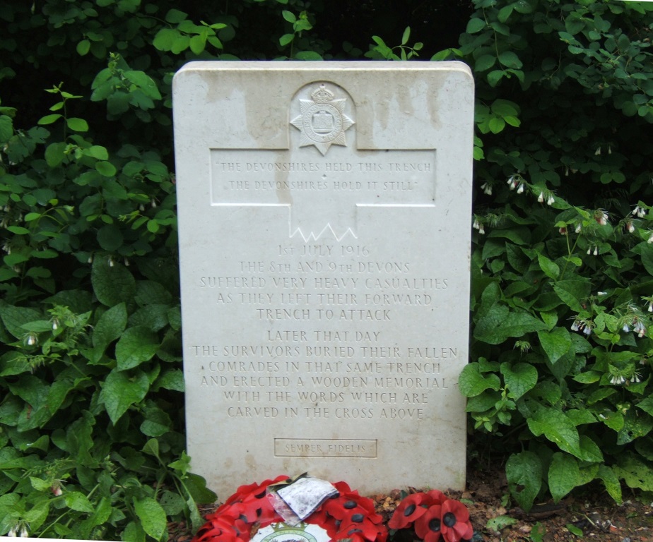
Mametz was within the German lines until 1 July 1916 when it was captured by the 7th Division, and Mametz Wood, north-east of the village, was cleared on the days following 7 July. The 8th and 9th Battalions of the Devonshire Regiments, which were part of the 7th Division, attacked on 1 July 1916 from a point on the south-west side of Albert-Maricourt road, due south of Mametz village, by a plantation called Mansel Copse. On 4 July they returned this location and established a cemetery, burying their dead in a section of their old front line trench. All but two of the burials belong to these battalions. Devonshire Cemetery contains 163 Commonwealth burials of the First World War, ten of which are unidentified. The cemetery was designed by W H Cowlishaw.