Le Grand Hasard Military Cemetery, Morbecque
- Country France
- Total identified casualties 379 Find these casualties
- Region Nord
- Identified casualties from First & Second World War
- GPS Coordinates Latitude: 50.70629, Longitude: 2.51913
Location information
Morebecque is a small village in the Department of the Nord, 3 kilometres south-west of Hazebrouck. Leave the church in Morebecque and head north on the D916 towards Hazebrouck. After approximately 1 kilometre there There is a CWGC Cemetery Direction Sign. Turn left onto rue Keelebrugghe and follow the road for approximately 400 metres. The track leading to the cemetery is on the right.
Visiting information
ARRIVAL
The route to the cemetery from the single-track paved road (rue Keelebrugghe) is signposted. There is a signpost at the top of the single track leading to the cemetery.
PARKING
There is a single-track farm road to the cemetery from the main road. The track begins as dirt/loose gravel and quickly becomes grass and can become waterlogged. It is not possible to turn around at the top of the track.
ACCESS LAYOUT AND MAIN ENTRANCE
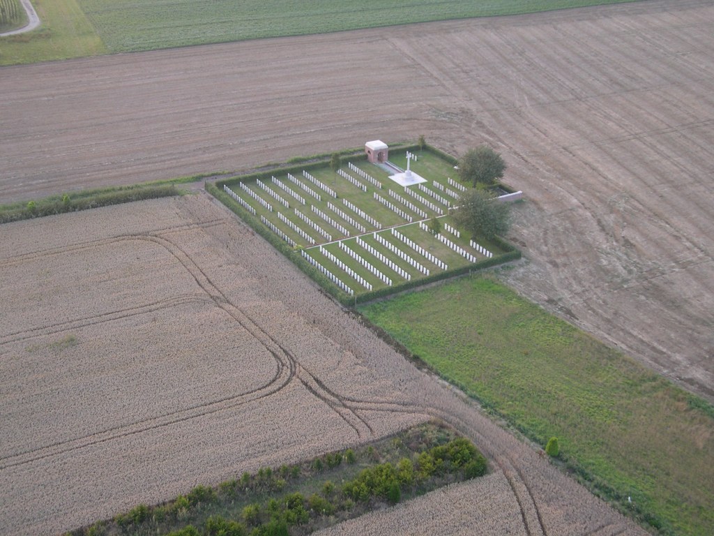
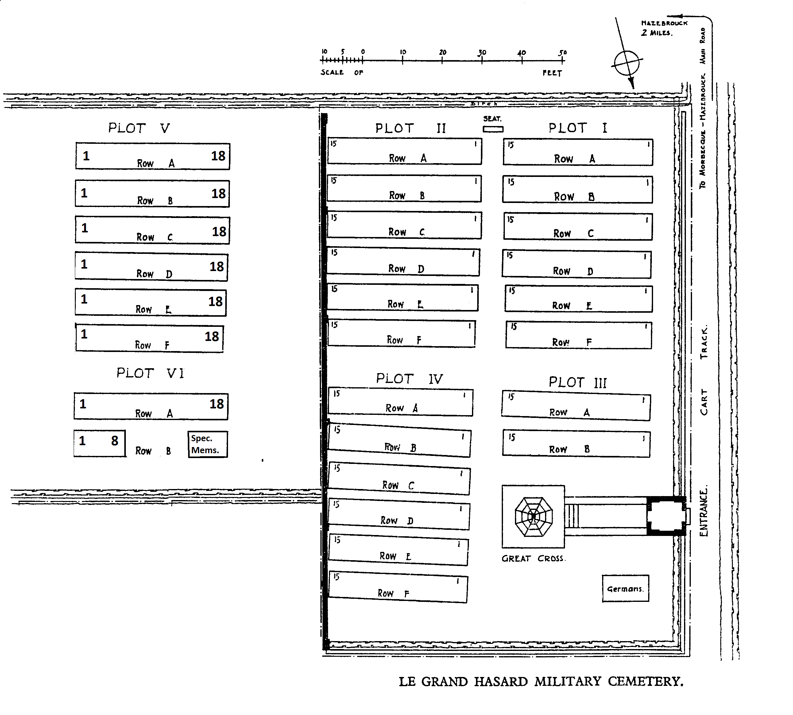
The cemetery is rectangular in shape with two sections divided by a low-level brick wall.
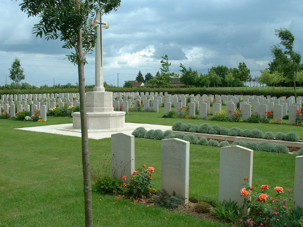
There is an arched memorial shelter at the main entrance, with a mid-level (thigh height) brown wooden gate that opens inwards into the cemetery. Underneath the gate is paving. The main gate is 900 mm wide. There is a small step up from the access track into the entrance shelter. There is a small, raised metal gate stropper on the right side of the entrance.
The Register Box is mounted on the wall inside the shelter, on the right-hand side.
The inside pathway from the shelter building is loose gravel, which leads to the Cross of Sacrifice. Five stone steps lead up to the paved area that surrounds the Cross of Sacrifice.
There is a low-level brick and stone dividing wall that runs through the middle of the cemetery. This wall is slightly elevated above ground height, approximately 25 mm to 100 mm above grass level.
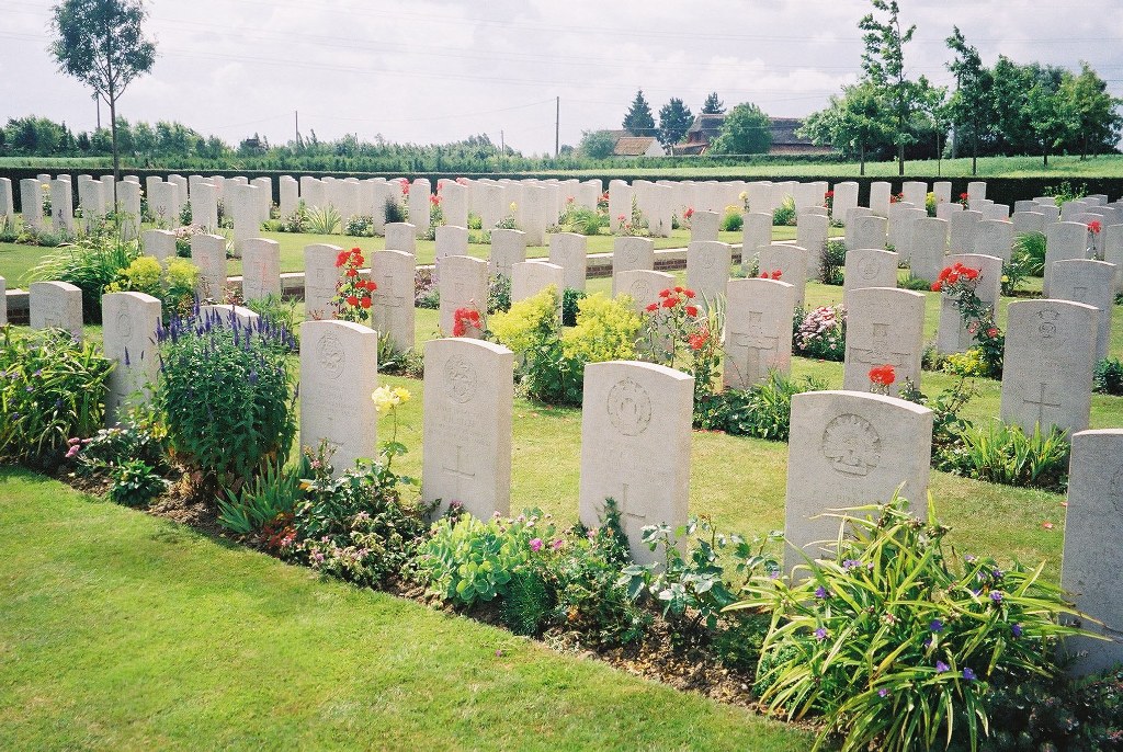
All the cemetery internal paths are grass, the ground is flat and firm.
ALTERNATIVE ACCESS
There is no alternative access into the cemetery.
ADDITIONAL INFORMATION
The cemetery is permanently open.
History information
Le Grand Hasard Military Cemetery, begun by the 31st Division at the end of June 1918, was also used by the 40th Division. On its closure at the end of August the cemetery comprised Plots I and II, but after the Armistice Plots III and IV were added when scattered graves were brought into the cemetery from a wide area around Hazebrouck. The earliest of these graves dates from May 1915, but the majority were from the fighting of April 1918.
There are now 300 Commonwealth burials of the First World War in the cemetery.
Two further plots of 138 burials were added to the cemetery during the Second World War. Among these later burials, all dating from May and June 1940, are special memorials to a number of casualties known to be buried within the cemetery whose graves could not be precisely located. 58 of the graves are unidentified.
The original cemetery was designed by Sir Herbert Baker.