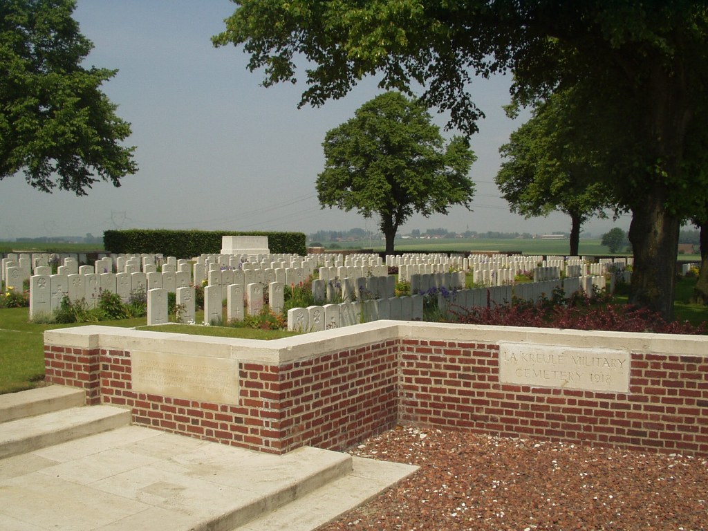
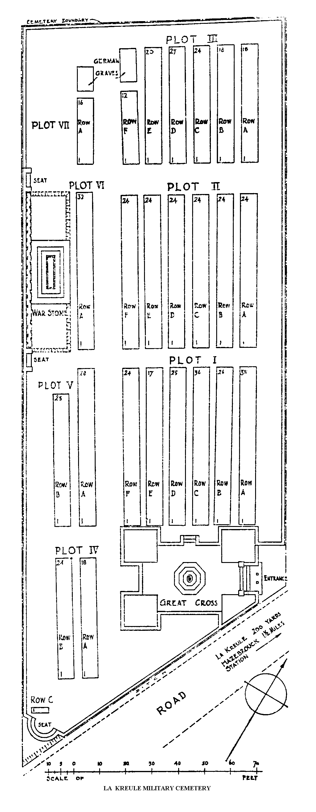
La Kreule Military Cemetery, Hazebrouck
- Country France
- Total identified casualties 586 Find these casualties
- Region Nord
- Identified casualties from First World War
- GPS Coordinates Latitude: 50.7409, Longitude: 2.5464
Location information
La Kreule is a small hamlet 2 kilometres north of Hazebrouck, on the road to St Sylvestre-Cappel and Steenvoorde. Leave Hazebrouck on the D916 heading north. The Cemetery is visible from the roundabout where the D916 crosses the Hazebrouck by-pass. The access road to the cemetery is 100 metres off the roundabout, on the left hand side.
Visiting information
Wheelchair access to this site is possible, but maybe by alternative entrance. For further information regarding wheelchair access, please contact our enquiries dept. on 01628 634221.
History information
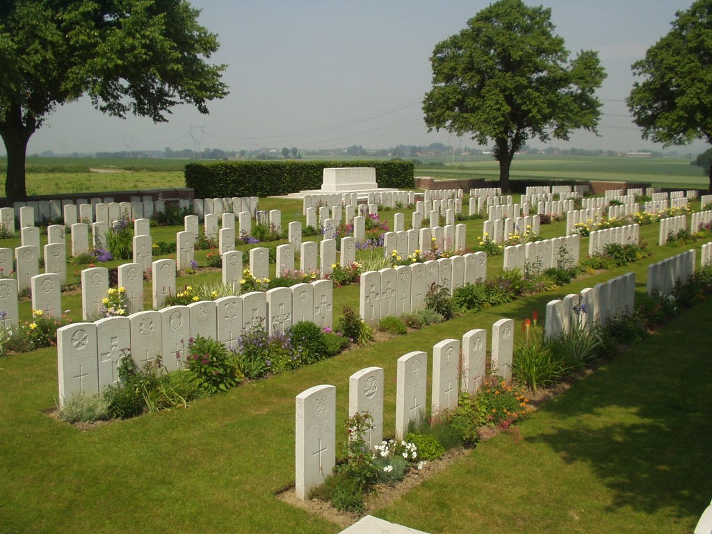
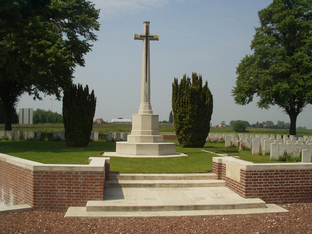
La Kreule Military Cemetery was opened in April 1918 by the 1st and 2nd Australian Casualty Clearing Stations, which came back from Outtersteene ahead of the German advance, and the 17th, which arrived from Lijssenthoek. These three stations, known collectively as "Ana Jana Siding", were posted to the north of La Kreule, but in the middle of April they withdrew to Blendecques, near St. Omer, and the cemetery was then used by heavy artillery and fighting units. In October 1918, the 17th Casualty Clearing Station returned with the 8th and the 64th and the cemetery was closed at the end of the month. The cemetery contains 576 Commonwealth burials of the First World War and 11 German war graves. The cemetery was designed by Sir Herbert Baker.