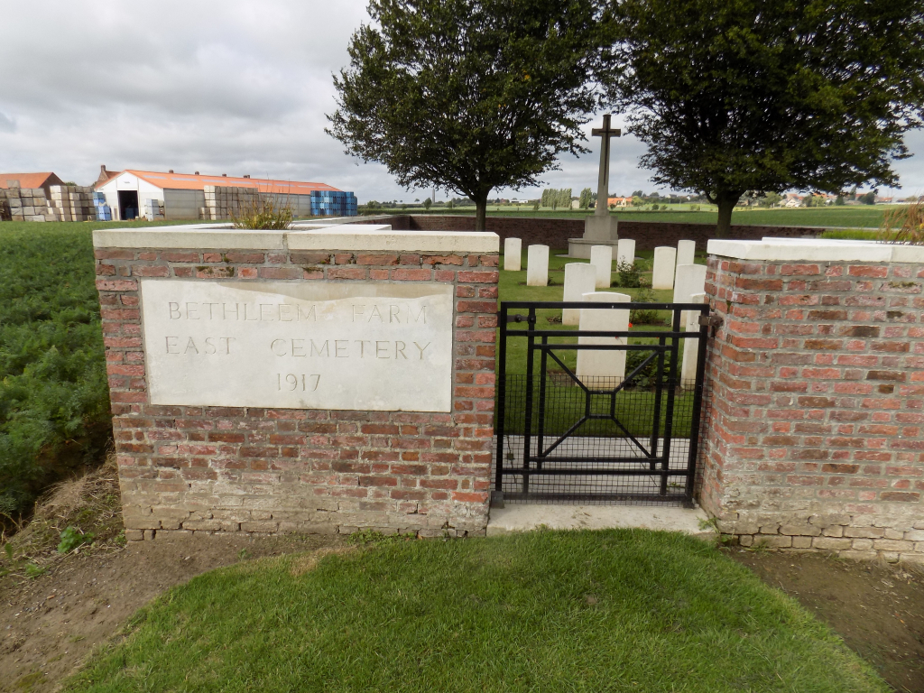
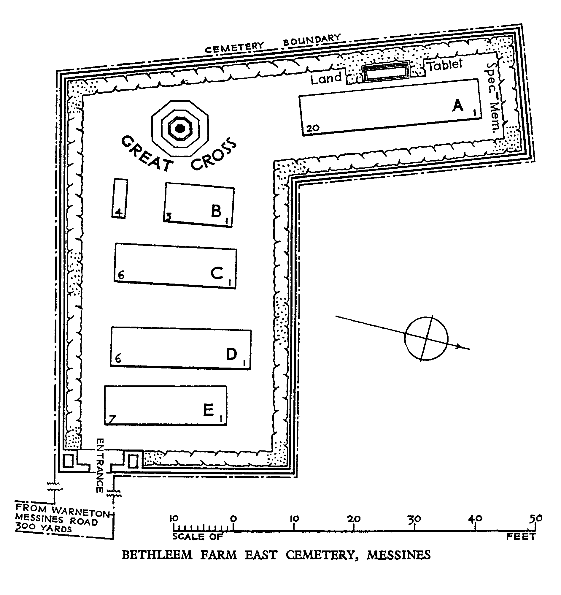
Bethleem Farm East Cemetery
- Country Belgium
- Total identified casualties 37 Find these casualties
- Region West-Vlaanderen
- Identified casualties from First World War
- GPS Coordinates Latitude: 50.76081, Longitude: 2.91151
PLEASE NOTE
Works have started on new wall footings. The cemetery will still be accessible while the works are taking place, however please take care when visiting. We apologise for any inconvenience.
Location information
Bethleem Farm East cemetery is located 10 Km south of Ieper town centre and 1 km south east of Mesen, on a road called the Rijselstraat, which leads from Mesen market square. (Mesen itself is located 10 Km from Ieper via the N365 connecting Ieper to Armentieres). The cemetery lies 1 Km beyond Mesen market place along the Rijselstraat, on the left hand side of the road. Visitors to this site should note a 250 metre grassed access path which is unsuitable for vehicles.
Visiting information
Wheelchair access possible via main entrance.
For further information regarding wheelchair access, please contact our Enquiries Department on telephone number: 01628 634221
History information
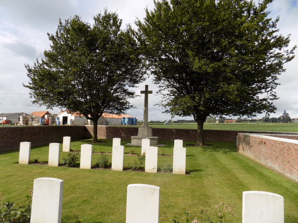
Bethleem Farm East Cemetery was made by Australian units when the nearby Bethleem Farm was captured by the 3rd Australian Division on 7 June 1917, in the Battle of Messines. The majority of the burials are those of officers and men killed in action on 8 or 10 June, though the cemetery continued to be used until the following September. There is also a West Cemetery nearby.
There are 44 servicemen of the First World War buried or commemorated in the cemetery. Eight of the burials are unidentified but a special memorial commemorates one casualty know to be buried among them.
The cemetery was designed by G H Goldsmith.