Bethleem Farm West Cemetery
- Country Belgium
- Total identified casualties 165 Find these casualties
- Region West-Vlaanderen
- Identified casualties from First & Second World War
- GPS Coordinates Latitude: 50.75857, Longitude: 2.90662
Location information
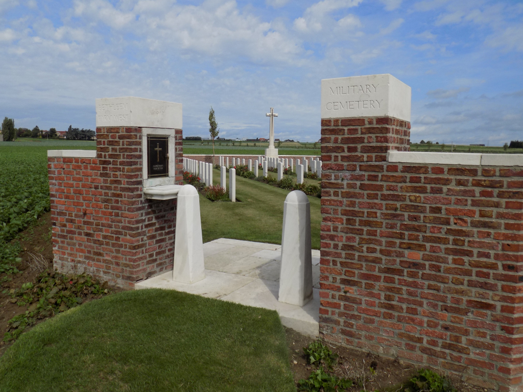
Bethleem Farm West cemetery is located 10 km south of Ieper town centre and 1 km south east of Mesen, on a road called the Rijselstraat, which leads from Mesen market square. (Mesen itself is located 10 km from Ieper via the N365 connecting Ieper to Armentieres). The cemetery lies 1 km beyond Mesen market place along the Rijselstraat, on the right hand side of the road, towards a farmstead (known as Nazareth or Schnitzel Farm). Visitors to this site should note a short grassed access path which is unsuitable for vehicles.
Visiting information
Wheelchair access possible via main entrance.
For further information regarding wheelchair access, please contact our Enquiries Department on telephone number: 01628 634221
History information
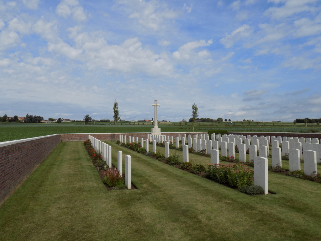
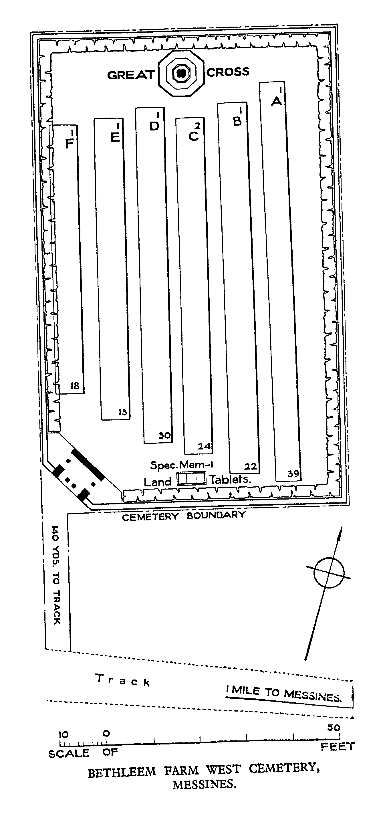
Bethleem Farm West Cemetery was made by units of the 3rd Australian Division (it was known to them as the '3rd Division General Cemetery'), who captured Bethleem Farm (which can be found to the north-east) on 7 June 1917 during the Battle of Messines. It continued to be used by the 14th (Light) Division until the end of 1917. There is also an East Cemetery located nearby. There are now 165 servicemen of the First World War buried or commemorated in the cemetery including one casualty commemorated by special memorial whose grave in the cemetery was destroyed by shell fire. The cemetery also contains one unidentifed burial of the Second World War. The cemetery was designed by G H Goldsmith.