Harare Memorial
- Country Zimbabwe
- Total identified casualties 66 Find these casualties
- Identified casualties from First World War
- GPS Coordinates Latitude: -17.85038, Longitude: 31.03735
Historical Note
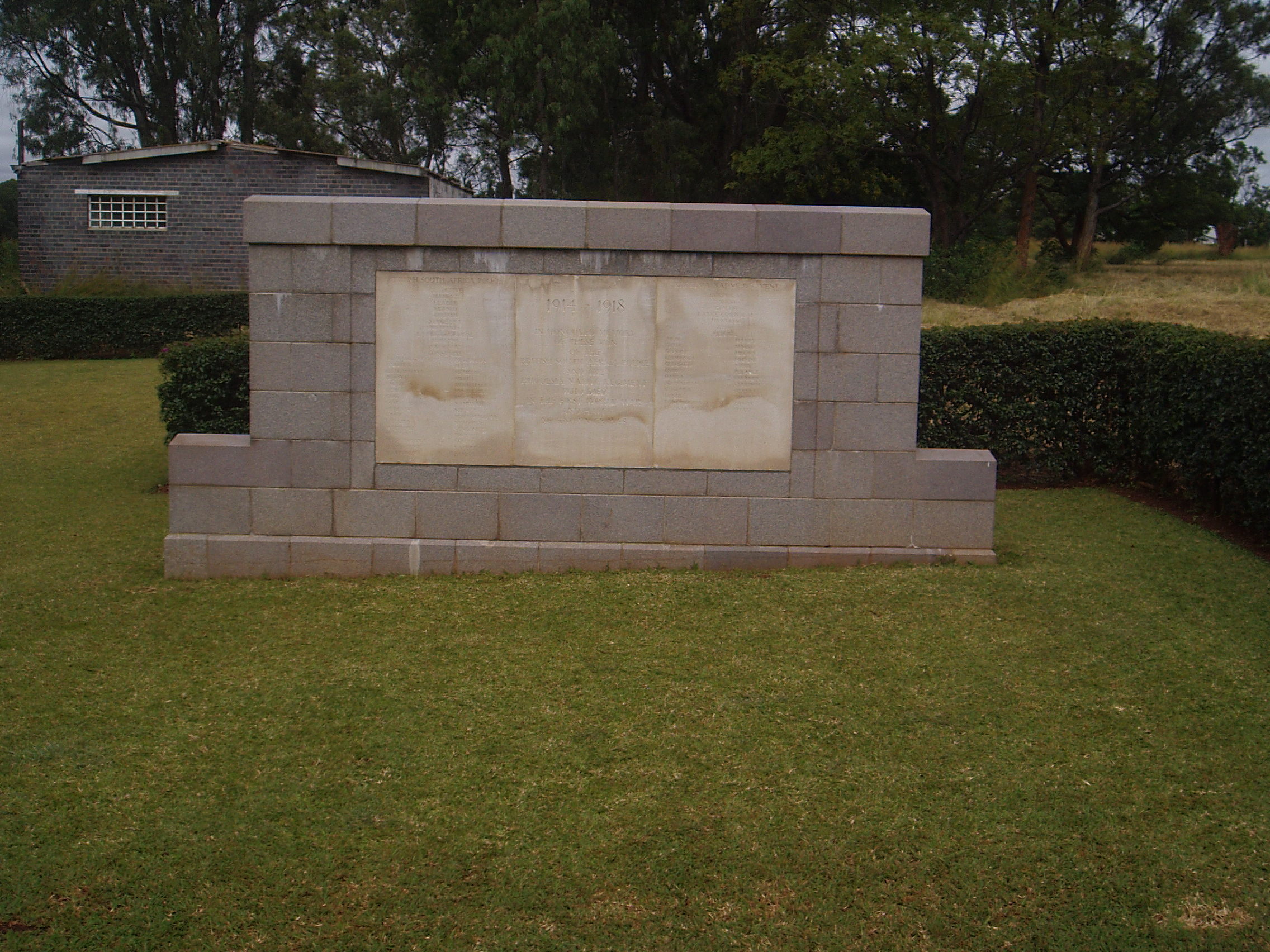
 The original Harare Park Memorial was constructed in the 1920s as a general memorial to the missing. It did not carry the names of the casualties it commemorated on its panels. Instead, they were included in the printed memorial register. In 1997 the names were added to this new memorial.
You can find more information about historical inequalities in commemoration in our Special Committee’s report.
Location information
The Harare Memorial is located within the African plot of Harare (Pioneer) Cemetery. From Unity Square (town centre) proceed 200 metres on 2nd Street and turn right into Jason Moyo Avenue. Proceed for 2 kilometres keeping to the right, and turn left at the lights into Rotten Row. Proceed for a further 2 kilometres, passing over a large flyover. At the crossroads turn right and the entrance to the Cemetery will be found 200 metres further along on the right.
Visiting information
ARRIVAL
The main municipal cemetery (Mbare West Cemetery) is signposted. The main entrance is on Remembrance Drive. The Commonwealth War Graves Commission (CWGC) sections are not signposted. The African Section, with the Harare Memorial, is located approximately 150 metres from the main entrance, near the centre of the cemetery. The European Section, with the Harare Cremation Memorial, is located towards the top right-hand corner of the cemetery, approximately 300 metres from the main entrance.
PARKING
There is no car park at the cemetery.
It is possible to drive around the municipal cemetery and to a point close to the CWGC sections where is possible to park, approximately 3 metres from the entrances to the CWGC sections.
The ground is flat and firm, the ground surface is a mixture of scrubland, gravel, and sand.
There are two separate plots in the Cemetery; the European Section and the African Section, both with a Cross of Sacrifice.
ACCESS, LAYOUT AND MAIN ENTRANCE
European Section
The plot is rectangular shaped.
There is a cobbled pathway adjacent to the road. Three steps lead down into the plot at the far end, and a paved ramp slopes down into the burial area near the beginning of the pathway.
The Cross of Sacrifice is in the centre of the cemetery.
The Harare Cremation Memorial is located near the Cross of Sacrifice.
There are seating areas with stone benches facing the Cross of Sacrifice.
All the internal cemetery paths are grass, the ground is firm and flat.
African Section
The plot is accessed directly from the track running adjacent to the plot.
The Harare Memorial is located at the head of the cemetery, near the Cross of Sacrifice.
All the internal cemetery paths are grass, the ground is firm and flat.
ADDITIONAL INFORMATION
The cemetery is open during working hours, Monday to Friday 0600 hrs to 1800 hrs.
Outside of the working hours, the cemetery gates are closed and padlocked.
History information
(References to place names and military units are those in use at the time of the First World War) During the War, and for some years later, the whole of Rhodesia was administered by the British South Africa (the "Chartered") Company. Its armed forces in August 1914, were the British South Africa Police (in Southern Rhodesia) and the Northern Rhodesia Police. The South-West corner of North-Western Rhodesia touched the "Caprivi Strip" of German South-West Africa; the North-East boundary of North-Eastern Rhodesia, from Lake Tanganyika to Lake Nyasa, was open to German East Africa. On the 21st September 1914, Northern Rhodesia Police occupied the Caprivi Strip and garrisoned the line of the Zambesi; but danger from the West was removed in July 1915, by the surrender of the last German forces in South-West Africa. The operations on the North-Eastern frontier were more serious. Until May 1916, they were necessarily mainly defensive. The Rhodesia Regiment, the Rhodesia Native Regiment and the Northern Rhodesia Rifles, all fresh formations, were raised, and the existing units strengthened; but the contingents sent to South-West Africa and to British East Africa, and the forces which held the frontier, used the full man-power of Rhodesia. With Belgian help, Abercorn was defended against German attacks on the 5th and 9th September 1914, Fife on the 6th and 27th December, and Saisi on the 28th-29th June, and the 26th July-2nd August 1915. In the period December 1915-February 1916, two motor-boats, brought overland to Lake Tanganyika, destroyed the German flotilla on the lake. But in May 1916, the increasing success of the main attack from British East Africa enabled the Nyasaland and Rhodesian forces to advance into German territory; the threat to Rhodesia was removed, and the story of the Rhodesian forces merges with that of the conquest of German East Africa. It was not till September 1918, that German troops, driven into Portuguese East Africa and out again, recrossed the Rhodesian border; and General von Lettow-Vorbeck surrendered, close to Abercorn, on the 25th November 1918.
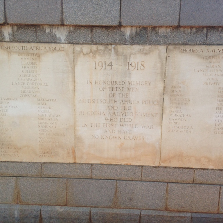
Officers and men of Rhodesian units who fell in the Great War and whose graves are not known, and of the Northern Rhodesian native carriers who fell in the Great War and whose names and graves are alike unknown, are commemorated on the Abercorn, Livingstone Camp and Harare Memorials. The Harare Memorial commemorates by name 38 men of the British South Africa Police and 28 of the Rhodesia Native Regiment who fell in the First World War. These men were previously commemorated by the nearby Harare Park Memorial, an obelisk erected to the honour of South Rhodesian soldiers by their government.