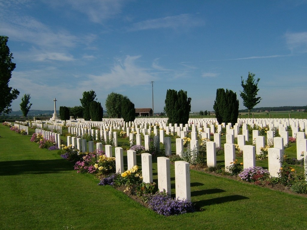
Nine Elms British Cemetery
- Country Belgium
- Total identified casualties 1617 Find these casualties
- Region West-Vlaanderen
- Identified casualties from First & Second World War
- GPS Coordinates Latitude: 50.85095, Longitude: 2.69701
Location information
Nine Elms British Cemetery is located west of Poperinge on the Helleketelweg, a road leading from the N33 Poperinge ring road. From Ieper follow the signs to Poperinge. At the traffic lights at the end of the expressway turn left onto the Poperinge ring road, the Europalaan. Follow the ring road to the roundabout and take the second exit. At the next roundabout take the second exit, follow the ring road and take the first turning on the left, the Helleketelweg. The cemetery is along here on the left.
Visiting information
ARRIVAL
The route to the cemetery is signposted.
PARKING
Parking is available along the side of the road at the main entrance and along the front of the cemetery.
There is space for approximately 5 vehicles.
The ground is uncompacted gravel with an uneven boundary between the road and lay-by.
The distance from parking area to main entrance is approximately 10 metres.
ACCESS, LAYOUT AND MAIN ENTRANCE
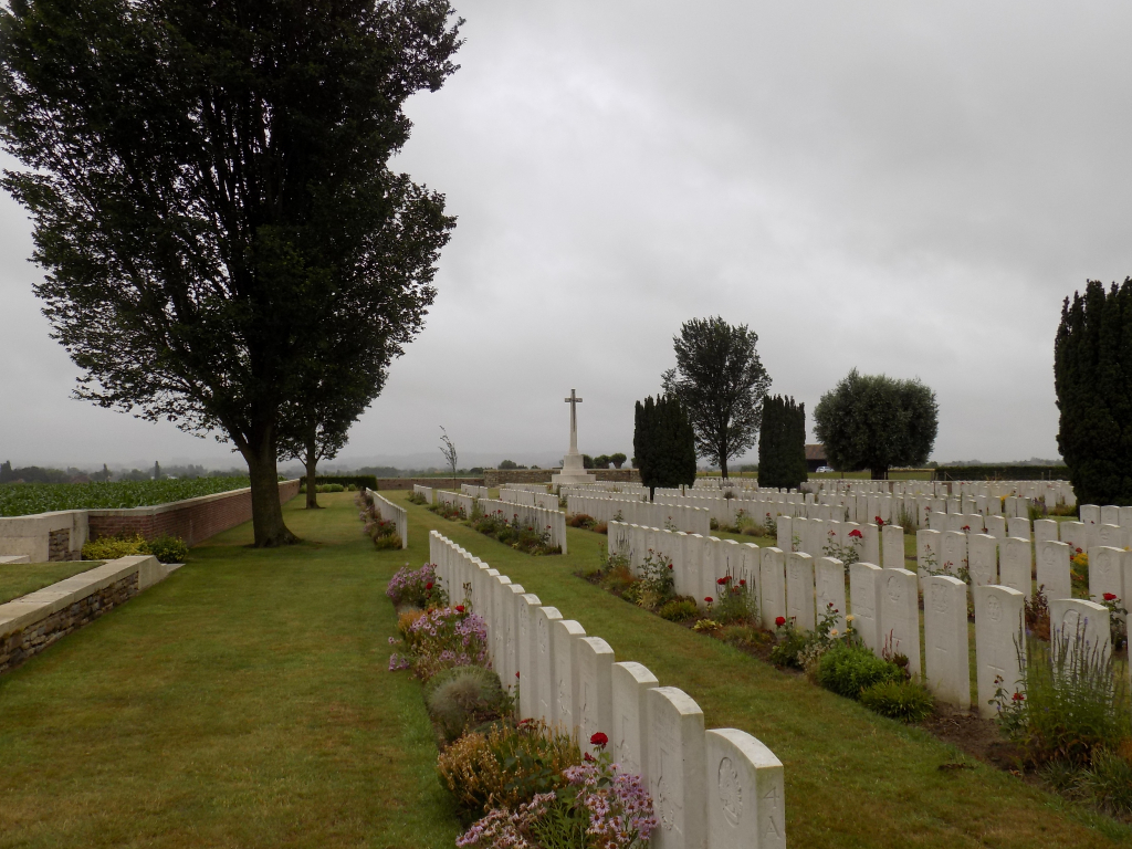
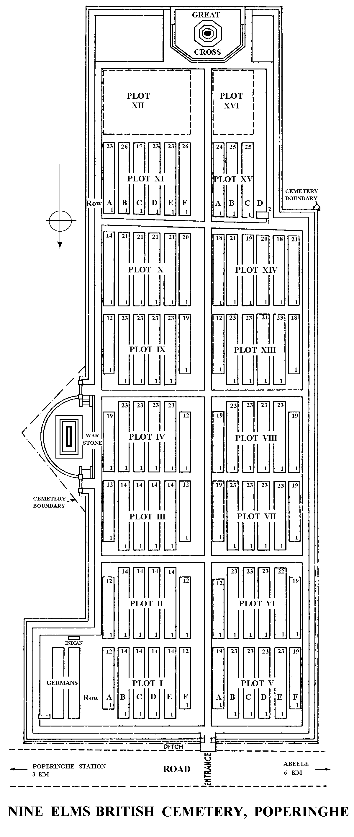
The cemetery is a rectangular shape.¬
Entrance to the cemetery is through an archway, approximately 1.5 metres wide in the entrance building. One step up and another down, both approximately 100 mm deep leads into the cemetery. There are no gates at the entrance.
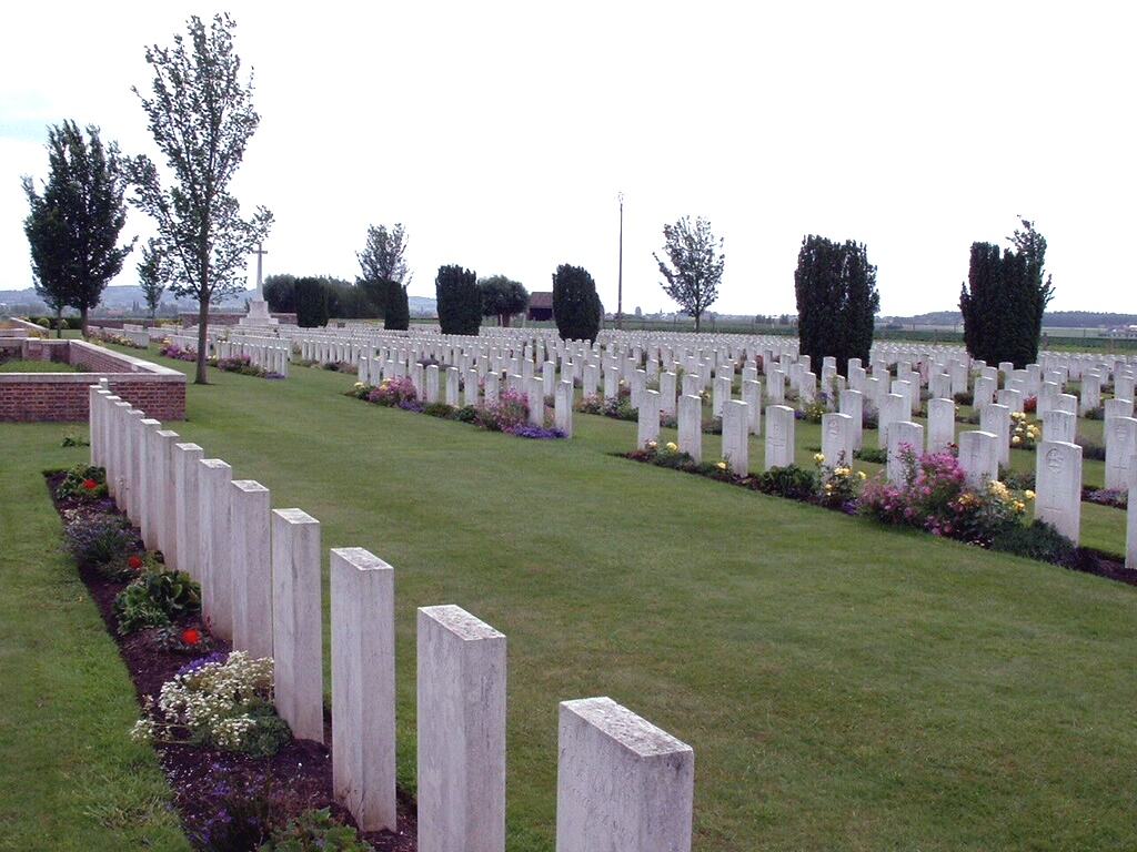
The Cross of Sacrifice stands in a central position at the far end of the cemetery opposite the entrance, on a raised platform. Three shallow steps lead up to the grassed platform.
There is a Stone of Remembrance on the east side of the cemetery, halfway along its length in a recessed arc part of the wall on a raised platform. Three steps lead up to the raised area on the southern edge of the raised area.
All internal paths are grass, the ground is flat.
The main entrance arch is also a shelter, with stone benches in a seating area.
The cemetery Register Box is built into the wall of the Entrance building inside the archway.
ALTERNATIVE ACCESS
There is an opening, approximately 1.5 metres wide, on the eastern end of the front wall of the cemetery.
ADDITIONAL INFORMATION
The cemetery is permanently open.
History information
The cemetery was begun and used by the 3rd Australian and 44th Casualty Clearing Stations when they moved to Poperinghe (now Poperinge), from Brandhoek and Lijssenthoek respectively, in September 1917. Nearly all the burials in Plots I to IX came from these Casualty Clearing Stations, whilst they operated in this area during the 1917 Battle of Ypres, up until December 1917.
Plots X, XI, XIII, XIV and XV cover the dates between the beginning of March, 1918 and the 12th October, 1918, the period of the German offensive in Flanders, the British counter attacks and the final advance of August-September. The burials in these cases were carried out almost entirely by fighting units.
The cemetery contains 1,556 Commonwealth burials of the First World War and 37 German war graves from this period. There are also 22 Second World War burials in the cemetery, all dating from the Allied retreat to Dunkirk in 1940.
The cemetery was designed by Sir Reginald Blomfield.