Dozinghem Military Cemetery
- Country Belgium
- Total identified casualties 3309 Find these casualties
- Region West-Vlaanderen
- Identified casualties from First & Second World War
- GPS Coordinates Latitude: 50.89244, Longitude: 2.70158
Location information
The cemetery is located to the north-west of Poperinge near Krombeke. From Ieper follow the directions to Poperinge along the by-pass. At the end of the by-pass at the traffic lights turn right into Oostlaan. Follow Oostlaan over the roundabout to the end of the road. Turn left into Veurnestraat and follow along here to the first turning on the right. (From Poperinge centre, follow the directions to Veurne along the Veurnestraat to the second turning on the left.) Turn into Sint-Bertinusstraat and follow this road up the rise and round a left hand bend. After the bend, take the right hand turning in the direction of Krombeke along the Krombeekseweg. Follow the Krombeekseweg past the "De Lovie" centre where the road name changes to Leeuwerikstraat and then past a cafe on the left. Approximately 500 meters after the cafe on the left, you will see a sign for the cemetery pointing to a track on the right into the woods. The cemetery is along here at the end of the track.
Visiting information
ARRIVAL
The route to the cemetery is signposted.
PARKING
There is a single lane track from the main road, Leeuwerikstraat, to the cemetery. The track is a combination of gravel and compacted earth and can become muddy when wet.
It is possible to drive up to the main entrance, a distance of approximately 200 metres, and park along the side of the track to the front of the cemetery.
There is space for up to 5 vehicles, all the parking area is within 10 metres of the main entrance gate.
ACCESS, LAYOUT AND MAIN ENTANCE
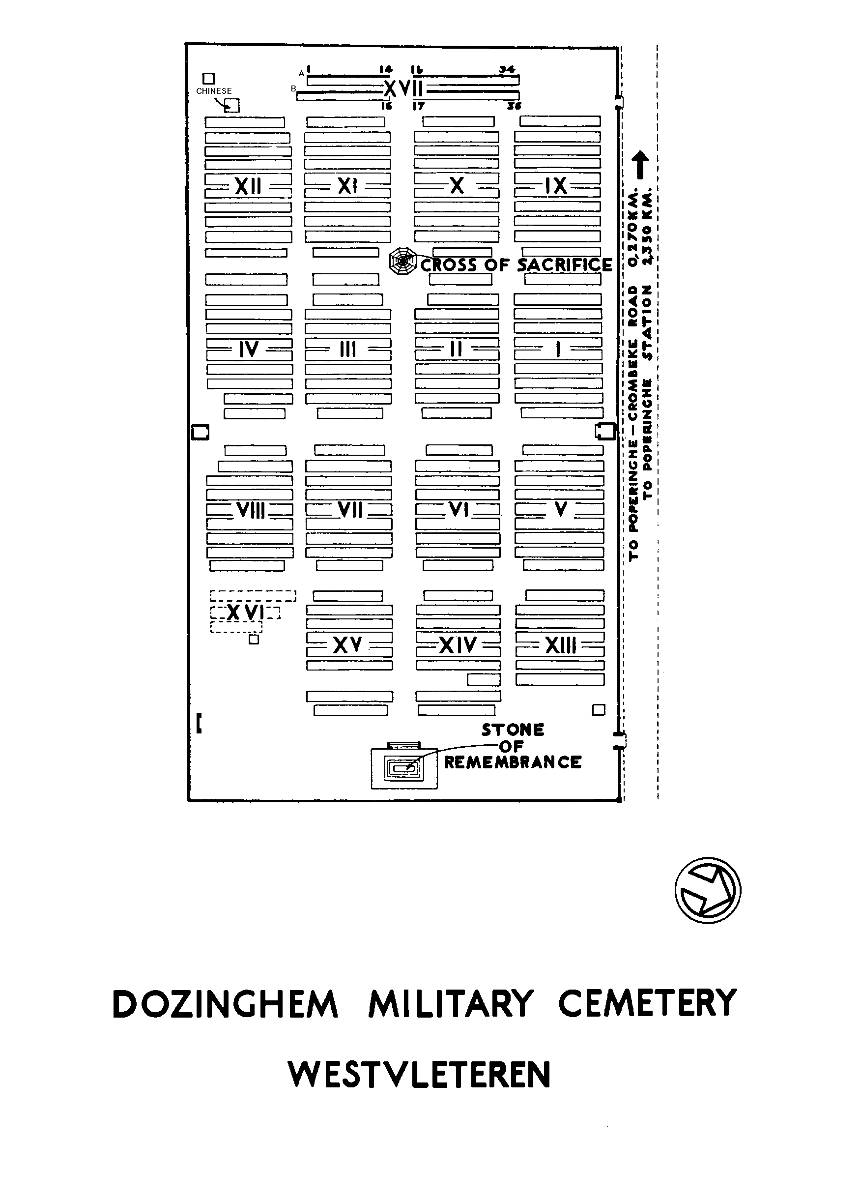
The cemetery is rectangular shaped, running parallel to a farm track.
The main entrance is located at the northwest corner of the cemetery, adjacent to the farm track. The main entrance is comprised of two brick and stone pillars, with a two-leaf black metal gate, approximately waist high, with stone paving underneath. The right-side gate leaf is opened by turning a ringed latched handle clockwise. The clear opening of both gates is 2.0 metres.
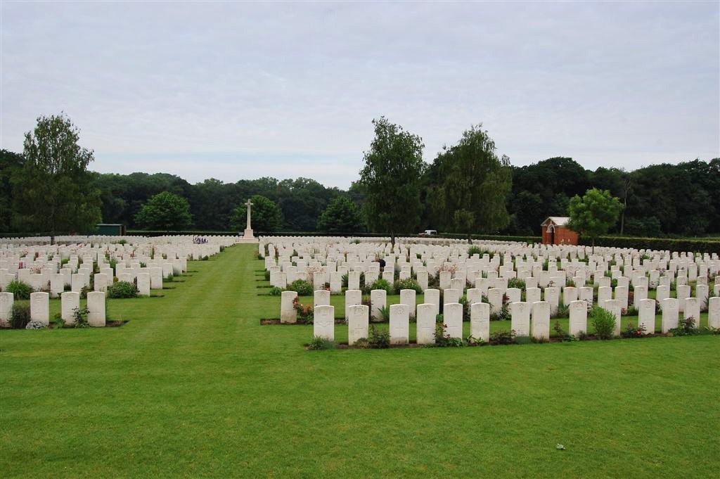
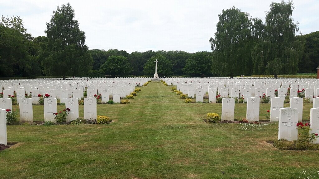
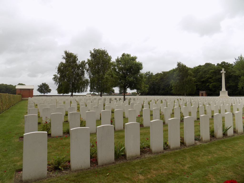
The Stone of Remembrance is located inside the cemetery close to the far end (eastern end) of the site. It is located on an elevated platform with 4 stone steps in front of the Stone of Remembrance. The raised platform is approximately 450 mm above ground level and drops off on three sides. The rear of the platform is bound by the cemetery hedge surrounding the site.
The Cross of Sacrifice is in the centre of the cemetery closer to the western end of the site.
There are 2 red brick shelter buildings either side of the cemetery, at the midpoint of both the north and south sides of the cemetery. The shelters both contain stone benches and sit on a raised stone floor, approximately 200 mm above ground level. There is a dirt strip, approximately 100 mm wide between the grass and the step up into the shelter.
There are wooden seats around the cemetery as well as a brick seating structure in the southeast corner of the site facing the Stone of Remembrance.
The Register Box is built into one of the main gate posts at the main entrance, inside the cemetery.
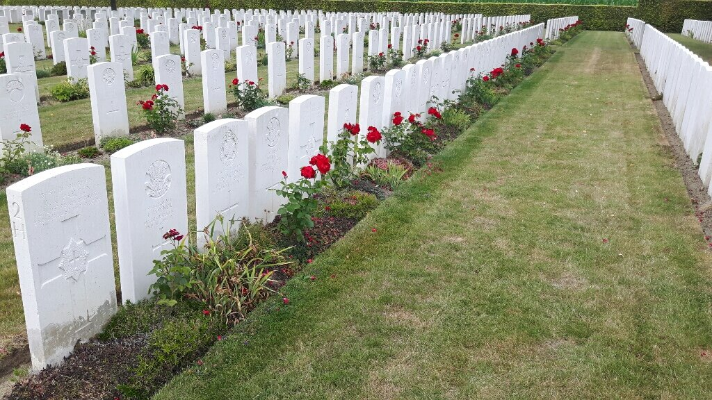
All internal paths are grass, the ground is flat and firm.
ALTERNATIVE ACCESS
There is an alternative entrance at the northeast corner of the cemetery. The second entrance is along the track that continues alongside the front of the cemetery.
There are two tall brick and stone pillars, approximately 2.5 metres tall with a tall, two-leaf black metal gate, approximately 2 metres high, with stone paving underneath. The right-side gate leaf is opened by turning a ringed latched handle clockwise. The clear opening of both gates is 1.0 metre and opens inwards into the cemetery.
ADDITIONAL INFORMATION
The cemetery is permanently open.
History information
Westvleteren was outside the front held by Commonwealth forces in Belgium during the First World War, but in July 1917, in readiness for the forthcoming offensive, groups of casualty clearing stations were placed at three positions called by the troops Mendinghem, Dozinghem and Bandaghem.
The 4th, 47th and 61st Casualty Clearing Stations were posted at Dozinghem and the military cemetery was used by them until early in 1918.
There are now 3,174 Commonwealth burials of the First World War in the cemetery and 65 German war graves from this period. The cemetery also contains 73 Second World War burials dating from the Allied withdrawal to Dunkirk in May 1940.
The cemetery was designed by Sir Reginald Blomfield.