Mazingarbe Communal Cemetery
- Country France
- Total identified casualties 108 Find these casualties
- Region Pas de Calais
- Identified casualties from First World War
- GPS Coordinates Latitude: 50.46921, Longitude: 2.7123


Location information
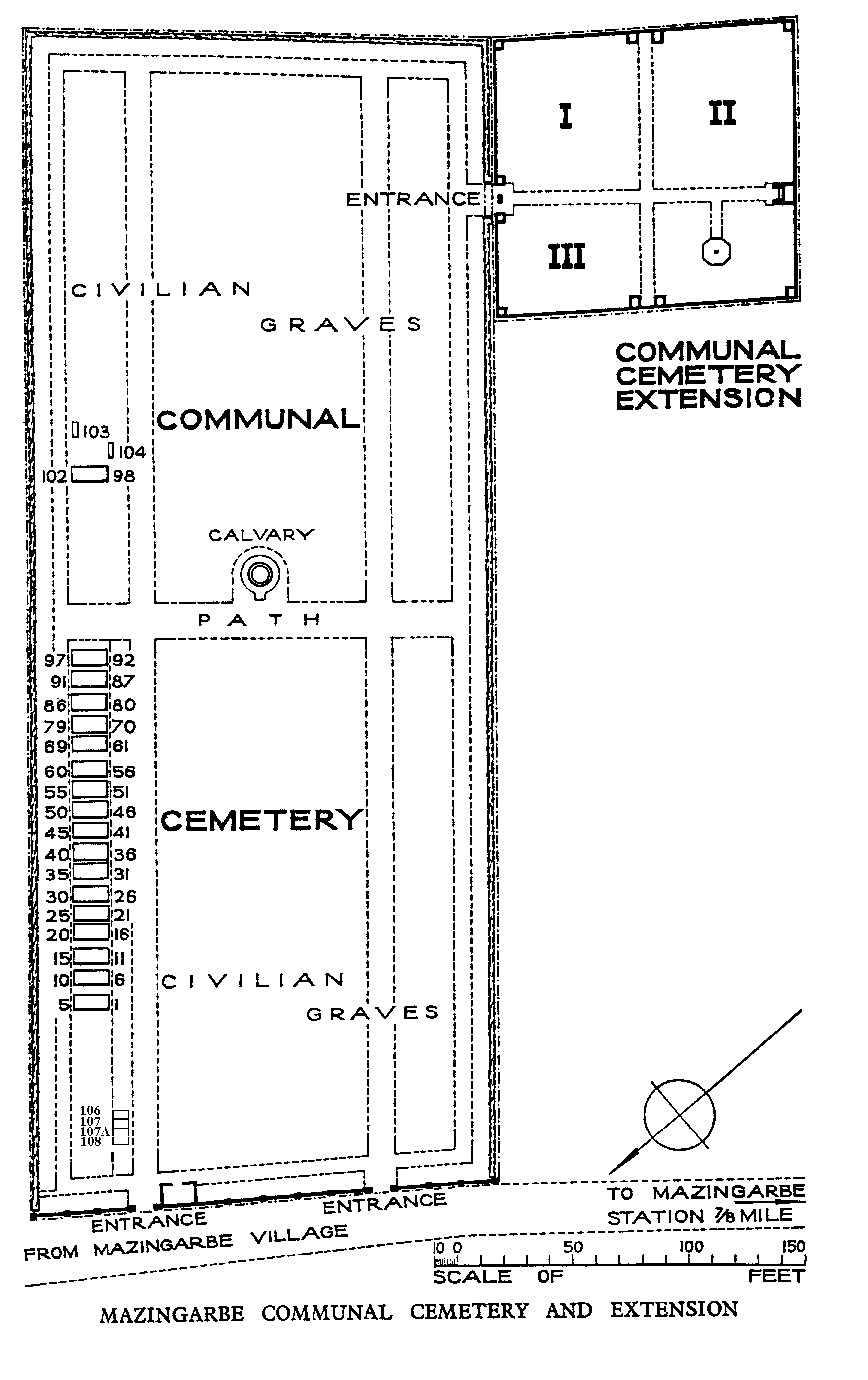
Mazingarbe is a small town located in the Pas de Calais between the larger town of Lens and Bethune. Mazingarbe Communal Cemetery and Extension is situated adjacent to the Sains-en-Gohelle road from Mazingarbe on the D75, which can be reached from two major roads, the D932 Arras to Bethune road, and the N43 Lens to Bethune road. There are signposts to the cemetery visible in the centre of Mazingarbe town and on the D75 road. Access to the cemetery and parking is best obtained by taking a small side street off the D75. It should be noted that a one-way system is permanently in operation in Mazingarbe town. The War Graves will be found in two parts of the Communal Cemetery and, as with all town cemeteries, opening hours must be observed.
Visiting information
Wheelchair access is possible via the main entrance. For further information regarding wheelchair access, please contact our Enquiries Section on 01628 507200.
History information
MAZINGARBE COMMUNAL CEMETERY was used by units and field ambulances from June 1915 to February 1916. It contains 108 Commonwealth burials of the First World War and 24 French war graves. The adjoining COMMUNAL CEMETERY EXTENSION was begun by the 16th (Irish) Division in April 1916 and was used until October 1918. It contains 248 Commonwealth burials of the First World War and two German graves. The extension was designed by Sir Herbert Baker.