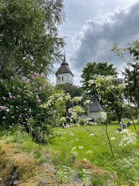
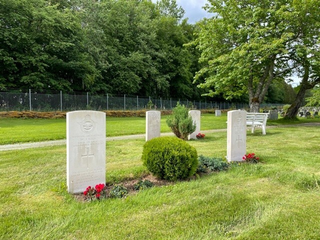
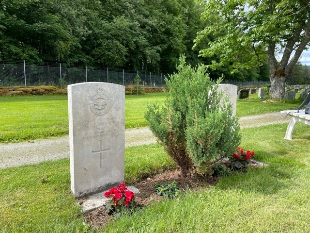
Vaernes Churchyard
- Country Norway
- Total identified casualties 4 Find these casualties
- Identified casualties from Second World War
- GPS Coordinates Latitude: 63.45511, Longitude: 10.95436
Location information
The town of Vaernes is located approximately 30 kilometres east of Trondheim close to the E14 route to the Swedish border. From Trondheim follow the E6 past the turn-off for Vaernes airport. Take the next exit onto the E14, signposted to Sundsvall, and follow the E14 for approximately 1 kilometre. Turn right at the sign for Vaernes church (symbol) and follow unclassified road for 1.5 kilometres to the church; the white steeple and patinated copper roof of which can be seen on the right from some distance. Follow the path from the gate 50 metres to the church, from which point the four Commission headstones can be seen approximately 20 metres from the rear boundary wall of the churchyard.
History information
During the Second World War, Norway was of strategic importance to the Germans. Their invasion on 9 April 1940 was sudden and widespread and despite Allied intervention, the entire country was under German occupation by early June. Thereafter, Allied activity in Norway was confined to raids and special operations, with the Commonwealth air forces providing support to Norwegian resistance groups until the German capitulation in May 1945. There are no Commonwealth war cemeteries in Norway, those who died there being buried in civil cemeteries and churchyards. Vaernes Churchyard contains the graves of four Commonwealth airmen who died in 1945 while stationed at Vaernes, the site of Trondheim airfield. The Germans had occupied the airfield in 1940.