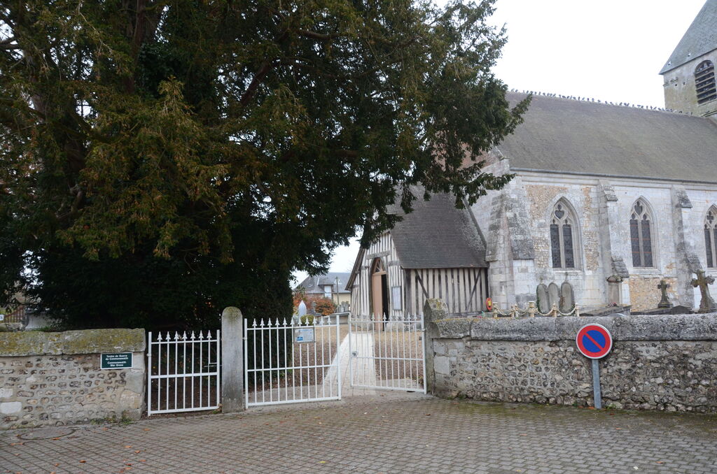
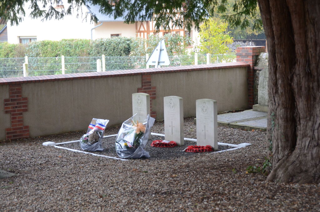
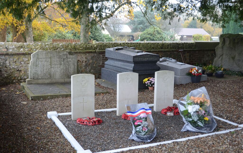
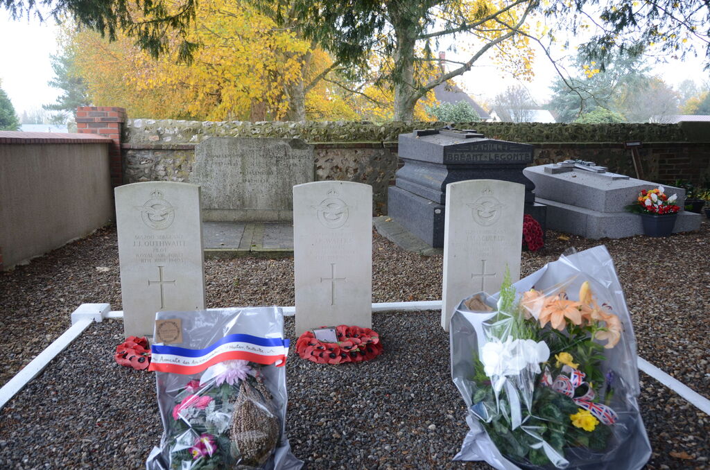
Boulleville Churchyard
- Country France
- Total identified casualties 3 Find these casualties
- Region Eure
- Identified casualties from Second World War
- GPS Coordinates Latitude: 49.36099, Longitude: 0.38103
Location information
Boulleville is a village about 67 kilometres north-west of Evreux and some 9 kilometres west of Pont-Audemer, a town 24 kilometres south-east of Honfleur. The graves of three airmen of the Royal Air Force are in the northern corner of the churchyard.