Kumasi Public Cemetery
- Country Ghana
- Total identified casualties 120 Find these casualties
- Identified casualties from Second World War
- GPS Coordinates Latitude: 6.71812, Longitude: -1.62184
Location information
Kumasi, the chief town of the Ashanti region, lies some 275 kilometres inland from Accra. The cemetery is known locally as Tafo Public Cemetery and is about 3 kilometres from the centre of the town on the Mampong road.
Visiting information
ARRIVAL
The route to the cemetery is signposted. The Commonwealth War Graves (CWGC) section is a rectangular section within the main cemetery, surrounded by a 2-metre-high security fence. A roughened concrete area is located off the dirt track in front of the gate. Access into the main cemetery is through a gate at the southern end of the cemetery, where a memorial mason business is located, on Mampong Road.
PARKING
There is a single lane dirt track, uneven in many places, winding in a northeasterly direction towards the entrance of the CWGC section of the cemetery, approximately 200 metres from the entrance. Alongside the track, in front of the gate leading into the plot, there is a concreted area where it is possible to park 2 vehicles.
ACCESS, LAYOUT AND MAIN ENTRANCE
The main entrance gate is halfway along a tall green security fence with a 3.5-metre-wide double gate that opens inwards into the cemetery.
There is a concrete strip underneath the main opening section, with a raised section (ridge) running across the bottom of the gate (20 cm high).
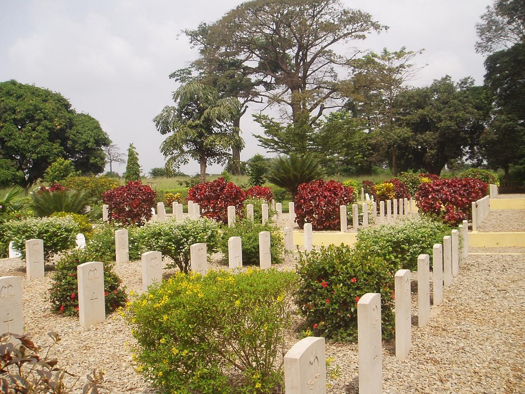
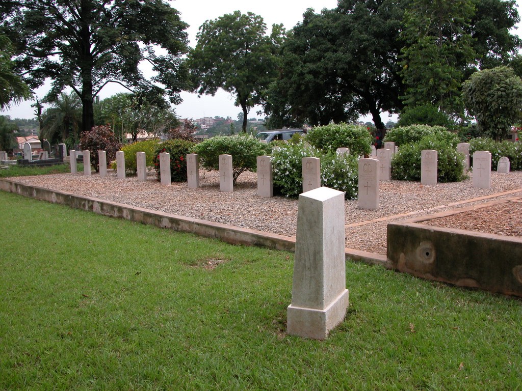
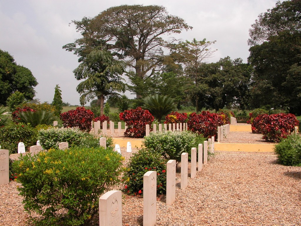
The CWGC military section is rectangular shaped and divided into 3 smaller terraced plots, with a drop of approximately 30 cm along each plot.
The 3 plots are separated by religious denomination and physically separated with raised concrete kerbstone edging. The burial area inside the kerbstones is flat and level with a grey aggregate surface.
Along the right-hand side of the cemetery is a long strip of grass, which slopes up to the far end of the cemetery. Concrete kerbs along each plot adjacent to the grass are approximately 10 cm high at the upper end and slopes downward to 40 cm at the end of the plot. Access the plots are at these 10 cm high kerbs.
There is a concrete plinth with an information sign mounted on it next to the first burial plot.
ALTERNATIVE ACCESS
There are no alternative entrances into the CWGC section.
ADDITIONAL INFORMATION
The cemetery is open daily between 0600 hrs to 1800 hrs.
History information
Kumasi was for many years the main station for the Gold Coast Regiment, Royal West African Frontier Force. A transit camp was housed there during the Second World War and the town raised two companies of the Gold Coast Home Guard, which was created in 1940 and disbanded in 1944. In January 1944, No. 52 British General Hospital was posted to Kumasi and was still there in December 1945.
Kumasi Public Cemetery contains 122 Commonwealth burials of the Second World War, two being unidentified and a further 2 civilians. The majority of the burials are in the military section which is divided into 3 plots, Plot 1 being for Christian burials, Plot 2 for non-faith burials and Plot 3 for Muslim burials. There are also 41 unidentified post war burials within the Military Section