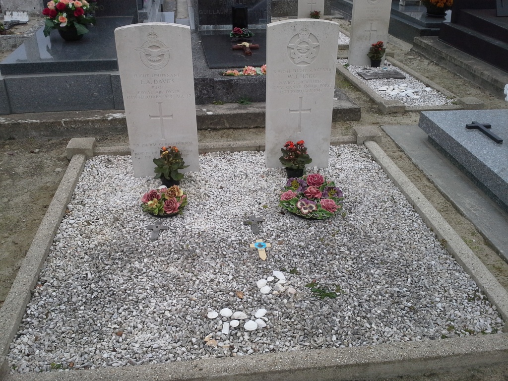
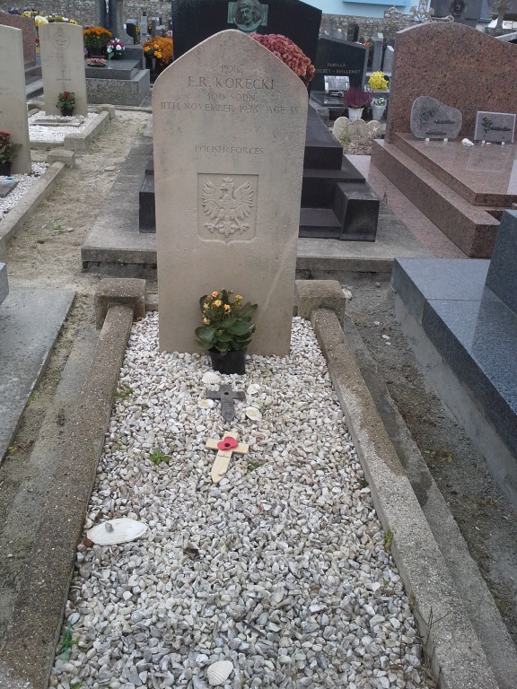
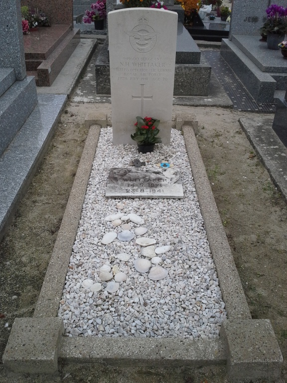
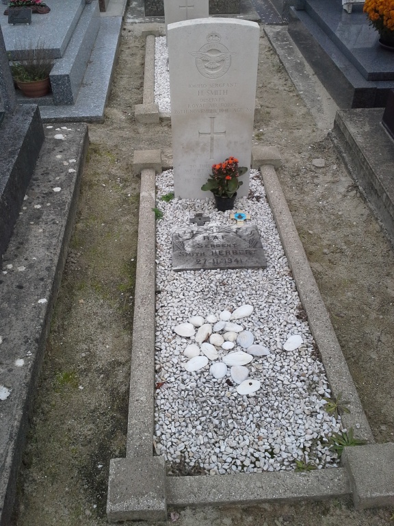
Gavres Communal Cemetery
- Country France
- Total identified casualties 5 Find these casualties
- Region Morbihan
- Identified casualties from Second World War
- GPS Coordinates Latitude: 47.6921, Longitude: -3.35374
Location information
Gavres is a village and commune 12 kilometres south-west of the town of Hennebont. The village is situated just north of the Pointe de Gavres, a peninsula close to the town of Port Louis, with which it is connected by ferry. It is most conveniently reached by taxi from Hennebont, which is on the Paris-Le Mans-Vannes-Quimper railway line to Port Louis for the ferry.
History information
The cemetery is 150 metres north of the church. The burials are west (left) of the entrance.