Figueras Municipal Cemetery
- Country Spain
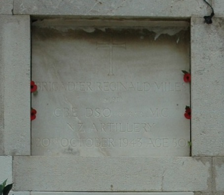
- Total identified casualties 1 Find these casualties
- Identified casualties from Second World War
- GPS Coordinates Latitude: 42.26401, Longitude: 2.972778
Location information
Figueras is a town in the north-east of Spain, some 25 kilometres south of the Spanish-French frontier, and on the main road and railway from Perpignan (France) to Barcelona. If travelling by train, the Catalunya Express runs from Barcelona to Figueres. The cemetery is about 3 kilometres out of Figueras, off the road to Rosas. Cemetery address: Passeig del Cementiri, s/n - 17600 Figueras. GPS Co-ordinates: 42.264527, 2.974269.
Visiting information
This cemetery is open daily from 8am to 6pm.
The one war grave is situated in the blue section. On entry, turn immediately right and follow path for about 50 meters, down 4 steps and turn left. The Niche is second from the top of Column 90, facing a rectangular storage building. The GPS co-ordinates for the niche are 42.263735, 2.973363.
For further information and enquiries please contact enquiries@cwgc.org