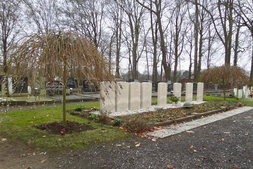
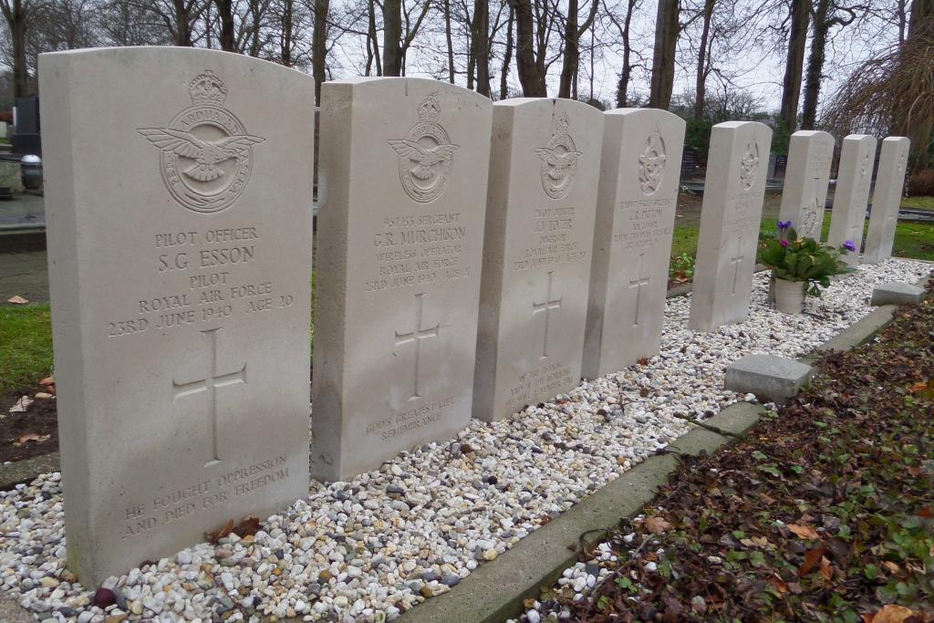
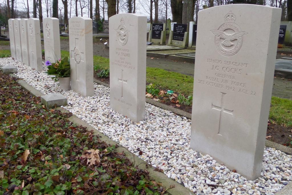
Steenwijkerwold (Willemsoord) General Cemetery
- Country Netherlands
- Total identified casualties 8 Find these casualties
- Region Overijssel
- Identified casualties from Second World War
- GPS Coordinates Latitude: 52.82695, Longitude: 6.07066
Location information
Willemsoord is situated 5 kilometres north-north-west of Steenwijk on the main road to Leeuwarden. The cemetery lies 200 metres east of the church which stands in the centre of the village.