Nederweert War Cemetery
- Country Netherlands
- Total identified casualties 363 Find these casualties
- Region Limburg (Netherlands)
- Identified casualties from Second World War
- GPS Coordinates Latitude: 51.28973, Longitude: 5.74974
Location information
The village of Nederweert lies in the south of the Netherlands, approx 30kms to the south east of Eindhoven. From the A2 motorway Eindhoven to Maastricht take exit 39 (Afrit 39) N275 NEDERWEERT and follow the signs for NEDERWEERT. Continue for approx 1.5kms and turn left onto the N266 direction HELMOND. Continue for approx 1km and turn left (CWGC sign) onto MONSEIGNEUR KREYELMANSSTRAAT. The cemetery can be found after 200m on the right. The cemetery address is:- Monseigneur Kreyelmanstraat 6031 Nederweert Netherlands GPS Location is:- N 51 17 22 E 05 44 59
Visiting information
ARRIVAL
The cemetery is within a residential area. The route to the cemetery is signposted.
PARKING
There is a parking area outside the cemetery with space for several vehicles.
Access to the parking is along a gravel track off Monseigneur Kreijelmansstraat, approximately 80 metres from the road.
The ground is firm and flat, the top surface is fine gravel.
ACCESS, LAYOUT AND MAIN ENTRANCE
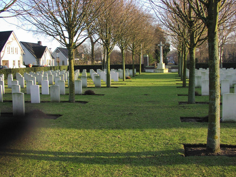
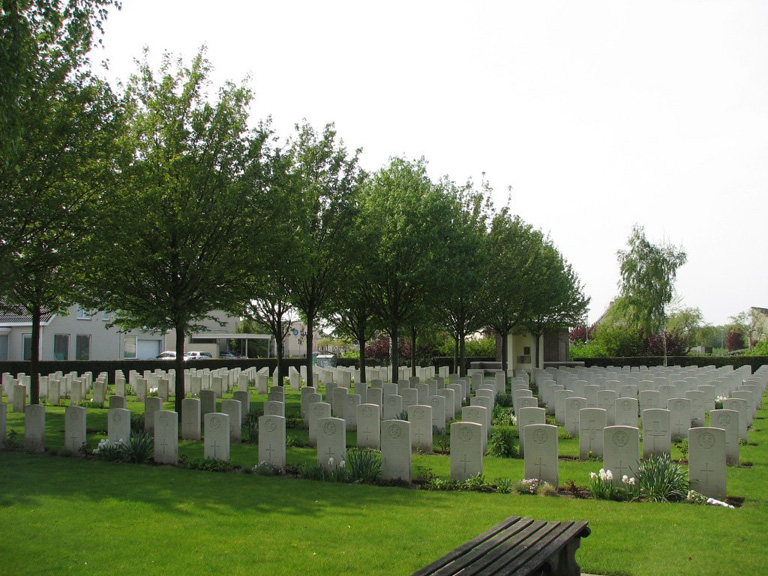
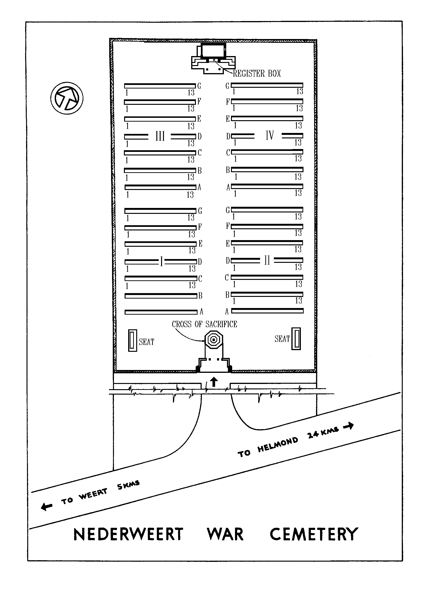
A rectangular shaped cemetery, with trees lining the central alley of the cemetery providing shade when in leaf.
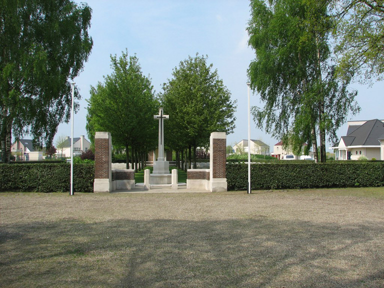
Access into the cemetery is through an entrance feature with two tall brick pillars on either side of a central gate. Stone paving located between the pillars and carries through under the gate. The main gate is a 1-metre-wide black metal gate. The latch is on the left side of the gate. The gate opens inwards.
The Cross of Sacrifice is immediately inside the entrance, and the surrounding paving is approximately 50 mm higher than the entrance paving.
There is a brick and stone shelter at the far end of the cemetery with stone bench seating areas on either sides and inside. The paving in front of the shelter is level with the grass.
The Register Box is built into the back wall of the shelter above the stone bench. There is also a metal information sign on the back wall of the shelter.
There are timber benches located at the front of the cemetery, located on each side of the Cross of Sacrifice.
All internal paths are grass, the ground is flat and firm.
ALTERNATIVE ACCESS
There is a service entrance to the rear left side of the cemetery, with a 1.2 metre wide, waist height, green metal gate, accessed via a paved pathway from Thieu Gielenstraat.
ADDITIONAL INFORMATION
The cemetery is permanently open.
History information
Nederweert was liberated by British troops on 21st September, 1944. The front line until 14th November was close by, following the Zuidwillemsvaart and Wessem-Nederweert canals; during that period there were casualties from patrol activity and from daily German shelling of Nederweert, besides some deaths in German minefields. After the British crossed the canals and went on towards the Maas, burials continued in the war cemetery from the surrounding area.
There are now over 350 1939-1945 War casualties commemorated in this site.