Milsbeek War Cemetery
- Country Netherlands
- Total identified casualties 210 Find these casualties
- Region Limburg (Netherlands)
- Identified casualties from Second World War
- GPS Coordinates Latitude: 51.72604, Longitude: 5.94995
Location information
The village of Milsbeek is in the east of the Netherlands, and approx 15kms south east of the city of Nijmegen. From the A73 motorway NIJMEGEN to VENLO take exit 3 (Afrit 3) MALDEN / GROESBEEK / MOOK / HEUMEN / OVERASSELT. Follow signs for N271 MOOK. Continue through the villages of MOLENHOEK / MOOK and PLASMOLEN following the signs for VENLO / GENNEP. On entering the village of Milsbeek turn left (CWGC sign) onto ZWARTEWEG. After approx 400m turn left (CWGC sign) onto PASTOOR HOEFNAGELSTRAAT. At the end turn right onto KERKSTRAAT. The cemetery lies directly behind the church and is at the rear of the civilian cemetery. The cemetery address is:- Kerkstraat 6596 Milsbeek Netherlands GPS Location is:- N 51 43 32 E 05 57 05
Visiting information
ARRIVAL
The route to the cemetery from the town centre is signposted.
PARKING
There is off road parking with space for vehicles approximately 100 metres from the man entrance to the cemetery.
The route to the main entrance is signposted from the car park.
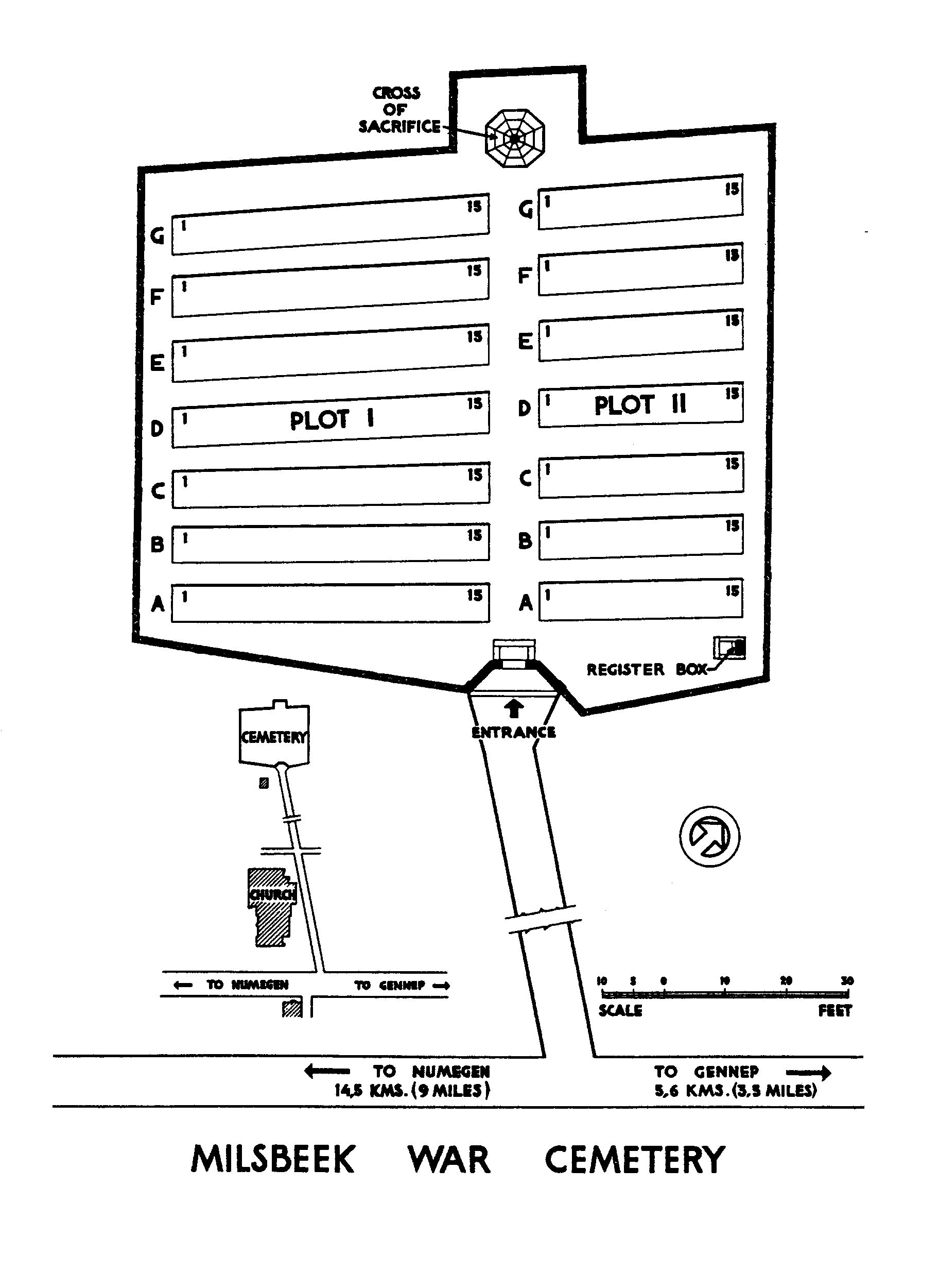
ACCESS, LAYOUT AND MAIN ENTRANCE
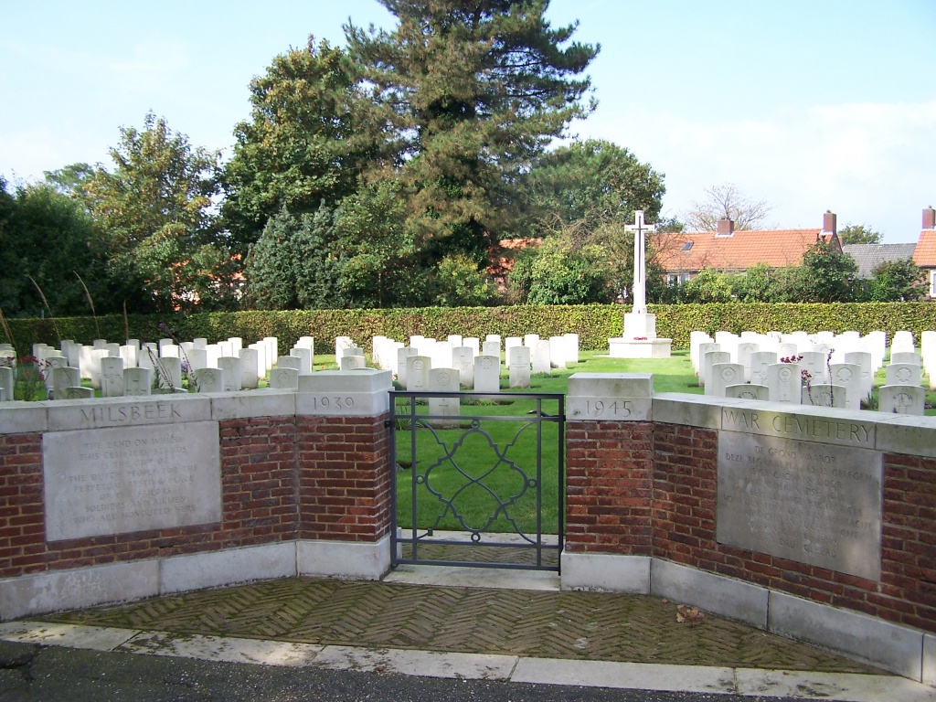
The cemetery is located behind a church at the end of a path running approximately 100 metres from the main road.
The cemetery is rectangular shaped.
A low level (waist height), latched metal gate which is approximately one metre wide marks the main entrance and opens inwards into the cemetery. Brick and stone paving, level with the external pathway forms part of the entrance.
Internal paths are grass, and the ground is flat.
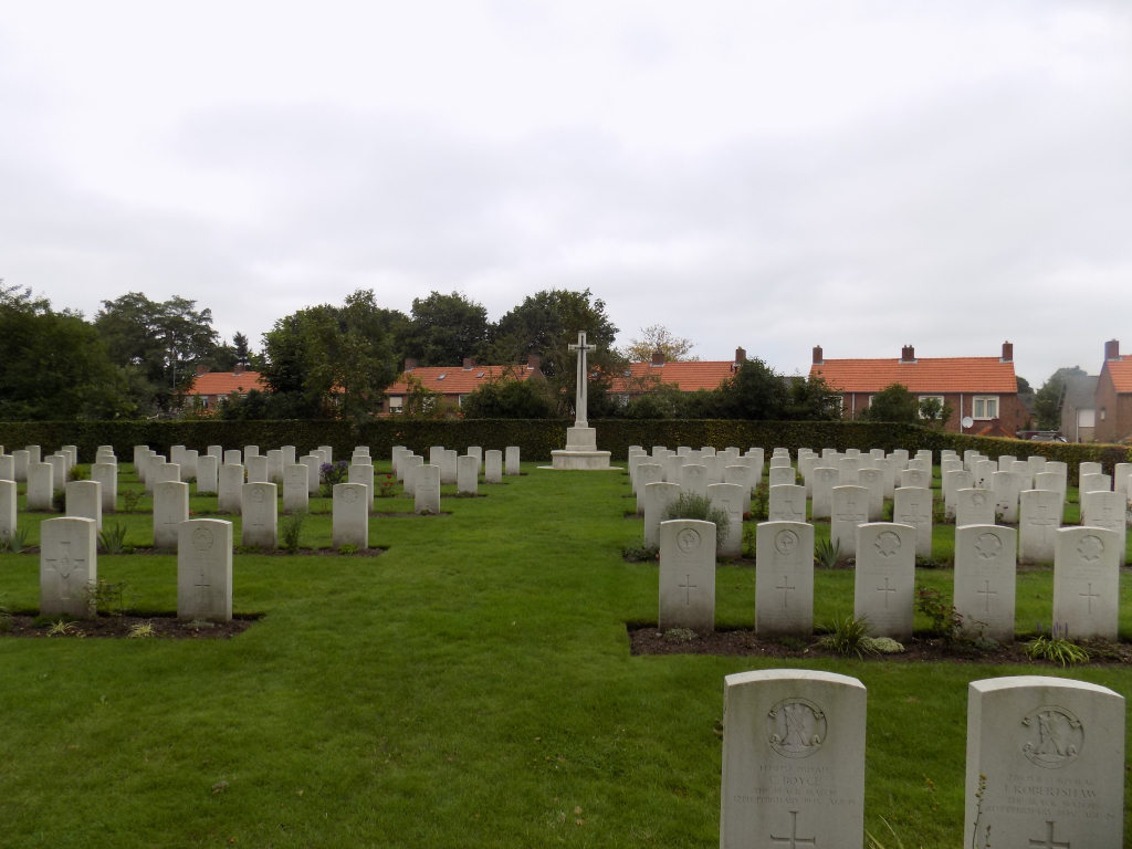
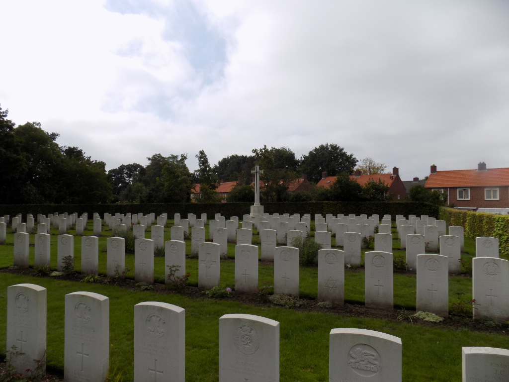
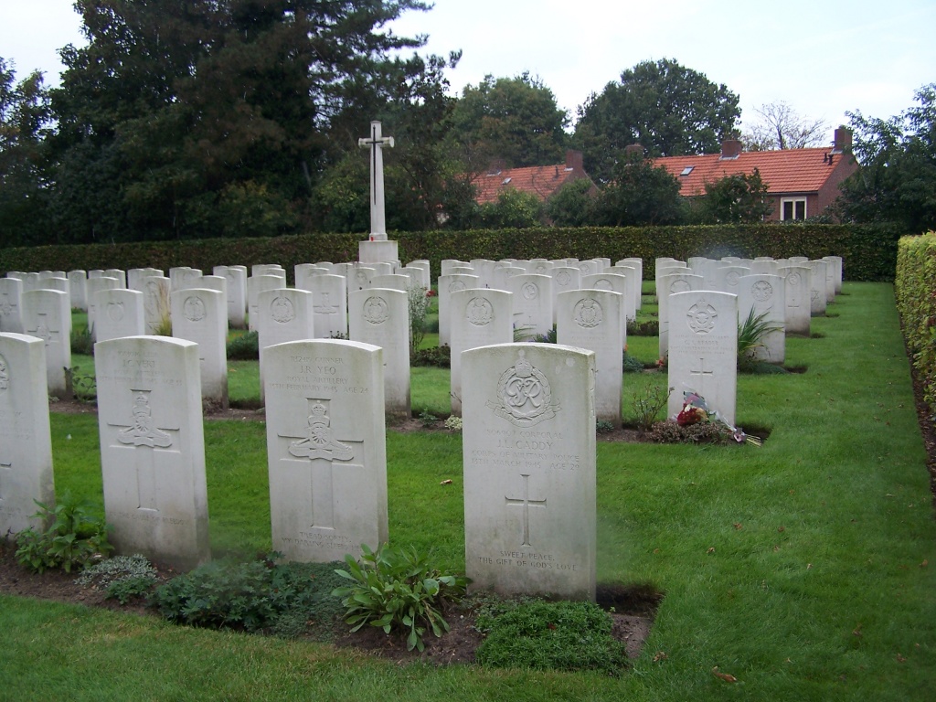
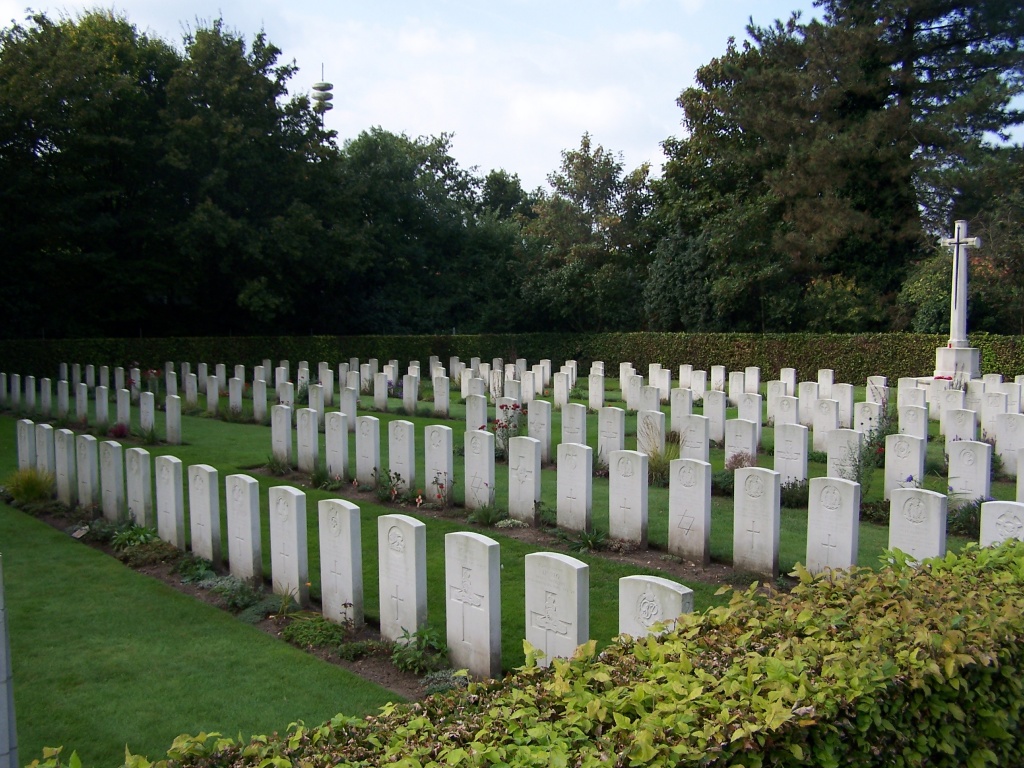
The Cross of Sacrifice is at the rear of the cemetery, facing the main entrance.
The cemetery Register Box is on the right-hand side at the front of the cemetery. The Register Box is mounted on a stone pillar, built on a raised plinth, approximately 200 mm above the grass.
There is a wooden bench outside the cemetery on the left-hand side of the pathway under a tree.
ALTERNATIVE ACCESS
There is no alternative entrance into the cemetery.
ADDITIONAL INFORMATION
The cemetery is permanently open.
History information
The Netherlands fell to the Germans in May 1940 and was not re-entered by Allied forces until September 1944.
With a few exeptions, burials at Milsbeek War Cemetery date from February and March 1945, the days of the advance into Germany. They include men from the 51st (Highland) Division, the 52nd (Lowland) Division, and the 3rd Battalion Irish Guards.
The cemetery contains 210 Commonwealth burials of the Second World War.