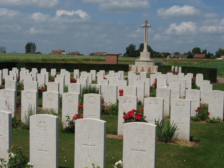
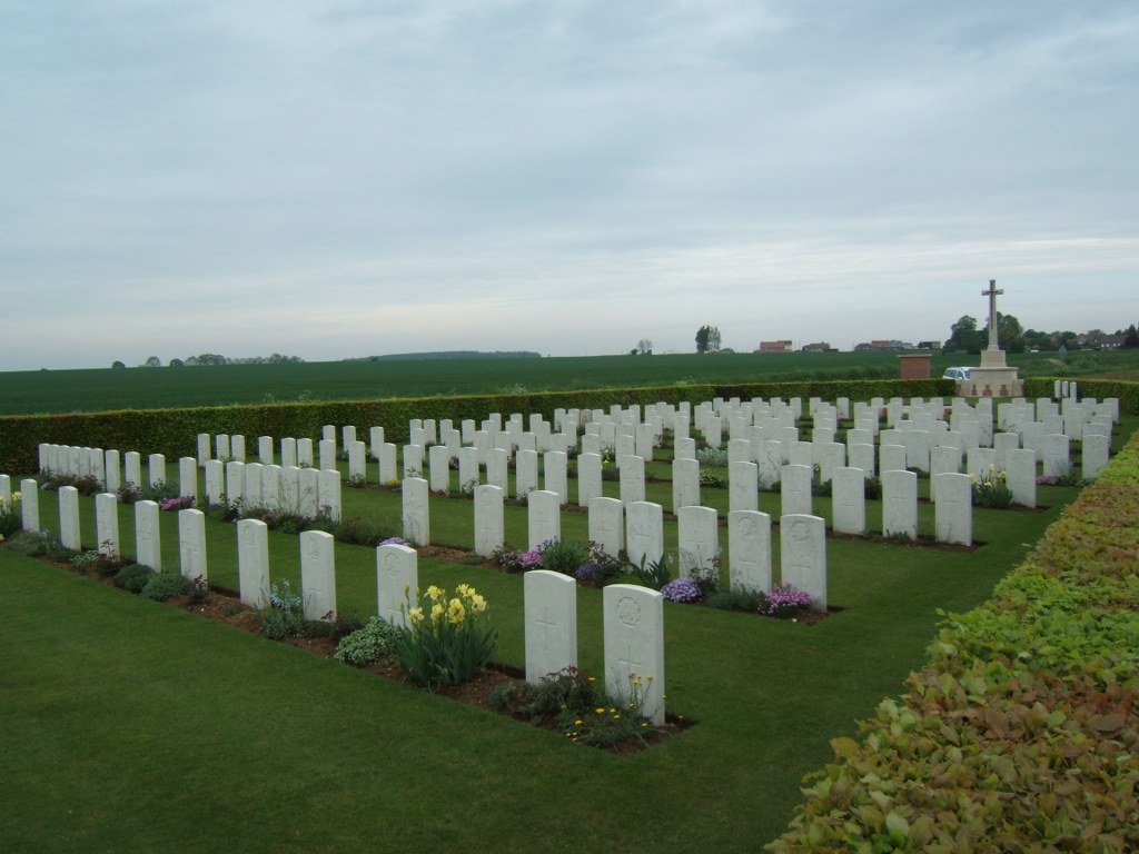
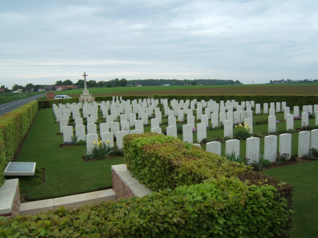
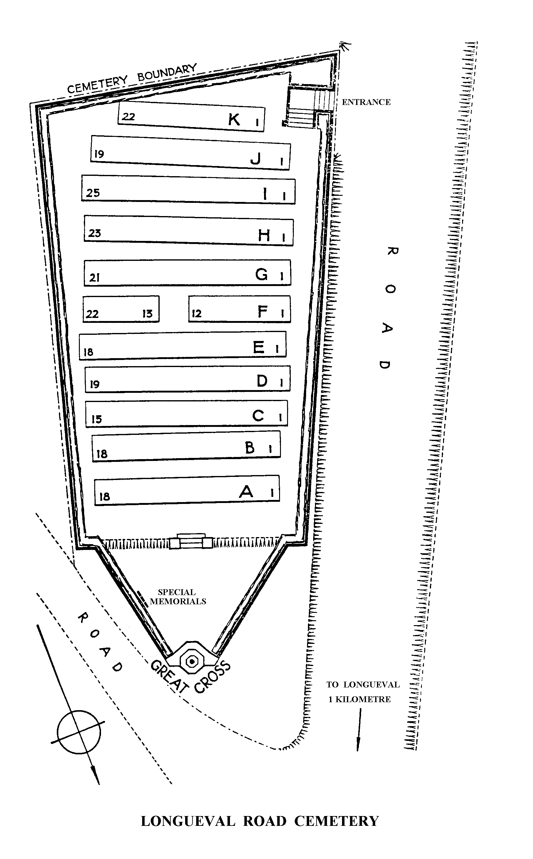
Longueval Road Cemetery
- Country France
- Total identified casualties 176 Find these casualties
- Region Somme
- Identified casualties from First World War
- GPS Coordinates Latitude: 50.01913, Longitude: 2.79884
Location information
Longueval is a village in the Department of the Somme, 11 kilometres east of Albert. Travel north-east from Albert on the D929 in the direction of Bapaume. After 10 kilometres take the D6 in the direction of Martinpuich and follow signs for Longueval. From Longueval crossroads continue in the direction of Maricourt, D197, for 800 metres. Longueval Road Cemetery is situated on the left hand side of the road.
Visiting information
Wheelchair access to this site is possible, but may be by alternative entrance. For further information regarding wheelchair access, please contact our Enquiries Section on 01628 507200.
History information
Longueval was the scene of furious fighting in 1916, lasting from 14 to 29 July, when the village was cleared by the 5th Division. It was lost in March 1918, and retaken by the 38th (Welsh) Division and the Carabineers on 28 August 1918. Longueval Road Cemetery was begun in September 1915, near a dressing station known as "Longueval Alley", or "Longueval Water Point". It was used until January 1917, but further burials were made in August and September 1918. At the Armistice, the cemetery contained 171 graves and others were brought in from a wide area round Longueval in 1923-24. Longueval Road Cemetery now contains 222 burials and commemorations of the First World War. 48 of the burials are unidentified but there are special memorials to three soldiers known or believed to be buried among them. There is also one German burial in the cemetery. The cemetery was designed by A J S Hutton.