La Clytte Military Cemetery
- Country Belgium
- Total identified casualties 846 Find these casualties
- Region West-Vlaanderen
- Identified casualties from First World War
- GPS Coordinates Latitude: 50.80174, Longitude: 2.80039

Location information
La Clytte Military Cemetery is located 8 Kms west of Ieper town centre on the N304 Klijtseweg, a road leading from the N375 Dikkebuseweg, connecting Ieper to Dikkebus, Klijte and on to Loker. From Ieper town centre the Dikkebusseweg (N375) is located via Elverdingsestraat, straight over a roundabout onto J.Capronstraat (for 30 metres), then left along M.Fochlaan. Immediately after the train station, the first right hand turning is the Dikkebusseweg. 7 Kms along the Dikkebusseweg lies the village of De Klijte (formerly La Clytte) and the right hand turning at the roundabout just before the village leads onto the N304 Reningelststraat. The cemetery lies 100 metres after this right hand turning on the left hand side of the road.
Visiting information
ARRIVAL
The route to the cemetery is signposted.
PARKING
Parking is at the front of the cemetery along the edge of the road, where there is space for up to 5 vehicles.
There are entrances on the left and right-hand sides of the wall along the front of the cemetery. Parking is immediately in front of the entrances.
The pavement next to the parking has a tarmac surface, and the ground is firm and flat. There is a concrete drainage channel between the layby and the road.
ACCESS LAYOUT AND MAIN ENTRANCE
There are two entrances into the cemetery. One at either end of the front of the cemetery off the main road.
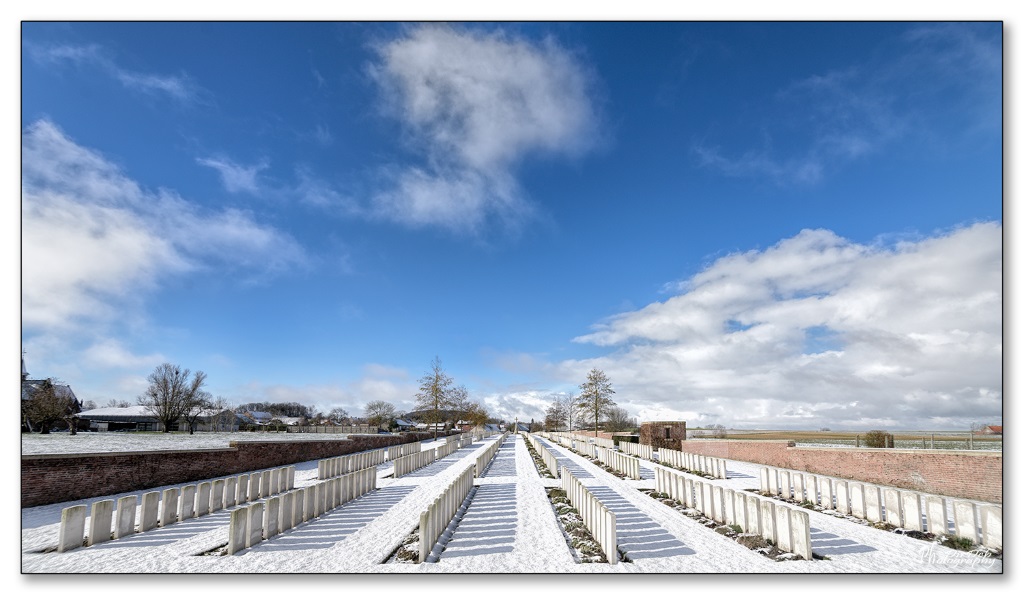
The site is long and narrow and surrounded by a brick wall.
Two red brick memorial entrance buildings, each with arched doorways 1.20 metres wide (no gate), lead into the cemetery. There is a 5-centimetre stone step up into the shelter from the pavement and another down onto the grass inside the cemetery.
The Register Box is mounted inside the left-side memorial entrance building, built into the wall.
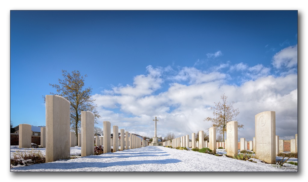
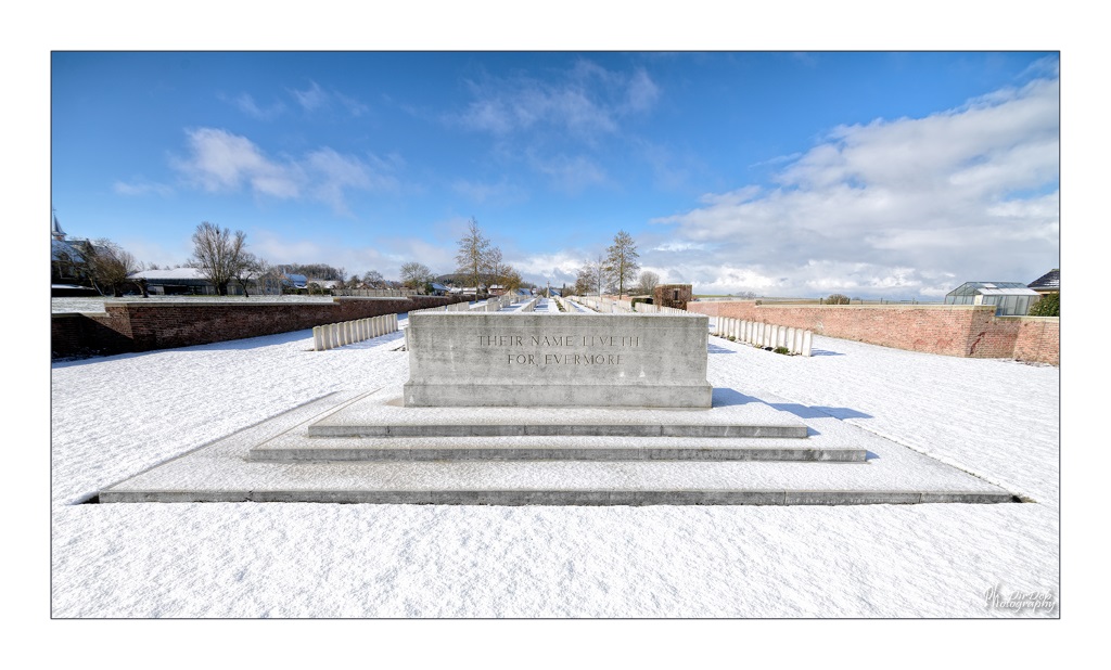
The Stone of Remembrance is at the front of the cemetery along the centre line of the site.
The Cross of Sacrifice is located at the rear of site, in line with the Stone of Remembrance.
There are stone bench seating areas either side of the cemetery in line with the Stone of Remembrance.
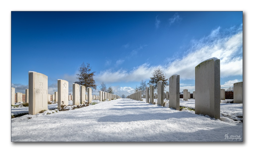
All the internal cemetery paths are grass. The ground slopes up from the entrance to the mid-point of the cemetery, then slopes down towards the Cross of Sacrifice.
ALTERNATIVE ACCESS
There is no alternative access into the cemetery.
ADDITIONAL INFORMATION
The cemetery is permanently open.
History information
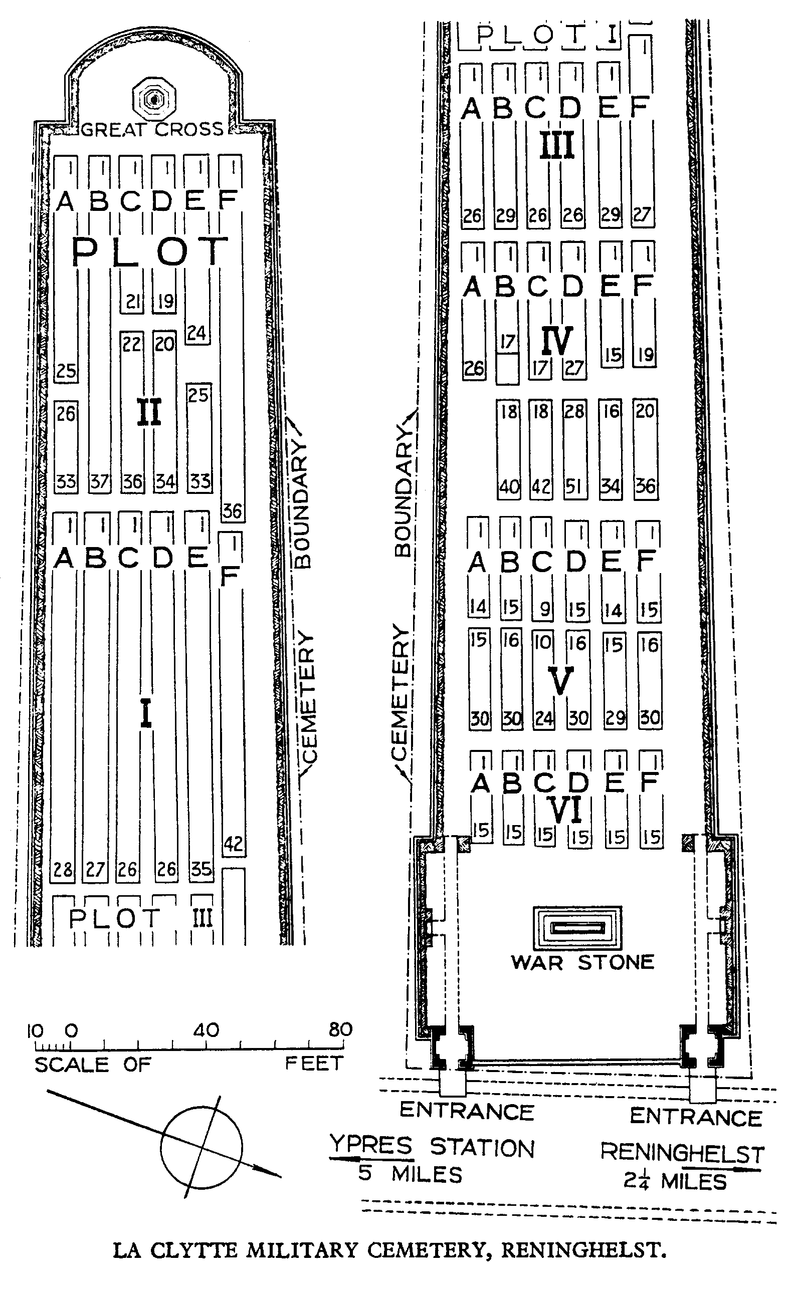
The first burial in the cemetery took place on the 1st November 1914, and between that date and April 1918, Plots I, II and III and part of Plot IV were filled. The hamlet of La Clytte was used as Brigade Headquarters, and the burials were carried out by Infantry, Artillery and Engineer units (out of 600, 250 are those of Artillery personnel and 66 are those of Engineers).
After the Armistice Plot IV was completed, and Plots V and VI formed by the concentration of isolated graves and small graveyards from the area round Reninghelst, Dickebusch, Locre and Kemmel.
There are now 1,082 casualties of the First World War buried or commemorated in this cemetery. 238 of the burials are unidentified and one of the graves, brought in from LEICESTER CAMP CEMETERY (a group of 17 graves on the road to Reninghelst), is marked with the names of two men between whom the identification rests. Other special memorials commemorate casualties known to have been buried in the cemetery, but whose graves could not be located.
The cemetery was designed by Sir Edwin Lutyens.