Jambes Communal Cemetery
- Country Belgium
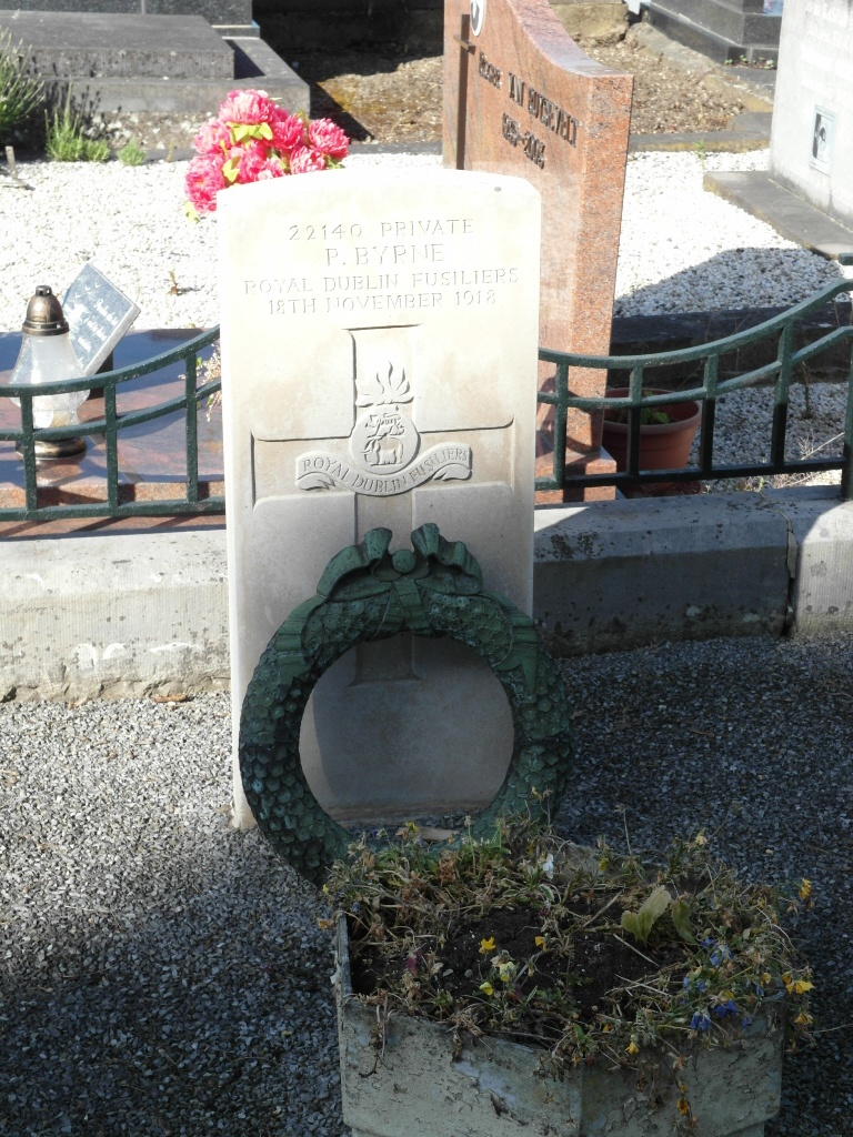
- Total identified casualties 1 Find these casualties
- Region Namur
- Identified casualties from First World War
- GPS Coordinates Latitude: 50.45457, Longitude: 4.8838
Location information
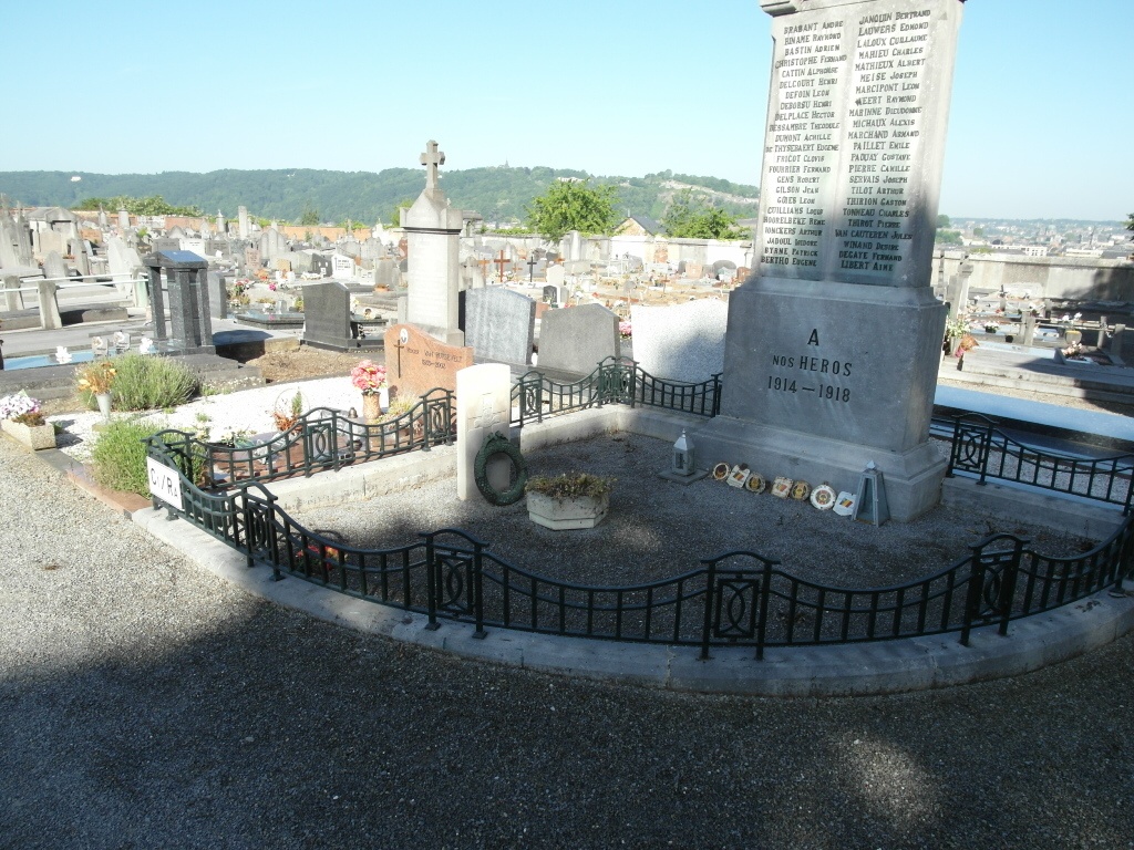
The village of Jambes is located south of the town of Namur on the N92. From the motorway E411/A4, which runs between Namur and Brussels, turn off at junction 14 onto the N80 direction Namur. Follow the N80 to the junction with the N92 and turn left onto the N92 direction Dinant. When the road runs along by the river take the second turning left to Jambes and cross the river along avenue Bourg. At the crossroads go straight on into Jean Materne. Follow this road over two railway crossings and the cemetery is along on the right. The grave is located next to the war memorial a short distance from the entrance.
History information
Jambes Communal Cemetery contains one Commonwealth burial of the First World War.