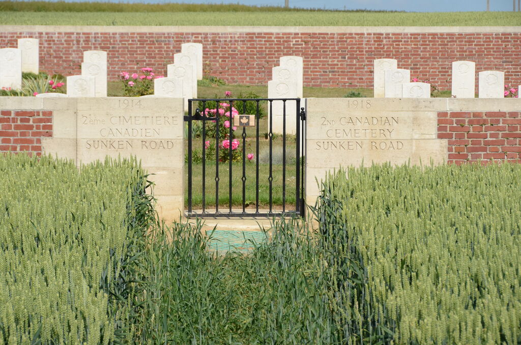
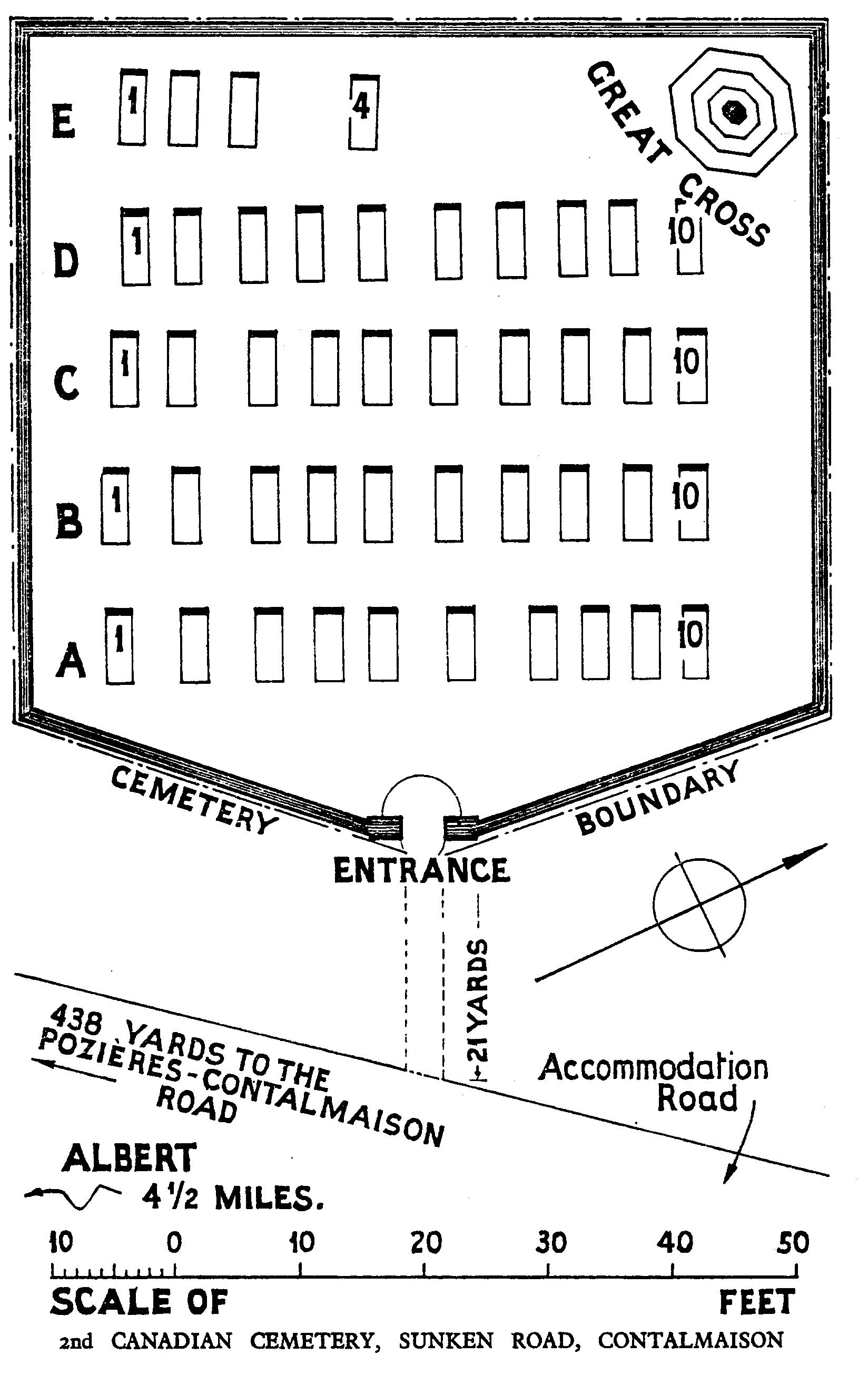
2Nd Canadian Cemetery, Sunken Road, Contalmaison
- Country France
- Total identified casualties 46 Find these casualties
- Region Somme
- Identified casualties from First World War
- GPS Coordinates Latitude: 50.03208, Longitude: 2.7302
Location information
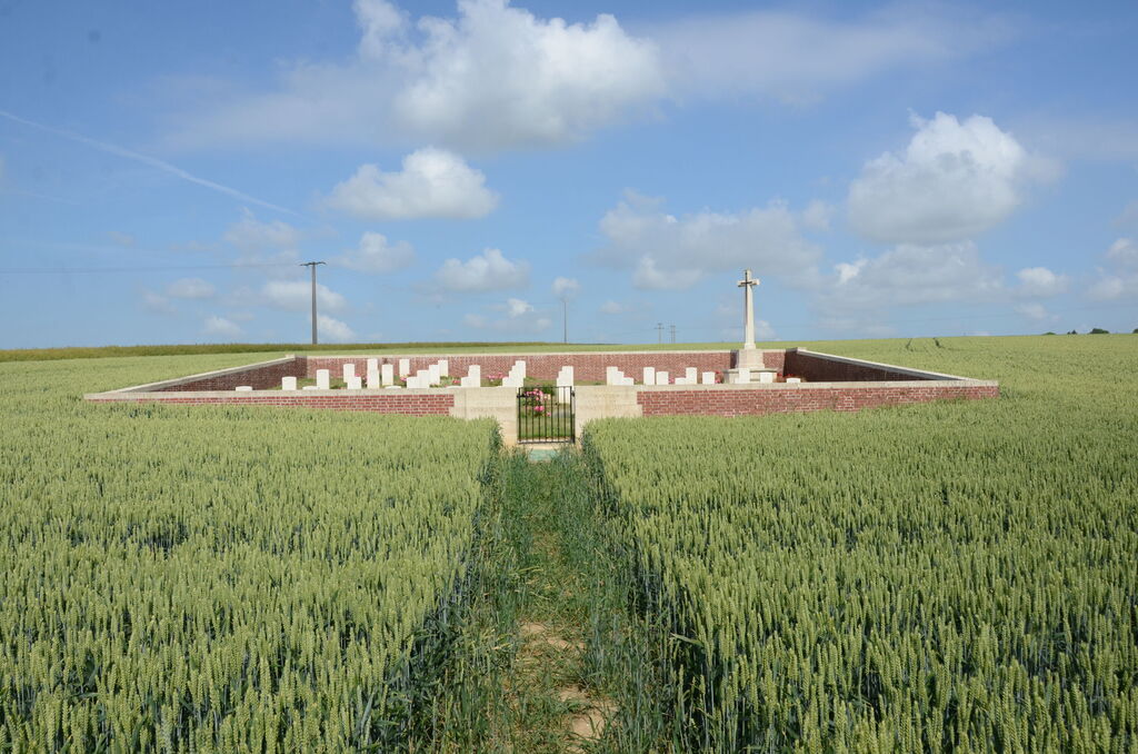
Contalmaison is a village and commune in the Department of the Somme, 6 kilometres east-north-east of Albert. The sunken road from which this cemetery is named is part of the Contalmaison-Pozieres road. The cemetery lies in the fields on Accommodation road 400 metres east of the main Contalmaison to Pozieres road.
Visiting information
Access to the cemetery is via a rough track which can be inaccessible under bad weather conditions.
Wheelchair access with some difficulty.
For further information regarding wheelchair access, please contact our enquiries dept. on 01628 634221.
History information
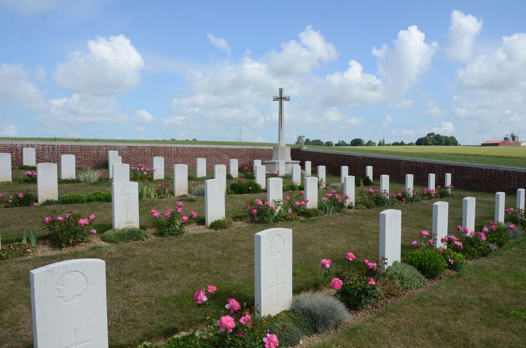
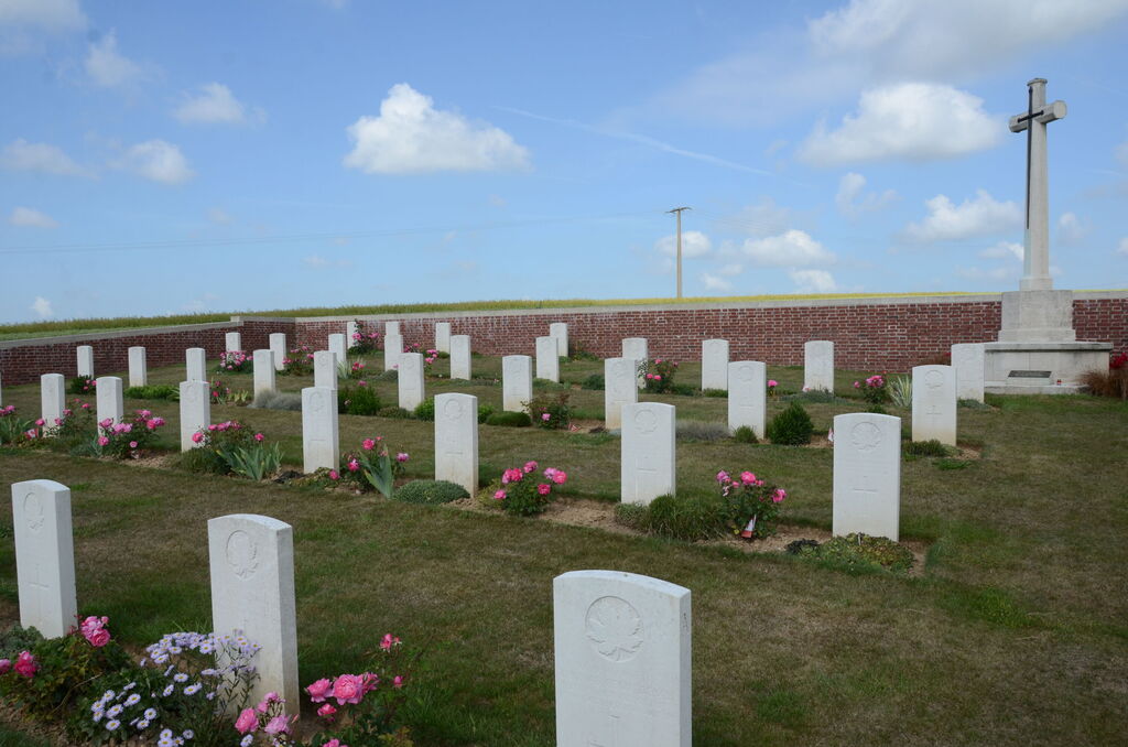
The 2nd Canadian Cemetery was made in July-October, 1916, during the middle fighting in the Somme offensive.
There are now over 40, 1914-18 war casualties commemorated in this site.
The Cemetery covers an area of 383 square metres and is enclosed by a low red brick wall.