Karasouli Military Cemetery
- Country Greece
- Total identified casualties 1371 Find these casualties
- Identified casualties from First World War
- GPS Coordinates Latitude: 40.99451, Longitude: 22.58151
Location information
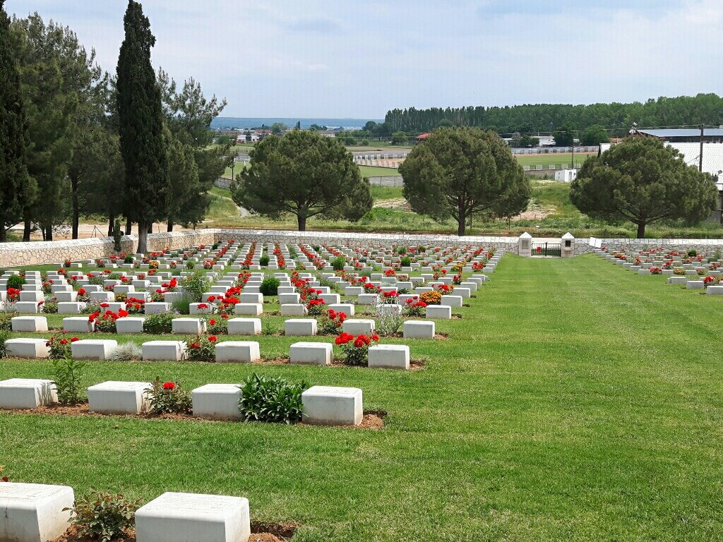
Karasouli Military Cemetery is on the edge of the town of Polykastro (formerly Karasouli) which lies some 73 kilometres from Thessaloniki, between the River Axios (Vardas) and the south end of Lake Ardzan (now dry and replaced by a reservoir). The cemetery is behind the football stadium and is next to the Civil Cemetery. Take the main highway north from Thessaloniki to Evzoni & Skopje. After approximately 70km take the exit signed Kilkis and Polykastro where you shall pick up the CWGC signs that shall lead you into Polykastro and to the cemetery.
Visiting information
The cemetery is on the edge of the village of Polykastro, formerly Karasouli, 73 kilometres from Thessaloniki.
ARRIVAL
All routes to the cemetery are signposted.
PARKING
It is possible to park vehicles at the side of the main road along the front of the cemetery, near to the main entrance, within 3 metres of the main entrance gate.
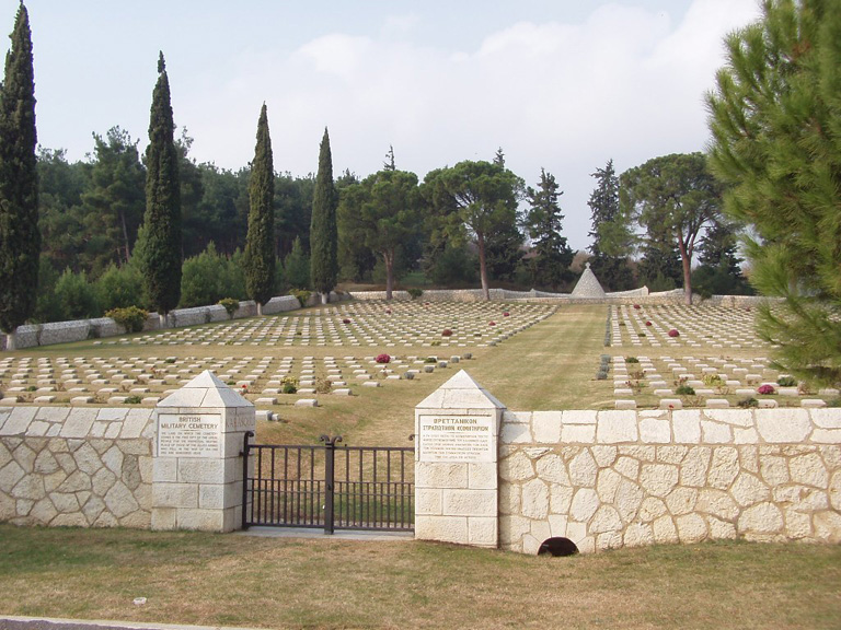
ACCESS, LAYOUT AND MAIN ENTRANCE
Large rectangular cemetery with six burial plots within the cemetery.
A small sloped concrete ramp leads from road up to a grassed area in front of the cemetery entrance. A three metre grassed area lies between the road and the gates.
A double metal gate approximately 1.5 metres wide (2 0.75 m wide sections) opens on a flagstone slab into the cemetery. To the right of the gate there is a metal slotted covered storm drain. A metal slotted drain also runs the length of the gate inside the cemetery between the paving slabs and the grass.
The Register Box is located inside the main gate in the left side column facing into the cemetery.
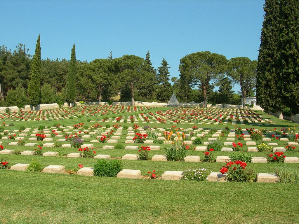
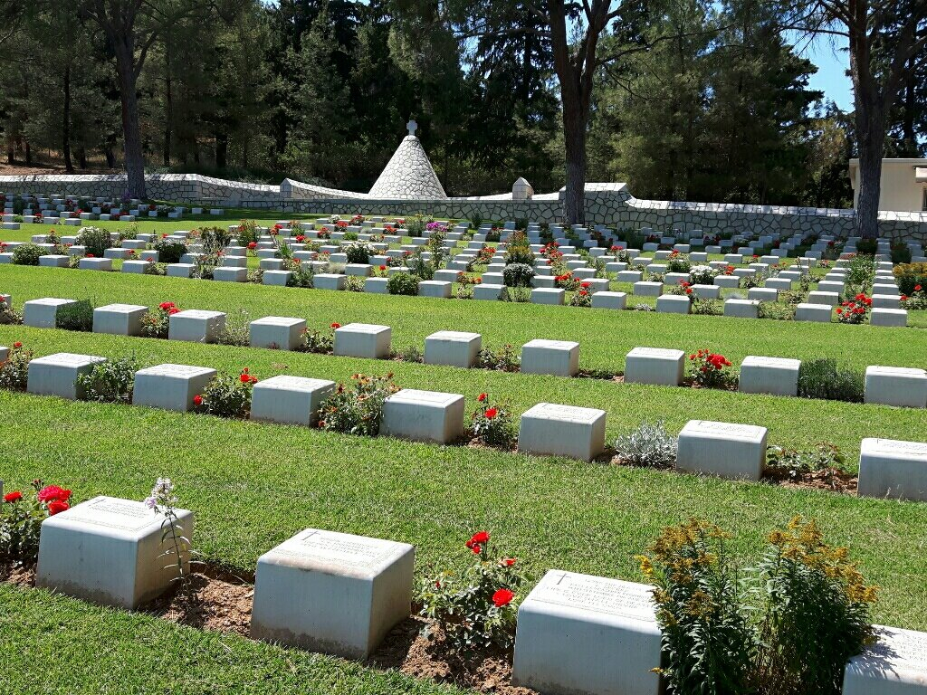
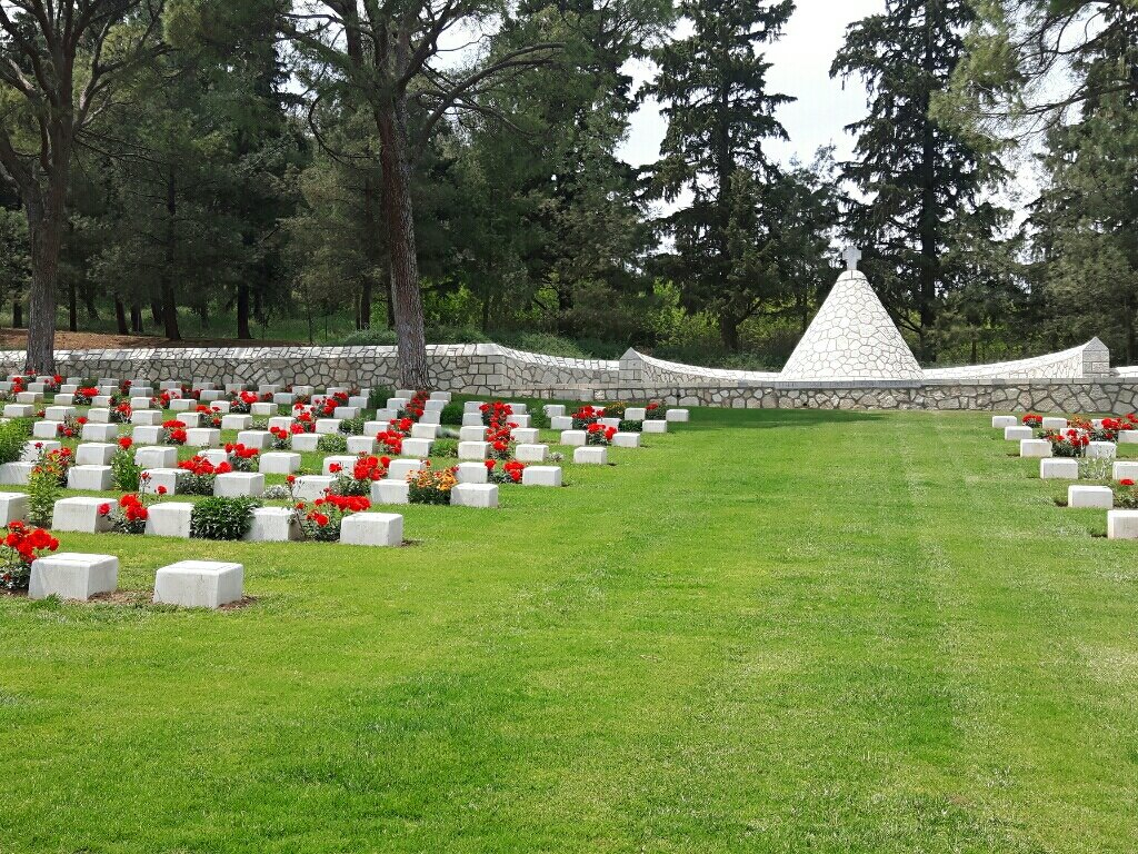
The cemetery slopes uphill away from the main entrance. All internal paths are grass. The ground slopes upward from the main entrance to the Cairn Cross at the top of the cemetery.
A raised stone platform is accessed by steps on either side of the Cross with an incorporated Stone of Remembrance.
There are no seating areas in the cemetery.
ALTERNATIVE ACCESS
There is an additional access entrance at the top end of the cemetery on the right-hand side, in front of the cemetery staff building
A single width track leads up to the entrance and it is possible to park within 2 metres of a metal gate (approximately 1.5 metres wide), and allows entrance into the top of the cemetery, near the Cross.
ADDITIONAL INFORMATION
The cemetery is permanently open.
History information
The cemetery was begun in September 1916 for the use of casualty clearing stations on the Doiran front. At the Armistice, it contained about 500 burials but was greatly increased when graves were brought in from the following cemeteries:
HADZI BARI MAH MILITARY CEMETERY - graves transferred to Karasouli in April 1919.
Hadzi Bari Mah (also known as Haji Bari Mahalesi) is a village at the foot of the mountains 14 miles West of Lake Doiran, across the Vardar river. The Military Cemetery, South of the village, was in use only from the 25th August to the 17th September 1918. It contained 61 British and 2 Bulgar graves, and 46 of these were the graves of men of the 10th Hampshires and the 2nd Gloucesters who captured the enemy salient here on the 1st September.
CAUSSICA MILITARY CEMETERY - graves transferred to Karasouli in November 1920.
Caussica (also known as Chaushitsa) is a village in the marshes on the North side of Lake Ardzan. The Military Cemetery, begun in February 1917, contained 62 burials from Field Ambulances; but in February 1919, it was increased by the removal to it of four isolated graves and of those from the Military Cemeteries of:-
Senelle Ravine, a front line position between Doiran town and the Greek border, where the British cemetery contained 95 British graves.
Gugunci (properly Chuguntsi), a village about four miles North-East of Caussica, where between August 1916, and September 1918, the Field Ambulances buried 154 British soldiers.
Doldzeli (or La Tortue, or Torquay), a front-line cemetery a mile South West of Lake Doiran with 23 British graves.
Reselli (or Ereselli), a village three miles North-West of Caussica, where the 13th Manchesters began a cemetery of 31 British graves.
Kilindir (or Krundirtsi), a village with a railway junction three miles South of Lake Doiran, where 45 British soldiers were buried in two cemeteries.
Ardzan (Arjan, or Harajinovo), a village two miles West of Caussica, where the 12th Cheshires began a front-line cemetery of 22 British graves.
KALINOVA MILITARY CEMETERY - graves transferred to Karasouli in December 1920.
Kalinova is a village two miles North East of Caussica, at the foot of the hills which stand between Lakes Ardzan and Doiran. The Military Cemetery, used by Field Ambulances from October 1917, to September 1918, contained at the Armistice 52 British graves; but early in 1919 there were brought into it the British graves from the Military Cemeteries of-
Kalinova No.2 - 18 graves.
Rates, a village five miles South of Lake Doiran - 11 graves.
Cidemli, a village 2.5 miles to the North, where the small cemeteries of the 8th D.C.L.I. and the 117th Brigade, R.F.A., and two others contained 30 British graves.
Senelle Ravine, where 35 British soldiers were buried in the French Military Cemetery.
Horseshoe Hill, captured by the O.B.L.I. in August 1916, a cemetery on the Greco Serbian boundary which held 162 British graves and was largely used in the fighting of April 1917.
Pearse Ravine, a front line cemetery containing 74 British grave.
Whaleback, Worcester Post, Bastion Hill, Crow Hill, Kidney Hill, Scratchbury Hill, Christmas Ravine, Clichy and other points named from positions opposite the Petit Couronne and the Grand-Couronne, where 94 British soldiers in all were buried.
Karasouli Military Cemetery now contains 1,421 Commonwealth burials of the First World War, 56 being unidentified.